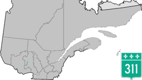
Quebec Route 311
Route 311 is a provincial highway located in the Laurentides region of Quebec. The 77 kilometer-highway runs from south to north from the junction of Route 309 in Notre-Dame-de-Pontmain to Mont-Saint-Michel also at the junction of Highway 309. It is briefly concurrent with Route 117 at Beaux-Rivages and Lac-des-Écorces.
| ||||
|---|---|---|---|---|
 | ||||
| Route information | ||||
| Maintained by Transports Québec | ||||
| Length | 80.0 km[1] (49.7 mi) | |||
| Major junctions | ||||
| South end | ||||
| North end | ||||
| Location | ||||
| Counties | Antoine-Labelle | |||
| Major cities | Lac-des-Écorces, Mont-Saint-Michel | |||
| Highway system | ||||
| ||||

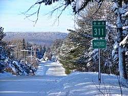
Route 311 near Chute-St-Philippe
Municipalities along Route 311
- Notre-Dame-de-Pontmain
- Lac-du-Cerf
- Kiamika
- Val-Barrette
- Beaux-Rivages
- Lac-des-Écorces
- Chute-Saint-Philippe
- Lac-Saint-Paul
- Mont-Saint-Michel
Major intersections
| RCM or ET | Municipality | km | Junction | Notes |
|---|---|---|---|---|
Southern terminus of Route 311 | ||||
| Antoine-Labelle | Notre-Dame-de-Pontmain | 0.0 | 309 SOUTH: to Notre-Dame-du-Laus 309 NORTH: to Saint-Aimé-du-Lac-des-Îles | |
| Lac-des-Écorces | 44.0 44.3 |
117 NORTH: to Mont-Laurier 117 SOUTH: to Lac-Saguay | ||
| Mont-Saint-Michel | 80.0 | North end of Route 309 309 SOUTH: to Ferme-Neuve | ||
Northern terminus of Route 311 | ||||
gollark: The java native object serializey one may be bad and not good.
gollark: Serialißed how?
gollark: NDBall doesn't have any way to conveniently write strings, as far as I know.
gollark: For space-efficiently sending really big programs you might as well use gzip.
gollark: It would probably be possible to serialize to some nice binary format, but not necessarily very useful.
See also
References
- Ministère des transports, "Distances routières", page 95-96, Les Publications du Québec, 2005
This article is issued from Wikipedia. The text is licensed under Creative Commons - Attribution - Sharealike. Additional terms may apply for the media files.