Quebec Route 393
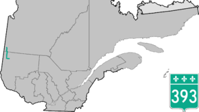
Route 393 is a Quebec provincial highway located in the province's Abitibi-Témiscamingue and Nord-du-Québec regions. The highway runs from the junction of Route 101 in the Rouyn-Noranda suburb of Destor and ends in Val-Paradis in the municipality of Baie-James. In La Sarre it overlaps Route 111.
| ||||
|---|---|---|---|---|
 | ||||
| Route information | ||||
| Maintained by Transports Québec | ||||
| Length | 98.0 km[1] (60.9 mi) | |||
| Major junctions | ||||
| South end | Val-Paradis in 'Baie-James (Route-des-Richesses) | |||
| North end | ||||
| Location | ||||
| Major cities | Rouyn-Noranda, La Sarre | |||
| Highway system | ||||
| ||||

Municipalities along Route 393
.jpg)
Quebec Route 393 in Rouyn-Noranda
- Rouyn-Noranda
- Duparquet
- Rapide-Danseur
- Palmarolle
- Sainte-Hélène-de-Mancebourg
- La Sarre
- Clermont (Val-Saint-Gilles)
- Baie-James (Beaucanton / Val-Paradis)
gollark: GTech_apiosphere_04™.
gollark: heav_.
gollark: Guess I'll just obliterate everything within 50 metres of your base then.
gollark: Well, if I don't want to spend at least 3 time joining, I need to know the coordinates a priori.
gollark: <@151391317740486657> Coordinates?
See also
References
- Ministère des transports, "Distances routières", page 95, Les Publications du Québec, 2005
External links
- Official Transports Quebec Map (in French)
- Route 393 on Google Maps
This article is issued from Wikipedia. The text is licensed under Creative Commons - Attribution - Sharealike. Additional terms may apply for the media files.