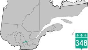
Quebec Route 348
Route 348 is a provincial highway located in the Lanaudière and Mauricie regions of Quebec. It runs from the junction of Route 125 just west of Rawdon and ends at Route 138 in Louiseville. It overlaps Route 337 and Route 341 in Rawdon, Route 131 northwest of Saint-Félix-de-Valois, and Route 347 in Saint-Gabriel-de-Brandon.
| ||||
|---|---|---|---|---|
 | ||||
| Route information | ||||
| Maintained by Transports Québec | ||||
| Length | 91.5 km[1] (56.9 mi) | |||
| Major junctions | ||||
| West end | ||||
| East end | ||||
| Location | ||||
| Major cities | Rawdon, Saint-Gabriel-de-Brandon, Louiseville | |||
| Highway system | ||||
| ||||

Towns along Route 348
.jpg)
Quebec Route 348 in Rawdon
- Rawdon
- Sainte-Mélanie
- Saint-Cléophas-de-Brandon
- Saint-Gabriel-de-Brandon
- Saint-Didace
- Saint-Édouard-de-Maskinongé
- Sainte-Ursule
- Louiseville
Major Intersections
| RCM or ET | Municipality | Km | Road | Notes |
|---|---|---|---|---|
| Matawinie | Rawdon | 0.0 | ||
| 5.7 | Western terminus of Route 341 / Route 348 overlap | |||
| 6.9 | Western terminus of Route 337 / Route 341 / Route 348 overlap | |||
| 7.2 | Eastern terminus of Route 337 / Route 341 / Route 348 overlap | |||
| 8.3 | Eastern terminus of Route 341 / Route 348 overlap | |||
| Joliette | Saint-Ambroise-de-Kildare | 19.3 | ||
| ~21 | Route de Sainte-Béatrix (north) | To Sainte-Béatrix | ||
| ~22 | Route de Sainte-Béatrix (south) | To Saint-Charles-Borromée | ||
| Sainte-Mélanie | 26.6 | Chemin du Lac Sud | To Notre-Dame-de-Lourdes | |
| Matawinie | Saint-Félix-de-Valois | 32.6 | Western terminus of Route 131 / Route 348 overlap | |
| 33.5 | Eastern terminus of Route 131 / Route 348 overlap | |||
| ~38 | Chemin de Saint-Gabriel | To Saint-Félix-de-Valois | ||
| D'Autray | Saint-Gabriel-de-Brandon | 50.0 | Western terminus of Route 347 / Route 348 overlap | |
| Saint-Gabriel | 51.0 | Eastern terminus of Route 347 / Route 348 overlap | ||
| Saint-Gabriel-de-Brandon | 55.0 | Rang Saint-Augustin | To Mandeville | |
| Saint-Didace | 61.3 | Northern terminus of Route 349 | ||
| Maskinongé | Saint-Édouard-de-Maskinongé | 75.6 | Western terminus of Route 350 | |
| Saint-Ursule | 84.4 | Route Gérin | To Saint-Ursule and Saint-Justin | |
| Louiseville | 91.5 |
gollark: I agree.
gollark: Actually, yes, hm, troubling.
gollark: There will also be advertising, which will arbitrarily tell you to use Haskell if you search for anything with Java in it, for instance.
gollark: To the extent of "which links did someone click after making a search query", without a person attached.
gollark: I suppose I *could* just harvest all user data/souls for later analysis and ML.
See also
References
- Distance routière, page 101, Les Publications du Québec, 2005
External links
- Transports Quebec Official Map (in French)
- Route 348 on Google Maps
This article is issued from Wikipedia. The text is licensed under Creative Commons - Attribution - Sharealike. Additional terms may apply for the media files.