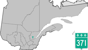
Quebec Route 371
Route 371 is a provincial highway located in the Capitale-Nationale region in south-central Quebec. The highway starts in the L'Ancienne-Lorette sector of Quebec City at the junction of Route 138 (Boulevard Wilfrid-Hamel) and ends in Stoneham-et-Tewkesbury at the junctions of Autoroute 73 and Route 175 (where it is the current northern terminus of A-73). In the Loretteville sector it is briefly concurrent with Route 369 and also travels across CFB Valcartier military base and its village.
| ||||
|---|---|---|---|---|
 | ||||
| Route information | ||||
| Maintained by Transports Québec | ||||
| Length | 1.0 km[1] (0.6 mi) | |||
| Major junctions | ||||
| North end | ||||
| South end | ||||
| Location | ||||
| Major cities | Quebec City, Stoneham | |||
| Highway system | ||||
| ||||

Towns along Route 371
- Quebec City including L'Ancienne-Lorette and Loretteville
- Val-Bélair
- Valcartier
- Saint-Gabriel-de-Valcartier
- Stoneham-et-Tewkesbury
gollark: Well, look, it doesn't use NLP logic as good as the blasphemy detector yet.
gollark: oh no.
gollark: oh no.
gollark: Fairness.
gollark: ++choice 1000 "lyric" "heavpoot" "gollark"
See also
References
- Ministère des transports, "Distances routières", page (?), Les Publications du Québec, 2005 (in French)
This article is issued from Wikipedia. The text is licensed under Creative Commons - Attribution - Sharealike. Additional terms may apply for the media files.