Stanstead-Est, Quebec
Stanstead-Est | |
|---|---|
Municipality | |
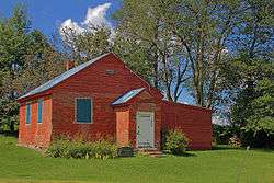 Mansur Rural School in Stanstead-Est | |
 Location within Coaticook RCM. | |
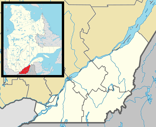 Stanstead Est Location in southern Quebec. | |
| Coordinates: 45°06′N 72°03′W[1] | |
| Country | |
| Province | |
| Region | Estrie |
| RCM | Coaticook |
| Constituted | July 16, 1932 |
| Government | |
| • Mayor | Guy Lefebvre |
| • Federal riding | Compton—Stanstead |
| • Prov. riding | Saint-François |
| Area | |
| • Total | 116.10 km2 (44.83 sq mi) |
| • Land | 113.82 km2 (43.95 sq mi) |
| Population (2011)[3] | |
| • Total | 603 |
| • Density | 5.3/km2 (14/sq mi) |
| • Pop 2006-2011 | |
| • Dwellings | 322 |
| Time zone | UTC−5 (EST) |
| • Summer (DST) | UTC−4 (EDT) |
| Postal code(s) | J0B 3E0 |
| Area code(s) | 819 |
| Highways | |
Stanstead-Est is a municipality in Quebec.
Demographics
Population
Population trend:[4]
| Census | Population | Change (%) |
|---|---|---|
| 2011 | 603 | |
| 2006 | 628 | |
| 2001 | 661 | |
| 1996 | 668 | |
| 1991 | 686 | N/A |
gollark: I'm pretty sure it is just modulo some prime for this. The Wikipedia article explains that this is done to avoid providing some information about the other points via the shape of the graph or something.
gollark: It's a polynomial in a finite field, for purposes.
gollark: Shamir's secret sharing <@336962240848855040>.
gollark: Consider Desmos.
gollark: Do you know what graphs of log(x) look like? It's that but translated left a bit.
References
- Reference number 60706 of the Commission de toponymie du Québec (in French)
- Geographic code 44050 in the official Répertoire des municipalités (in French)
- "(Code 2444050) Census Profile". 2011 census. Statistics Canada. 2012.
- Statistics Canada: 1996, 2001, 2006, 2011 census
Places adjacent to Stanstead-Est, Quebec | ||||||||||
|---|---|---|---|---|---|---|---|---|---|---|
| ||||||||||
| Cities | |
|---|---|
| Municipalities | |
| Townships | |
| Communities | |
| |
This article is issued from Wikipedia. The text is licensed under Creative Commons - Attribution - Sharealike. Additional terms may apply for the media files.