Pardailhan
Pardailhan is a commune in the Hérault department in the Occitanie region in southern France.
Pardailhan | |
|---|---|
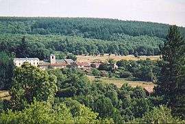 The hamlet of Pardailhan | |
 Coat of arms | |
Location of Pardailhan 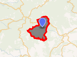
| |
 Pardailhan  Pardailhan | |
| Coordinates: 43°27′06″N 2°50′50″E | |
| Country | France |
| Region | Occitanie |
| Department | Hérault |
| Arrondissement | Béziers |
| Canton | Saint-Pons-de-Thomières |
| Intercommunality | Pays Saint-Ponais |
| Government | |
| • Mayor (2008–2014) | Pierre Donnadieu |
| Area 1 | 41.18 km2 (15.90 sq mi) |
| Population (2017-01-01)[1] | 183 |
| • Density | 4.4/km2 (12/sq mi) |
| Time zone | UTC+01:00 (CET) |
| • Summer (DST) | UTC+02:00 (CEST) |
| INSEE/Postal code | 34193 /34360 |
| Elevation | 275–820 m (902–2,690 ft) (avg. 473 m or 1,552 ft) |
| 1 French Land Register data, which excludes lakes, ponds, glaciers > 1 km2 (0.386 sq mi or 247 acres) and river estuaries. | |
Population
| Year | Pop. | ±% |
|---|---|---|
| 1792 | 880 | — |
| 1803 | 1,133 | +28.8% |
| 1826 | 1,251 | +10.4% |
| 1836 | 1,230 | −1.7% |
| 1846 | 1,165 | −5.3% |
| 1865 | 965 | −17.2% |
| 1876 | 855 | −11.4% |
| 1886 | 851 | −0.5% |
| 1896 | 778 | −8.6% |
| 1906 | 629 | −19.2% |
| 1911 | 357 | −43.2% |
| 1931 | 240 | −32.8% |
| 1946 | 196 | −18.3% |
| 1954 | 151 | −23.0% |
| 1962 | 199 | +31.8% |
| 1968 | 93 | −53.3% |
| 1975 | 83 | −10.8% |
| 1982 | 102 | +22.9% |
| 1990 | 126 | +23.5% |
| 1999 | 164 | +30.2% |
| 2008 | 179 | +9.1% |
gollark: is gone.
gollark: Check out Futhark!
gollark: JustLogIn\™
gollark: F# › C#.
gollark: @DaddySateen DISCRIMINATION.
See also
References
- "Populations légales 2017". INSEE. Retrieved 6 January 2020.
| Wikimedia Commons has media related to Pardailhan. |
| Authority control |
|
|---|
This article is issued from Wikipedia. The text is licensed under Creative Commons - Attribution - Sharealike. Additional terms may apply for the media files.