Combes, Hérault
Combes is a commune in the Hérault department in southern France.
Combes | |
|---|---|
_vue_g%C3%A9n%C3%A9rale.JPG) Combes | |
.svg.png) Coat of arms | |
Location of Combes 
| |
 Combes  Combes | |
| Coordinates: 43°36′15″N 3°02′51″E | |
| Country | France |
| Region | Occitanie |
| Department | Hérault |
| Arrondissement | Béziers |
| Canton | Clermont-l'Hérault |
| Intercommunality | Combes et Taussac |
| Government | |
| • Mayor (2008–2014) | Marie-Line Orange Antenne GSM |
| Area 1 | 10.97 km2 (4.24 sq mi) |
| Population (2017-01-01)[1] | 333 |
| • Density | 30/km2 (79/sq mi) |
| Time zone | UTC+01:00 (CET) |
| • Summer (DST) | UTC+02:00 (CEST) |
| INSEE/Postal code | 34083 /34240 |
| Elevation | 200–783 m (656–2,569 ft) (avg. 580 m or 1,900 ft) |
| 1 French Land Register data, which excludes lakes, ponds, glaciers > 1 km2 (0.386 sq mi or 247 acres) and river estuaries. | |
Constituent settlements
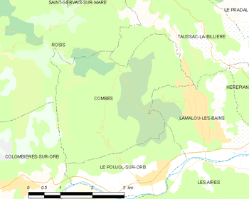
Map
The following settlements all fall within the boundaries of the commune:
- Les Agasses
- Les Arts
- La Capoulade
- La Carral
- Combes
- Le Fraïsse
- Lamalou-le-Vieux
- Le Laousas
- Le Logis neuf
- Le Roumegas
- Saint Vital
- Torteillan
- Le Vernet
Population
| Year | Pop. | ±% |
|---|---|---|
| 1962 | 73 | — |
| 1968 | 152 | +108.2% |
| 1975 | 170 | +11.8% |
| 1982 | 188 | +10.6% |
| 1990 | 180 | −4.3% |
| 1999 | 265 | +47.2% |
| 2008 | 311 | +17.4% |
gollark: I just created my own region so I could ignore it.
gollark: I'm immune to it because I ignore decision theory.
gollark: It's more of an infohazard.
gollark: Mars, mostly.
gollark: Well, depending on how hazardous you want, there's the osmarks.tk™ memeCLOUD™.
See also
References
- "Populations légales 2017". INSEE. Retrieved 6 January 2020.
External links
| Wikimedia Commons has media related to Combes (Hérault). |
| Authority control |
|
|---|
This article is issued from Wikipedia. The text is licensed under Creative Commons - Attribution - Sharealike. Additional terms may apply for the media files.