Berlou
Berlou is a commune in the Hérault department in the Occitanie region in southern France.
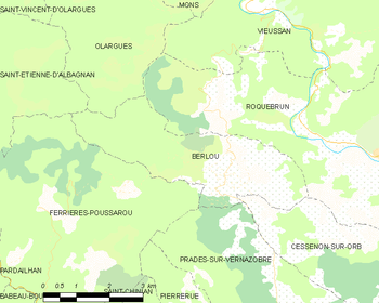
Map
Berlou | |
|---|---|
.svg.png) Coat of arms | |
Location of Berlou 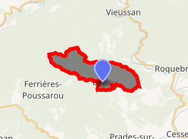
| |
 Berlou  Berlou | |
| Coordinates: 43°29′28″N 2°57′24″E | |
| Country | France |
| Region | Occitanie |
| Department | Hérault |
| Arrondissement | Béziers |
| Canton | Saint-Pons-de-Thomières |
| Intercommunality | Orb et Jaur |
| Government | |
| • Mayor (2008–2014) | Denis Calmette |
| Area 1 | 11.34 km2 (4.38 sq mi) |
| Population (2017-01-01)[1] | 203 |
| • Density | 18/km2 (46/sq mi) |
| Time zone | UTC+01:00 (CET) |
| • Summer (DST) | UTC+02:00 (CEST) |
| INSEE/Postal code | 34030 /34360 |
| Elevation | 130–680 m (430–2,230 ft) (avg. 140 m or 460 ft) |
| 1 French Land Register data, which excludes lakes, ponds, glaciers > 1 km2 (0.386 sq mi or 247 acres) and river estuaries. | |
Population
| Year | Pop. | ±% |
|---|---|---|
| 1962 | 244 | — |
| 1968 | 267 | +9.4% |
| 1975 | 228 | −14.6% |
| 1982 | 203 | −11.0% |
| 1990 | 193 | −4.9% |
| 1999 | 184 | −4.7% |
| 2008 | 189 | +2.7% |
gollark: Like this.
gollark: Basically ASCII art of a hexagon.
gollark: I probably *could* just go for "scan through the grid to find matching first letters, find neighbours which match any relevant second letters" but that seems less nice and also I don't know how to find the neighbours.
gollark: Aidan managed to make a cryptic but apparently functional solution in the traditional how does this even work Aidan style, I'm stuck trying to work out the coordinate systems.
gollark: So, I'm doing a programming puzzle thing to find words in a hexagonal wordsearch thing.
See also
References
- "Populations légales 2017". INSEE. Retrieved 6 January 2020.
| Wikimedia Commons has media related to Berlou. |
| Authority control |
|
|---|
This article is issued from Wikipedia. The text is licensed under Creative Commons - Attribution - Sharealike. Additional terms may apply for the media files.