Montady
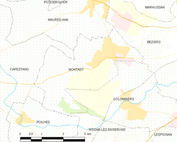
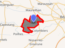
Montady is a commune in the Hérault department in the Occitanie region in southern France.

Map
Montady | |
|---|---|
Étang de Montady | |
.svg.png) Coat of arms | |
Location of Montady 
| |
 Montady  Montady | |
| Coordinates: 43°19′53″N 3°07′18″E | |
| Country | France |
| Region | Occitanie |
| Department | Hérault |
| Arrondissement | Béziers |
| Canton | Cazouls-lès-Béziers |
| Intercommunality | Domitienne |
| Government | |
| • Mayor (2008–2014) | Alain Castan |
| Area 1 | 9.95 km2 (3.84 sq mi) |
| Population (2017-01-01)[1] | 3,935 |
| • Density | 400/km2 (1,000/sq mi) |
| Time zone | UTC+01:00 (CET) |
| • Summer (DST) | UTC+02:00 (CEST) |
| INSEE/Postal code | 34161 /34310 |
| Elevation | 10–113 m (33–371 ft) (avg. 7 m or 23 ft) |
| 1 French Land Register data, which excludes lakes, ponds, glaciers > 1 km2 (0.386 sq mi or 247 acres) and river estuaries. | |
Population
| Year | Pop. | ±% |
|---|---|---|
| 1793 | 163 | — |
| 1800 | 174 | +6.7% |
| 1806 | 160 | −8.0% |
| 1821 | 205 | +28.1% |
| 1831 | 261 | +27.3% |
| 1836 | 266 | +1.9% |
| 1841 | 317 | +19.2% |
| 1846 | 320 | +0.9% |
| 1851 | 346 | +8.1% |
| 1856 | 313 | −9.5% |
| 1861 | 360 | +15.0% |
| 1866 | 366 | +1.7% |
| 1872 | 384 | +4.9% |
| 1876 | 408 | +6.2% |
| 1881 | 470 | +15.2% |
| 1886 | 515 | +9.6% |
| 1891 | 590 | +14.6% |
| 1896 | 648 | +9.8% |
| 1901 | 703 | +8.5% |
| 1906 | 660 | −6.1% |
| 1911 | 651 | −1.4% |
| 1921 | 785 | +20.6% |
| 1926 | 700 | −10.8% |
| 1931 | 750 | +7.1% |
| 1936 | 725 | −3.3% |
| 1946 | 610 | −15.9% |
| 1954 | 620 | +1.6% |
| 1962 | 695 | +12.1% |
| 1968 | 911 | +31.1% |
| 1975 | 1,310 | +43.8% |
| 1982 | 1,635 | +24.8% |
| 1990 | 2,070 | +26.6% |
| 1999 | 2,533 | +22.4% |
| 2008 | 3,869 | +52.7% |
gollark: You can play this if you have something capable of decoding AV1.
gollark: <@!711227962401226793> ↑
gollark: Wrong.
gollark: Dreams aren't real, according to science.
gollark: https://qntm.org/ra
References
- "Populations légales 2017". INSEE. Retrieved 6 January 2020.
| Wikimedia Commons has media related to Montady. |
This article is issued from Wikipedia. The text is licensed under Creative Commons - Attribution - Sharealike. Additional terms may apply for the media files.