Maraussan
Maraussan is a commune in the Hérault department in southern France.
Maraussan | |
|---|---|
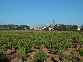 A view of old Maraussan | |
.svg.png) Coat of arms | |
Location of Maraussan 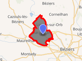
| |
 Maraussan  Maraussan | |
| Coordinates: 43°22′03″N 3°09′31″E | |
| Country | France |
| Region | Occitanie |
| Department | Hérault |
| Arrondissement | Béziers |
| Canton | Cazouls-lès-Béziers |
| Intercommunality | Domitienne |
| Government | |
| • Mayor (2008–2014) | Serge Pesce |
| Area 1 | 12.37 km2 (4.78 sq mi) |
| Population (2017-01-01)[1] | 4,414 |
| • Density | 360/km2 (920/sq mi) |
| Time zone | UTC+01:00 (CET) |
| • Summer (DST) | UTC+02:00 (CEST) |
| INSEE/Postal code | 34148 /34370 |
| Elevation | 8–92 m (26–302 ft) (avg. 38 m or 125 ft) |
| 1 French Land Register data, which excludes lakes, ponds, glaciers > 1 km2 (0.386 sq mi or 247 acres) and river estuaries. | |
It lies approximately 8 km northwest of Béziers, on route D14 ( Av de Béziers ), a busy route for commuters to Béziers.
Chateau Perdiguier lies just outside the town on the cross road D39 (Route de Tarbaka) leading down to the river Orb.
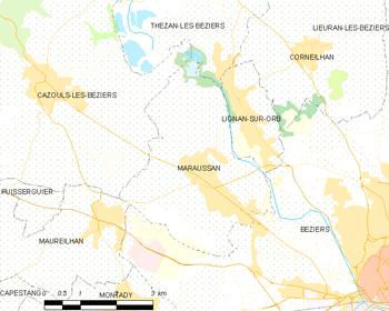
Map
Population
| Year | Pop. | ±% |
|---|---|---|
| 1962 | 1,595 | — |
| 1968 | 1,655 | +3.8% |
| 1975 | 2,088 | +26.2% |
| 1982 | 2,154 | +3.2% |
| 1990 | 2,336 | +8.4% |
| 1999 | 2,782 | +19.1% |
| 2008 | 3,448 | +23.9% |
gollark: _*\*\|*|*/*/*_
gollark: *\*\
gollark: DF is open-source? I don't think so.
gollark: Why not make your own and call it, say, "Small Being Castle" or something?
gollark: Yes, but multiplayer is quite a significant change.
See also
References
- "Populations légales 2017". INSEE. Retrieved 6 January 2020.
| Wikimedia Commons has media related to Maraussan. |
| Authority control |
|
|---|
This article is issued from Wikipedia. The text is licensed under Creative Commons - Attribution - Sharealike. Additional terms may apply for the media files.