Balaruc-le-Vieux
Balaruc-le-Vieux is a commune in the Hérault department in the Occitanie region in southern France.
Balaruc-le-Vieux | |
|---|---|
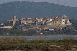 View of Balaruc-le-Vieux across the Étang de Thau | |
.svg.png) Coat of arms | |
Location of Balaruc-le-Vieux 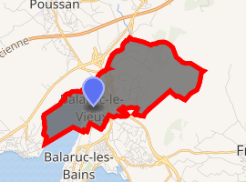
| |
 Balaruc-le-Vieux  Balaruc-le-Vieux | |
| Coordinates: 43°27′41″N 3°41′07″E | |
| Country | France |
| Region | Occitanie |
| Department | Hérault |
| Arrondissement | Montpellier |
| Canton | Frontignan |
| Intercommunality | CA Sète Agglopôle Méditerranée |
| Government | |
| • Mayor (2008–2014) | Max Serres |
| Area 1 | 5.92 km2 (2.29 sq mi) |
| Population (2017-01-01)[1] | 2,628 |
| • Density | 440/km2 (1,100/sq mi) |
| Time zone | UTC+01:00 (CET) |
| • Summer (DST) | UTC+02:00 (CEST) |
| INSEE/Postal code | 34024 /34540 |
| Elevation | 0–196 m (0–643 ft) (avg. 12 m or 39 ft) |
| 1 French Land Register data, which excludes lakes, ponds, glaciers > 1 km2 (0.386 sq mi or 247 acres) and river estuaries. | |
Population
| Year | Pop. | ±% |
|---|---|---|
| 1962 | 475 | — |
| 1968 | 533 | +12.2% |
| 1975 | 521 | −2.3% |
| 1982 | 701 | +34.5% |
| 1990 | 1,065 | +51.9% |
| 1999 | 1,802 | +69.2% |
| 2008 | 2,026 | +12.4% |
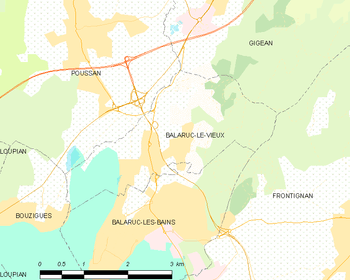
Map

The shopping mall from the Southeast.
gollark: r/fool
gollark: r/ihaveredditttoo
gollark: Turns out P does *not* equal NP!
gollark: ```osmarks@tyr ~/D/games> bash -c 'echo $((P = NP))'0```
gollark: Wait, no, wrong command.
References
- "Populations légales 2017". INSEE. Retrieved 6 January 2020.
| Wikimedia Commons has media related to Balaruc-le-Vieux. |
| Authority control |
|
|---|
This article is issued from Wikipedia. The text is licensed under Creative Commons - Attribution - Sharealike. Additional terms may apply for the media files.