Miribel, Ain
Miribel is a commune in the Ain department in eastern France.
Miribel | |
|---|---|
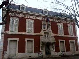 Town hall | |
.svg.png) Coat of arms | |
Location of Miribel 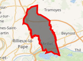
| |
 Miribel  Miribel | |
| Coordinates: 45°49′31″N 4°57′13″E | |
| Country | France |
| Region | Auvergne-Rhône-Alpes |
| Department | Ain |
| Arrondissement | Bourg-en-Bresse |
| Canton | Miribel |
| Intercommunality | CC Miribel et Plateau |
| Government | |
| • Mayor (2014–present) | Sylvie Viricel[1] |
| Area 1 | 24.49 km2 (9.46 sq mi) |
| Population (2017-01-01)[2] | 9,963 |
| • Density | 410/km2 (1,100/sq mi) |
| Time zone | UTC+01:00 (CET) |
| • Summer (DST) | UTC+02:00 (CEST) |
| INSEE/Postal code | 01249 /01700 |
| Elevation | 168–314 m (551–1,030 ft) (avg. 174 m or 571 ft) |
| 1 French Land Register data, which excludes lakes, ponds, glaciers > 1 km2 (0.386 sq mi or 247 acres) and river estuaries. | |
It is a suburb of Lyon.
Population
| Year | Pop. | ±% |
|---|---|---|
| 1793 | 1,975 | — |
| 1800 | 2,650 | +34.2% |
| 1806 | 2,555 | −3.6% |
| 1821 | 3,049 | +19.3% |
| 1831 | 2,400 | −21.3% |
| 1836 | 2,321 | −3.3% |
| 1841 | 2,636 | +13.6% |
| 1846 | 2,829 | +7.3% |
| 1851 | 2,913 | +3.0% |
| 1856 | 3,026 | +3.9% |
| 1861 | 3,139 | +3.7% |
| 1866 | 3,360 | +7.0% |
| 1872 | 3,205 | −4.6% |
| 1876 | 3,480 | +8.6% |
| 1881 | 3,076 | −11.6% |
| 1886 | 3,262 | +6.0% |
| 1891 | 3,420 | +4.8% |
| 1896 | 3,339 | −2.4% |
| 1901 | 3,406 | +2.0% |
| 1906 | 3,370 | −1.1% |
| 1911 | 3,379 | +0.3% |
| 1921 | 3,114 | −7.8% |
| 1926 | 3,437 | +10.4% |
| 1931 | 4,068 | +18.4% |
| 1936 | 4,330 | +6.4% |
| 1946 | 3,807 | −12.1% |
| 1954 | 4,248 | +11.6% |
| 1962 | 4,580 | +7.8% |
| 1968 | 5,651 | +23.4% |
| 1975 | 6,237 | +10.4% |
| 1982 | 7,053 | +13.1% |
| 1990 | 7,683 | +8.9% |
| 1999 | 8,545 | +11.2% |
| 2008 | 8,997 | +5.3% |
gollark: GIFs are carcinogenic. We're stuck with them as an *awful* format because they are considered images but are animated.
gollark: I have, but didn't know there was an actual WIP implementation.
gollark: Ooh, tiny turtles?
gollark: Oh, stuff finally switched to a *cool* config language for 1.13?
gollark: vs... well, java won't even let you define a function on its own.
See also
References
- "Miribel - L’heure du premier bilan pour Sylvie Viricel", lavoixdelain.fr.
- "Populations légales 2017". INSEE. Retrieved 6 January 2020.
External links
| Wikimedia Commons has media related to Miribel (Ain). |
This article is issued from Wikipedia. The text is licensed under Creative Commons - Attribution - Sharealike. Additional terms may apply for the media files.