La Chapelle-du-Châtelard
La Chapelle-du-Châtelard is a commune in the Ain department in eastern France.
La Chapelle-du-Châtelard | |
|---|---|
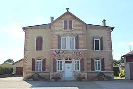 The town hall in La Chapelle-du-Châtelard | |
Location of La Chapelle-du-Châtelard 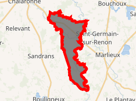
| |
 La Chapelle-du-Châtelard  La Chapelle-du-Châtelard | |
| Coordinates: 46°04′11″N 5°01′34″E | |
| Country | France |
| Region | Auvergne-Rhône-Alpes |
| Department | Ain |
| Arrondissement | Bourg-en-Bresse |
| Canton | Châtillon-sur-Chalaronne |
| Intercommunality | Dombes |
| Government | |
| • Mayor (2014-2020) | Cyrille Rimaud |
| Area 1 | 13.37 km2 (5.16 sq mi) |
| Population (2017-01-01)[1] | 388 |
| • Density | 29/km2 (75/sq mi) |
| Time zone | UTC+01:00 (CET) |
| • Summer (DST) | UTC+02:00 (CEST) |
| INSEE/Postal code | 01085 /01240 |
| Elevation | 236–285 m (774–935 ft) (avg. 266 m or 873 ft) |
| 1 French Land Register data, which excludes lakes, ponds, glaciers > 1 km2 (0.386 sq mi or 247 acres) and river estuaries. | |
Geography
The Chalaronne forms the commune's southeastern border, flows northwest through the northern part of the commune, then forms part of its northwestern border.
Population
| Year | Pop. | ±% |
|---|---|---|
| 2006 | 276 | — |
| 2007 | 310 | +12.3% |
| 2008 | 309 | −0.3% |
| 2009 | 325 | +5.2% |
| 2010 | 341 | +4.9% |
| 2011 | 357 | +4.7% |
| 2012 | 363 | +1.7% |
| 2013 | 375 | +3.3% |
| 2014 | 379 | +1.1% |
| 2015 | 383 | +1.1% |
| 2016 | 387 | +1.0% |
gollark: Anyway, basically, currently I use nginx, but the config is annoying.
gollark: No, I am not.
gollark: This is annoying. I want to redo my server setup, but people actually *use* it...
gollark: I will!
gollark: Squids be weird.
See also
References
- "Populations légales 2017". INSEE. Retrieved 6 January 2020.
| Wikimedia Commons has media related to La Chapelle-du-Châtelard. |
This article is issued from Wikipedia. The text is licensed under Creative Commons - Attribution - Sharealike. Additional terms may apply for the media files.