Courmangoux
Courmangoux is a commune in the Ain department in eastern France.
Courmangoux | |
|---|---|
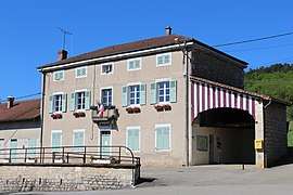
 The town hall in Courmangoux | |
.svg.png) Coat of arms | |
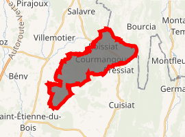
Location of Courmangoux 
| |
 Courmangoux  Courmangoux | |
| Coordinates: 46°19′55″N 5°22′11″E | |
| Country | France |
| Region | Auvergne-Rhône-Alpes |
| Department | Ain |
| Arrondissement | Bourg-en-Bresse |
| Canton | Saint-Étienne-du-Bois |
| Intercommunality | Treffort-en-Revermont |
| Government | |
| • Mayor (2008–2014) | Mireille Mornet |
| Area 1 | 14.82 km2 (5.72 sq mi) |
| Population (2017-01-01)[1] | 507 |
| • Density | 34/km2 (89/sq mi) |
| Time zone | UTC+01:00 (CET) |
| • Summer (DST) | UTC+02:00 (CEST) |
| INSEE/Postal code | 01127 /01370 |
| Elevation | 211–652 m (692–2,139 ft) (avg. 300 m or 980 ft) |
| 1 French Land Register data, which excludes lakes, ponds, glaciers > 1 km2 (0.386 sq mi or 247 acres) and river estuaries. | |
Population
| Year | Pop. | ±% |
|---|---|---|
| 1793 | 1,003 | — |
| 1800 | 1,050 | +4.7% |
| 1806 | 1,048 | −0.2% |
| 1821 | 1,060 | +1.1% |
| 1831 | 1,000 | −5.7% |
| 1836 | 975 | −2.5% |
| 1841 | 926 | −5.0% |
| 1846 | 919 | −0.8% |
| 1851 | 886 | −3.6% |
| 1856 | 828 | −6.5% |
| 1861 | 838 | +1.2% |
| 1866 | 783 | −6.6% |
| 1872 | 783 | +0.0% |
| 1876 | 796 | +1.7% |
| 1881 | 766 | −3.8% |
| 1886 | 736 | −3.9% |
| 1891 | 680 | −7.6% |
| 1896 | 641 | −5.7% |
| 1901 | 680 | +6.1% |
| 1906 | 675 | −0.7% |
| 1911 | 639 | −5.3% |
| 1921 | 554 | −13.3% |
| 1926 | 551 | −0.5% |
| 1931 | 536 | −2.7% |
| 1936 | 510 | −4.9% |
| 1946 | 448 | −12.2% |
| 1954 | 389 | −13.2% |
| 1962 | 395 | +1.5% |
| 1968 | 354 | −10.4% |
| 1975 | 296 | −16.4% |
| 1982 | 310 | +4.7% |
| 1990 | 327 | +5.5% |
| 1999 | 360 | +10.1% |
| 2008 | 490 | +36.1% |
gollark: I mean, it's faster on numbers for which the lookup table is valid, but so is hardcoding the answers.
gollark: Not really.
gollark: WRONG.
gollark: As opposed to the *general* number field sieve, which is just too complicated.
gollark: No, you should tell everyone about the quadratic number field sieve.
See also
References
- "Populations légales 2017". INSEE. Retrieved 6 January 2020.
| Wikimedia Commons has media related to Courmangoux. |
This article is issued from Wikipedia. The text is licensed under Creative Commons - Attribution - Sharealike. Additional terms may apply for the media files.