Ceignes
Ceignes (French pronunciation: [sɛɲ]) is a commune in the Ain department in eastern France.
Ceignes | |
|---|---|
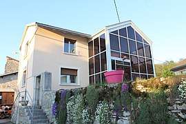 The town hall in Ceignes | |
Location of Ceignes 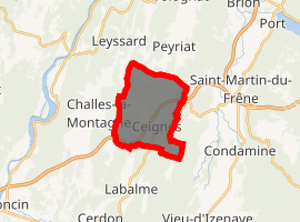
| |
 Ceignes  Ceignes | |
| Coordinates: 46°07′15″N 5°30′00″E | |
| Country | France |
| Region | Auvergne-Rhône-Alpes |
| Department | Ain |
| Arrondissement | Nantua |
| Canton | Pont-d'Ain |
| Intercommunality | Haut-Bugey Agglomération |
| Government | |
| • Mayor (2020-2026) | Alain Auboeuf |
| Area 1 | 10.01 km2 (3.86 sq mi) |
| Population (2017-01-01)[1] | 254 |
| • Density | 25/km2 (66/sq mi) |
| Time zone | UTC+01:00 (CET) |
| • Summer (DST) | UTC+02:00 (CEST) |
| INSEE/Postal code | 01067 /01430 |
| Elevation | 580–862 m (1,903–2,828 ft) (avg. 630 m or 2,070 ft) |
| 1 French Land Register data, which excludes lakes, ponds, glaciers > 1 km2 (0.386 sq mi or 247 acres) and river estuaries. | |
Population
| Year | Pop. | ±% |
|---|---|---|
| 2004 | 273 | — |
| 2006 | 282 | +3.3% |
| 2007 | 277 | −1.8% |
| 2008 | 271 | −2.2% |
| 2009 | 265 | −2.2% |
| 2010 | 261 | −1.5% |
| 2011 | 261 | +0.0% |
| 2012 | 261 | +0.0% |
| 2013 | 262 | +0.4% |
| 2014 | 263 | +0.4% |
| 2015 | 256 | −2.7% |
| 2016 | 253 | −1.2% |
gollark: Fear.
gollark: Muahahaha. I am accessing Discord via my phone via my computer.
gollark: Fearsome.
gollark: I just realized that osmarkslisp™ never actually uses the `NoParse` thing I defined in it and apparently nobody noticed.
gollark: Well, I think most cases would be fine with 1 to 3 bracketless arguments.
See also
References
- "Populations légales 2017". INSEE. Retrieved 6 January 2020.
| Wikimedia Commons has media related to Ceignes. |
This article is issued from Wikipedia. The text is licensed under Creative Commons - Attribution - Sharealike. Additional terms may apply for the media files.