Grade II* listed buildings in South Norfolk
There are over 20,000 Grade II* listed buildings in England. This page is a list of these buildings in the district of South Norfolk in Norfolk.
South Norfolk
| Name | Location | Type | Completed [note 1] | Date designated | Grid ref.[note 2] Geo-coordinates |
Entry number [note 3] | Image |
|---|---|---|---|---|---|---|---|
| Homersfield Bridge | Alburgh, South Norfolk | Bridge | 1869 | 3 June 1981 | TM2836785740 52°25′19″N 1°21′26″E |
1031993 | |
| Church of St Mary | Ashby St Mary | Parish Church | 12th century | 5 September 1960 | TG3292902234 52°34′05″N 1°26′08″E |
1050660 |  Church of St Mary |
| St Mary's Chapel | Ashwellthorpe, Ashwellthorpe and Fundenhall | House | 18th century | 11 September 1951 | TM1636997447 52°31′55″N 1°11′19″E |
1373555 |  |
| Church of St Botolph | Barford | Parish Church | 13th century | 26 November 1959 | TG1069707988 52°37′43″N 1°06′42″E |
1050737 | 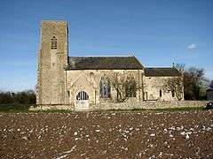 Church of St Botolph |
| Church Farmhouse | Bawburgh | Farmhouse | Late Medieval | 14 April 1983 | TG1531608666 52°37′59″N 1°10′49″E |
1050779 | |
| Lodge Farmhouse | Bawburgh | House | Mid 19th century | 14 April 1983 | TG1676708868 52°38′03″N 1°12′07″E |
1373047 | |
| The Hermit's House | Bawburgh | House | 17th century | 2 October 1951 | TG1573208818 52°38′03″N 1°11′12″E |
1050783 | |
| The Slipper Chapel in Garden of Brecon House | Bawburgh | Garden House | Mid 17th century | 2 October 1951 | TG1574408782 52°38′02″N 1°11′12″E |
1373019 | |
| Church of St Peter and St Paul | Bergh Apton | Parish Church | 14th century | 5 September 1960 | TM3105299895 52°32′52″N 1°24′23″E |
1373078 | 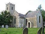 Church of St Peter and St Paul |
| Church of St Wandregesilius | Bixley | Church | 1771 | 26 November 1959 | TG2585904964 52°35′44″N 1°20′00″E |
1050487 | 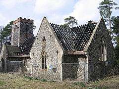 Church of St Wandregesilius |
| Barn and Attached Outbuildings at Church Farm | Hethel, Bracon Ash | Barn | Mid/Late 18th century | 15 November 1999 | TG1684900315 52°33′27″N 1°11′51″E |
1379809 | |
| Cart Shed at Church Farm | Hethel, Bracon Ash | Cart Shed | 18th century | 15 November 1999 | TG1686000344 52°33′28″N 1°11′52″E |
1379810 | |
| Church Farm House | Hethel, Bracon Ash | Farmhouse | 17th century | 15 November 1999 | TG1682600292 52°33′26″N 1°11′50″E |
1379811 | |
| Mergate Hall | Bracon Ash | House | 17th century | 2 October 1951 | TM1825799394 52°32′55″N 1°13′04″E |
1050692 | |
| Church of St Peter | Bramerton | Parish Church | c. 1300 | 26 November 1959 | TG2959704686 52°35′29″N 1°23′18″E |
1050489 | 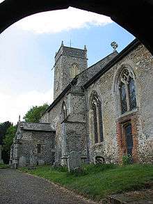 Church of St Peter |
| Grange Farmhouse | Bressingham | House | 16th century | 11 September 1951 | TM0848081400 52°23′27″N 1°03′45″E |
1373591 | |
| Valley Farmhouse | Bressingham | House | 16th century | 11 September 1951 | TM0727581595 52°23′35″N 1°02′42″E |
1049665 | |
| Brockdish Hall | Brockdish | House | Early 17th century | 11 September 1951 | TM2117580412 52°22′37″N 1°14′53″E |
1305933 | |
| The Grange | Brockdish | House | 1676 | 19 September 1957 | TM2024480020 52°22′26″N 1°14′03″E |
1049632 | |
| Church of St Peter | Brooke | Parish Church | Medieval | 5 September 1960 | TM2939799541 52°32′43″N 1°22′54″E |
1051120 | 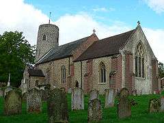 Church of St Peter |
| Porch House | Brooke | House | 17th century | 25 September 1951 | TM2917999275 52°32′35″N 1°22′42″E |
1372848 | |
| Alma House including Boundary Walls to North and South | Broome | Farmhouse | Early 18th century | 25 September 1951 | TM3431790840 52°27′55″N 1°26′53″E |
1152917 | |
| Church of St Mary | Burgh St Peter | Parish Church | 14th century | 5 September 1960 | TM4935193706 52°29′03″N 1°40′16″E |
1304545 | 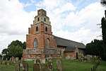 Church of St Mary |
| Church of St Mary | Burston | Tower | 1753 | 7 December 1959 | TM1370383187 52°24′18″N 1°08′25″E |
1305672 | 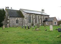 Church of St Mary |
| Shimpling Place | Shimpling | House | 16th century | 11 September 1951 | TM1516283523 52°24′27″N 1°09′43″E |
1049620 | Shimpling Place |
| Church of St Edmund | Caistor St Edmund | Parish Church | Early 14th century | 26 November 1959 | TG2322103380 52°34′57″N 1°17′36″E |
1373145 | 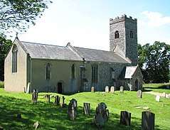 Church of St Edmund |
| The Old Hall | Caistor St Edmund | House | 1612 | 2 October 1951 | TG2329803807 52°35′10″N 1°17′41″E |
1050563 | |
| Church of St Peter | Carleton St Peter | Parish Church | 13th century | 5 September 1960 | TG3396702287 52°34′05″N 1°27′03″E |
1050629 | 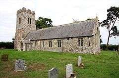 Church of St Peter |
| Remains of Claxton Castle | Claxton | Fortified House | Post 1333 | 25 September 1951 | TG3354303778 52°34′54″N 1°26′45″E |
1050630 | 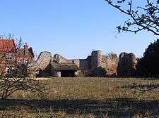 Remains of Claxton Castle |
| Church of St. Andrew | Colney | Church | 14th century | 20 April 1959 | TG1807407956 52°37′32″N 1°13′14″E |
1050754 | 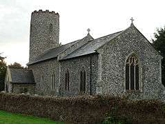 Church of St. Andrew |
| Church of St Peter | Cringleford | Church | 1940 | 26 November 1959 | TG1983605824 52°36′20″N 1°14′43″E |
1306659 | 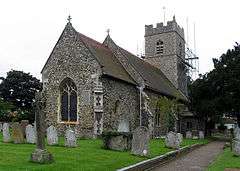 Church of St Peter |
| Lodge Farmhouse | Denton | Aisled House | Circa 14th century | 26 June 1981 | TM2890988611 52°26′51″N 1°22′01″E |
1373629 | |
| Church of St Mary | Hackford, Deopham | Parish Church | 12th century | 26 November 1959 | TG0594302258 52°34′45″N 1°02′17″E |
1172492 | 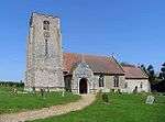 Church of St Mary |
| Crown Farmhouse | Deopham | Farmhouse | 16th century | 15 August 1983 | TG0434300801 52°34′00″N 1°00′49″E |
1172516 | |
| Manor House | Dickleburgh and Rushall | House | 18th century | 11 September 1951 | TM1657681889 52°23′32″N 1°10′54″E |
1304866 | |
| Dolphin House | Diss | Timber Framed House | Early 16th century | 29 December 1950 | TM1172979974 52°22′37″N 1°06′33″E |
1373524 | 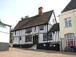 Dolphin House |
| 2 Mount Street | Diss | House | Early 19th century | 8 June 1972 | TM1169080061 52°22′40″N 1°06′31″E |
1049711 | 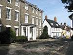 2 Mount Street |
| Earsham Hall | Earsham | House | 17th century | 11 September 1951 | TM3080389821 52°27′27″N 1°23′45″E |
1050397 | |
| Church of St Mary | East Carleton | Parish Church | Medieval | 26 November 1959 | TG1798002060 52°34′22″N 1°12′55″E |
1306618 | 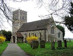 Church of St Mary |
| West Lodge | Lower Easton, Easton, Norfolk | Farmhouse | c. 1600 | 14 April 1983 | TG1409411710 52°39′39″N 1°09′52″E |
1050771 | |
| Church of St Michael | Flordon | Parish Church | 11th century or 12th century | 26 November 1959 | TM1892497267 52°31′45″N 1°13′34″E |
1172235 | 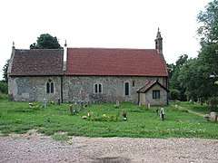 Church of St Michael |
| Flordon Hall | Flordon | Farmhouse | 1595-1612 | 2 October 1951 | TM1867497982 52°32′09″N 1°13′22″E |
1050698 | 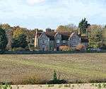 Flordon Hall |
| Old Hall Farmhouse | Forncett St Mary, Forncett | House | Late 16th century | 26 June 1981 | TM1664494238 52°30′11″N 1°11′26″E |
1373219 | |
| Yew Tree Farmhouse | Forncett St Mary, Forncett | Timber Framed House | 15th century | 26 June 1981 | TM1674094611 52°30′23″N 1°11′32″E |
1152706 | |
| Church of St Andrew | Framingham Pigot | Parish Church | 1859 | 7 September 1988 | TG2779503600 52°34′57″N 1°21′39″E |
1050456 | 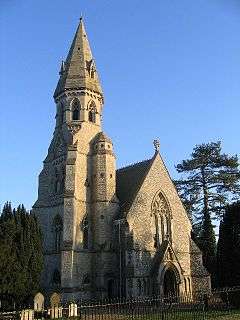 Church of St Andrew |
| Church of St. Michael and All Angels | Geldeston | Parish Church | 12th century | 5 September 1960 | TM3947492284 52°28′33″N 1°31′29″E |
1153255 | 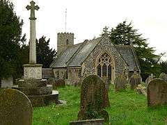 Church of St. Michael and All Angels |
| Gillingham Hall | Gillingham | Country House | c. 1600 | 25 September 1951 | TM4131492276 52°28′30″N 1°33′07″E |
1050581 | |
| Church of All Saints | Great Melton | Church | 11th century | 26 November 1959 | TG1406406148 52°36′39″N 1°09′37″E |
1050731 | 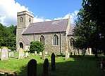 Church of All Saints |
| Remains of Church of St Mary | Great Melton | Tower | 15th century | 26 November 1959 | TG1404106123 52°36′38″N 1°09′36″E |
1050732 | 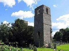 Remains of Church of St Mary |
| Church of St Michael | Great Moulton | Tower | 1887 | 7 December 1959 | TM1658490786 52°28′19″N 1°11′15″E |
1050319 | .jpg) Church of St Michael |
| Old Rectory | Moulton St Michael, Great Moulton | Tower | 1831 | 15 September 1977 | TM1659690724 52°28′17″N 1°11′15″E |
1050320 | |
| Tomb Chest About 20 Metres South South West of Church of St Michael | Great Moulton | Chest Tomb | 15th century | 19 August 1993 | TM1656290756 52°28′18″N 1°11′13″E |
1335082 | |
| Church of St Remigius | Hethersett | Parish Church | 14th century | 26 November 1959 | TG1608204918 52°35′57″N 1°11′21″E |
1373115 | 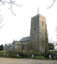 Church of St Remigius |
| Admiral's House | Hingham | House | Early 18th century | 26 November 1959 | TG0238602153 52°34′46″N 0°59′08″E |
1305575 | |
| Beaconsfield House Including Railings and Gateway in Front. | Hingham | House | Early 18th century | 26 November 1959 | TG0238802142 52°34′46″N 0°59′08″E |
1051143 | Beaconsfield House Including Railings and Gateway in Front. |
| Little London | Hingham | House | 18th century | 26 November 1959 | TG0238002180 52°34′47″N 0°59′08″E |
1051142 | .jpg) Little London |
| Quorn House | Hingham | House | Late 18th century | 26 November 1959 | TG0237602196 52°34′48″N 0°59′08″E |
1171512 |  Quorn House |
| Southernwood House | Hingham | House | C17/18 | 2 October 1951 | TG0236302221 52°34′48″N 0°59′07″E |
1051141 | |
| The Mansion House | Hingham | House | Late 17th century | 26 November 1959 | TG0221402267 52°34′50″N 0°58′59″E |
1171125 | |
| Holverston Hall | Holverston | House | 16th century | 7 September 1988 | TG3072703191 52°34′39″N 1°24′14″E |
1050458 | |
| Church of St Mary | Howe | Parish Church | Medieval | 5 September 1960 | TM2750299957 52°33′00″N 1°21′15″E |
1372850 | 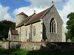 Church of St Mary |
| Church of All Saints | Intwood, Keswick and Intwood | Parish Church | 12th century | 26 November 1959 | TG1968704184 52°35′28″N 1°14′31″E |
1373136 | 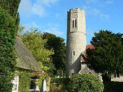 Church of All Saints |
| Church of St Peter | Ketteringham | Parish Church | 11th century | 26 November 1959 | TG1638102561 52°34′40″N 1°11′32″E |
1373140 | 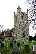 Church of St Peter |
| Left Gateway Turret to Stable Yard at Ketteringham Hall incorporating a Greek Marble, with Attached Range | Ketteringham | Gate | 1899 | 26 October 1987 | TG1645202544 52°34′39″N 1°11′35″E |
1373142 | .jpg) Left Gateway Turret to Stable Yard at Ketteringham Hall incorporating a Greek Marble, with Attached Range |
| Right Gateway Turret to Stable Yard at Ketteringham Hall and Attached Range, incorporating Three Greek Marbles | Ketteringham | Gate | 1899 | 26 October 1987 | TG1642602564 52°34′40″N 1°11′34″E |
1170116 | .jpg) Right Gateway Turret to Stable Yard at Ketteringham Hall and Attached Range, incorporating Three Greek Marbles |
| Stanfield Hall (that part in Ketteringham Parish) | Ketteringham | House | 1792 | 14 July 1972 | TG1434001004 52°33′53″N 1°09′40″E |
1050548 | |
| Church of St Mary | Carleton Forehoe, Kimberley | Parish Church | 15th century | 26 November 1959 | TG0896205845 52°36′37″N 1°05′05″E |
1172547 | 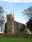 Church of St Mary |
| Church of St Peter | Kimberley | Parish Church | 12th century | 26 November 1959 | TG0715204172 52°35′45″N 1°03′26″E |
1050747 | 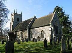 Church of St Peter |
| Church of St Andrew | Kirby Bedon | Parish Church | 14th century | 26 November 1959 | TG2785505440 52°35′56″N 1°21′47″E |
1169464 | 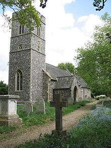 Church of St Andrew |
| Remains of Church of St Mary | Kirby Bedon | Church ruin | 13th century | 26 November 1959 | TG2792705414 52°35′55″N 1°21′51″E |
1050460 | 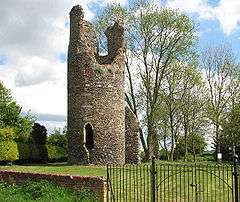 Remains of Church of St Mary |
| Kirby Cane Hall | Kirby Cane | Country House | 17th century | 25 September 1951 | TM3729294105 52°29′36″N 1°29′39″E |
1050591 | .jpg) Kirby Cane Hall |
| Church of St Margaret | Kirstead | Parish Church | c. 1200 | 5 September 1960 | TM2962298492 52°32′09″N 1°23′04″E |
1372852 | 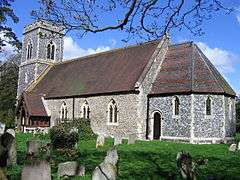 Church of St Margaret |
| Former Stable Block to Langley Abbey | Langley Green, Langley with Hardley | Abbey | 16th century | 25 September 1951 | TG3622002837 52°34′19″N 1°29′04″E |
1306556 | |
| Hardley Hall | Langley with Hardley | Country House | Mid/Late 16th century | 25 September 1951 | TG3873000031 52°32′45″N 1°31′10″E |
1050632 | 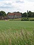 Hardley Hall |
| Church of St Mary and All Saints | Little Melton | Parish Church | Early 14th century | 26 November 1959 | TG1534106912 52°37′02″N 1°10′47″E |
1050541 | 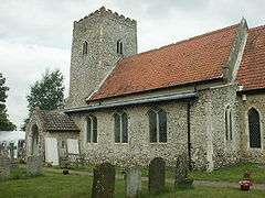 Church of St Mary and All Saints |
| Loddon House | Loddon | House | c. 1710 | 25 September 1951 | TM3628998416 52°31′56″N 1°28′57″E |
1050533 | .jpg) Loddon House |
| Small Barn immediately South East of Hales Hall | Hales Green, Loddon | Barn | 17th century | 4 February 1977 | TM3698296055 52°30′39″N 1°29′27″E |
1050506 | |
| Wall immediately South East of Hales Hall | Hales Green, Loddon | Gate | Late 15th century | 4 February 1977 | TM3696896033 52°30′38″N 1°29′27″E |
1169573 | |
| Premises Owned by Mr Tummore and G.J. Cracknell and Son | Long Stratton | House | 17th century | 7 December 1959 | TM1969192636 52°29′15″N 1°14′04″E |
1050276 | |
| The Old Rectory | Stratton St Michael, Long Stratton | House | 16th century | 7 December 1959 | TM2052093581 52°29′44″N 1°14′50″E |
1373264 | |
| Church of St Andrew | Colton, Marlingford and Colton | Parish Church | 14th century | 15 August 1983 | TG1044409327 52°38′27″N 1°06′32″E |
1050751 | 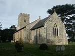 Church of St Andrew |
| Church of St Mary | Marlingford and Colton | Parish Church | 12th century | 29 November 1959 | TG1271608320 52°37′51″N 1°08′30″E |
1373046 | 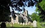 Church of St Mary |
| The Old Hall | Marlingford and Colton | Farmhouse | 1608 | 2 October 1951 | TG1326309178 52°38′18″N 1°09′02″E |
1151936 | |
| Church of St Botolph | Morley St Botolph, Morley | Parish Church | 15th century | 15 August 1983 | TG0693200214 52°33′37″N 1°03′05″E |
1373064 | 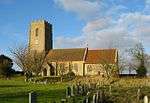 Church of St Botolph |
| Church of St Peter | Morley | Parish Church | 15th century | 29 November 1959 | TM0633998645 52°32′48″N 1°02′30″E |
1304931 | 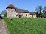 Church of St Peter |
| Morley Manor | Morley | Manor House | Early 17th century | 2 October 1951 | TM0544699429 52°33′14″N 1°01′44″E |
1373065 | |
| Church of St Mary Magdalen | Mulbarton | Parish Church | Medieval | 26 November 1959 | TG1942501147 52°33′50″N 1°14′10″E |
1172267 | 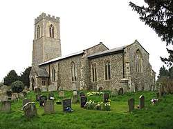 Church of St Mary Magdalen |
| Church of St Mary the Virgin | Newton Flotman | Parish Church | 15th century | 26 November 1959 | TM2129898475 52°32′21″N 1°15′43″E |
1050704 | 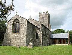 Church of St Mary the Virgin |
| Dairy Farmhouse Barn | Newton Flotman | Barn | c. 1500 | 2 December 1983 | TM2192999186 52°32′43″N 1°16′18″E |
1050707 | |
| Church Farmhouse | Poringland | Farmhouse | c. 1600 | 26 November 1959 | TG2714001644 52°33′55″N 1°21′00″E |
1306467 | |
| Porch House | Poringland | Farmhouse | Late 16th century | 26 November 1959 | TG2717101744 52°33′58″N 1°21′02″E |
1373181 | |
| Manor Farmhouse | Pulham Market | Farmhouse | Late 16th century | 11 September 1951 | TM2110988467 52°26′58″N 1°15′09″E |
1373298 | |
| Church of St Andrew | Raveningham | Parish Church | 12th century | 5 September 1960 | TM3978896399 52°30′46″N 1°31′57″E |
1050483 | 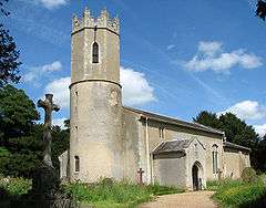 Church of St Andrew |
| Raveningham Hall | Raveningham Park, Raveningham | Country House | Late 18th century | 25 September 1951 | TM3991096467 52°30′48″N 1°32′03″E |
1306263 | |
| Candler's House | Harleston, Redenhall with Harleston | House | Early 18th century | 7 December 1959 | TM2471883605 52°24′15″N 1°18′08″E |
1156043 | |
| Swan Hotel | Harleston, Redenhall with Harleston | House | 17th century | 11 September 1951 | TM2453983416 52°24′10″N 1°17′58″E |
1050109 | |
| 16 & 18, Old Market Place, Harleston | Harleston, Redenhall with Harleston | House | C14/15 | 26 November 1976 | TM2461283322 52°24′06″N 1°18′01″E |
1303092 | |
| Church of St Mary | Rockland St Mary | Parish Church | 14th century | 26 November 1959 | TG3119303983 52°35′04″N 1°24′41″E |
1169589 | 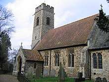 Church of St Mary |
| Church of All Saints | Runhall | Parish Church | 12th century | 15 August 1983 | TG0579606917 52°37′16″N 1°02′20″E |
1152154 | 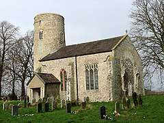 Church of All Saints |
| Church of All Saints | Welbourne, Runhall | Parish Church | 12th century | 15 August 1983 | TG0676310176 52°39′00″N 1°03′18″E |
1304940 | 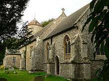 Church of All Saints |
| Church of All Saints | Brandon Parva, Runhall | Parish Church | 15th century | 15 August 1983 | TG0702608077 52°37′51″N 1°03′28″E |
1373067 | 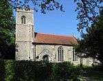 Church of All Saints |
| Church of St Michael | Coston, Runhall | Parish Church | 13th century | 15 August 1983 | TG0622706210 52°36′52″N 1°02′41″E |
1373066 | |
| Church of St Mary the Virgin | Saxlingham Nethergate | Parish Church | 11th century or 12th century | 26 November 1959 | TM2313797204 52°31′37″N 1°17′17″E |
1050666 | 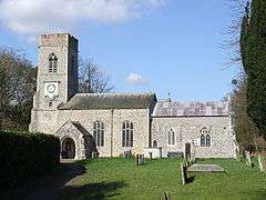 Church of St Mary the Virgin |
| Old Hall | Saxlingham Nethergate | Manor House | 1st half of 17th century | 2 October 1951 | 49°46′01″N 7°33′26″W | 1050665 | |
| Remains of Church of St Mary | Saxlingham Nethergate | Church ruin | Before 1700 | 26 November 1959 | TM2307696603 52°31′18″N 1°17′12″E |
1152354 | 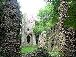 Remains of Church of St Mary |
| The Old Rectory | Saxlingham Nethergate | Vicarage | 1784 | 2 October 1951 | TM2310997170 52°31′36″N 1°17′15″E |
1050667 | |
| Billingford Windmill | Billingford, Scole | Windmill | Pre 1860 | 11 September 1951 | TM1669778567 52°21′44″N 1°10′52″E |
1303800 | |
| Church of St Andrew | Scole | Church | Pre Conquest | 7 December 1959 | TM1510279045 52°22′02″N 1°09′29″E |
1156145 | 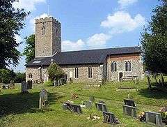 Church of St Andrew |
| Church of St Andrew | Thelveton, Scole | Church | 15th century | 7 December 1959 | TM1522881246 52°23′13″N 1°09′41″E |
1050120 | 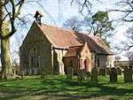 Church of St Andrew |
| Thelveton Hall | Thelveton, Scole | House | c. 1592 | 11 September 1951 | TM1555580855 52°23′00″N 1°09′57″E |
1156238 | |
| Church of St Margaret | Seething | Parish Church | Medieval | 5 September 1960 | TM3197497947 52°31′48″N 1°25′07″E |
1305988 | 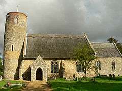 Church of St Margaret |
| Church of All Saints | Shotesham | Parish Church | 11th century or 12th century | 26 November 1959 | TM2466899016 52°32′33″N 1°18′42″E |
1050644 | 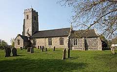 Church of All Saints |
| Church of St Mary | Shotesham St Mary, Shotesham | Parish Church | Medieval | 26 November 1959 | TM2378198826 52°32′29″N 1°17′55″E |
1050642 | .jpg) Church of St Mary |
| Grove Farmhouse, Formerly Creasey's Grove Farmhouse | Shotesham | Farmhouse | 16th century | 2 October 1951 | TM2527698764 52°32′24″N 1°19′14″E |
1050646 | |
| The Duke's Head | Shotesham | Timber Framed House | 1712 | 26 November 1959 | TM2465099136 52°32′37″N 1°18′42″E |
1050649 | |
| Church of St Mary | Sisland | Parish Church | Medieval | 5 September 1960 | TM3441198573 52°32′04″N 1°27′18″E |
1051106 | 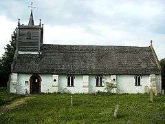 Church of St Mary |
| Church of St Remigius | Dunston | Parish Church | 13th century | 26 November 1959 | TG2285402239 52°34′20″N 1°17′14″E |
1050433 | 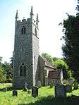 Church of St Remigius |
| Church of the Holy Cross | Stoke Holy Cross | Parish Church | 13th century | 26 November 1959 | TG2358300792 52°33′32″N 1°17′49″E |
1050437 | 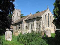 Church of the Holy Cross |
| Church of St Mary | Surlingham | Parish Church | Early 13th century | 26 November 1959 | TG3058406514 52°36′27″N 1°24′15″E |
1050438 | 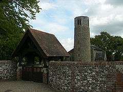 Church of St Mary |
| Church of St Peter | Swainsthorpe | Parish Church | 12th century | 26 November 1959 | TG2186300970 52°33′41″N 1°16′18″E |
1169726 | Mar2005.jpg) Church of St Peter |
| Barn c.40m West of Gowthorpe Manor House | Gowthorpe, Swardeston | Barn | Early 17th century | 2 October 1951 | TG2078502345 52°34′27″N 1°15′25″E |
1366141 | |
| Church of St Mary | Swardeston | Parish Church | 11th century | 2 October 1951 | TG1990102397 52°34′30″N 1°14′38″E |
1050556 | 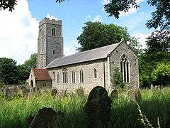 Church of St Mary |
| Gowthorpe Manor House | Gowthorpe, Swardeston | House | 16th century | 2 October 1951 | TG2084802321 52°34′26″N 1°15′28″E |
1050515 | |
| Mangreen Hall | Mangreen, Swardeston | House | 17th century | 2 October 1951 | TG2155703044 52°34′48″N 1°16′07″E |
1366150 | _-_geograph.org.uk_-_1584279.jpg) Mangreen Hall |
| Old Hall | Tacolneston | House | C16/17 | 11 September 1951 | TM1495295466 52°30′53″N 1°09′59″E |
1373381 | |
| Tacolneston Hall | Tacolneston | House | 16th century | 11 September 1951 | TM1381695515 52°30′56″N 1°08′59″E |
1050036 |  Tacolneston Hall |
| The Manor Farmhouse | Tacolneston | House | Late 16th century | 11 September 1951 | TM1449095295 52°30′48″N 1°09′34″E |
1050043 | |
| Tharston Hall | Tharston and Hapton | House | Late 16th century | 11 September 1951 | TM1914994017 52°30′00″N 1°13′38″E |
1373408 |  Tharston Hall |
| Thurton Lodge on North West Side of Drive to Langley Park | Thurton | Gate Lodge | c. 1785 | 5 September 1960 | TM3437099896 52°32′47″N 1°27′19″E |
1050638 | |
| Thurton Lodge, on South East Side of Drive to Langley Park | Thurton | Gate Lodge | c. 1785 | 5 September 1960 | TM3437899890 52°32′47″N 1°27′19″E |
1306478 | |
| Church of St Mary | Thwaite St Mary | Parish Church | 12th century | 5 September 1960 | TM3336395048 52°30′12″N 1°26′13″E |
1372881 |  Church of St Mary |
| Channonz Hall | Tibenham | Courtyard House | Second half of 16th century | 11 September 1951 | TM1477088471 52°27′07″N 1°09′33″E |
1179541 | |
| Remains of Church of St Mary | Tivetshall St Mary | Tower | c. 1300 | 7 December 1959 | TM1662485810 52°25′38″N 1°11′05″E |
1372995 |  Remains of Church of St Mary |
| The Elms | Toft Monks | Farmhouse | Early 17th century | 25 September 1951 | TM4332293992 52°29′22″N 1°34′58″E |
1373124 | |
| Church of St Margaret | Topcroft | Parish Church | Post Medieval | 5 September 1960 | TM2658592893 52°29′13″N 1°20′09″E |
1372884 | 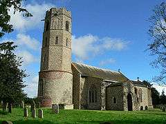 Church of St Margaret |
| Whitlingham Hospital Blocks 04, 05, 06 | Trowse with Newton | Country House | c. 1865 | 31 October 1985 | TG2549906936 52°36′48″N 1°19′46″E |
1373212 | 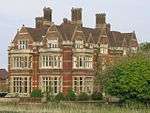 Whitlingham Hospital Blocks 04, 05, 06 |
| Wacton Hall | Wacton | House | 16th century | 11 September 1951 | TM1802990270 52°28′01″N 1°12′30″E |
1050822 | 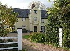 Wacton Hall |
| Church of St James | Crownthorpe, Wicklewood | Church/House | Medieval | 15 August 1983 | TG0828803138 52°35′10″N 1°04′24″E |
1152239 | .jpg) Church of St James |
| The Old Hall | Wicklewood | Farmhouse | c. 1600 | 15 August 1983 | TG0793202899 52°35′03″N 1°04′04″E |
1373072 | |
| Wicklewood Hall | Wicklewood | Farmhouse | 17th century | 2 October 1951 | TG0865600715 52°33′51″N 1°04′38″E |
1050726 | |
| Church of All Saints | Woodton | Parish Church | 12th century | 5 September 1960 | TM2854494621 52°30′06″N 1°21′57″E |
1170855 | 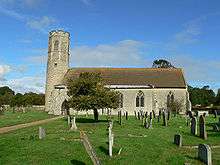 Church of All Saints |
| Oaks Farmhouse | Woodton | House | 17th century | 25 September 1960 | TM2771295683 52°30′41″N 1°21′16″E |
1170906 | |
| Homersfield Bridge | Wortwell | Bridge | 1869 | 3 June 1981 | TM2832985689 52°25′17″N 1°21′24″E |
1262142 | |
| Quaker Farmhouse | Wramplingham | Farmhouse | 1643 | 29 November 1959 | TG1150306512 52°36′55″N 1°07′22″E |
1050729 | |
| High House Farmhouse | Wreningham | Farmhouse/House | c. 1640 | 20 April 1959 | TM1454199392 52°33′00″N 1°09′47″E |
1373111 | .jpg) High House Farmhouse |
| Poplars | Wreningham | Farmhouse | 1586 | 2 December 1983 | TM1558798418 52°32′27″N 1°10′40″E |
1152496 | |
| Green Dragon Public House | Wymondham | Hall House | 1950 | 29 December 1950 | TG1084201559 52°34′15″N 1°06′35″E |
1196692 |  Green Dragon Public House |
| Kimberley Hall including Service Wings to North West and South East | Wymondham | Country House | 1712 | 29 December 1950 | TG0904204748 52°36′01″N 1°05′07″E |
1293198 | .jpg) Kimberley Hall including Service Wings to North West and South East |
| Priory House, Middleton Street | Wymondham | House | c. 1670 | 29 December 1950 | TG1083901644 52°34′18″N 1°06′35″E |
1297488 | |
| Stanfield Hall (that part in Wymondham Parish) | Stanfield, Wymondham | House | 1792 | 14 July 1972 | TG1433901002 52°33′53″N 1°09′40″E |
1196723 | |
| The Chestnuts | Wymondham | House | 18th century | 26 January 1995 | TG1077001941 52°34′28″N 1°06′32″E |
1243874 | |
| 3 Market Street | Wymondham | House | Later | 29 December 1950 | TG1091901551 52°34′15″N 1°06′40″E |
1196679 | |
.jpg)
_p3.028_-_Gillingham_Hall%2C_Norfolk.jpg)
.jpg)

Notes
- The date given is the date used by Historic England as significant for the initial building or that of an important part in the structure's description.
- Sometimes known as OSGB36, the grid reference is based on the British national grid reference system used by the Ordnance Survey.
- The "List Entry Number" is a unique number assigned to each listed building and scheduled monument by Historic England.
gollark: Oh, you will.
gollark: The Friendly Interactive Shell™.
gollark: NOW they are going down.
gollark: This apogee thing is wrong.
gollark: Or not.
External links
![]()
This article is issued from Wikipedia. The text is licensed under Creative Commons - Attribution - Sharealike. Additional terms may apply for the media files.