D519 road
D519 is a state road in Slavonia region of Croatia connecting Dalj and nearby Vukovar via Borovo Naselje and the D2 state road. The road is 16.2 km (10.1 mi) long.[1]
| |
|---|---|
| Route information | |
| Length | 16.2 km (10.1 mi) |
| Major junctions | |
| From | |
| To | |
| Location | |
| Counties | Osijek-Baranja, Vukovar-Syrmia |
| Major cities | Dalj, Borovo Naselje |
| Highway system | |
| State roads in Croatia | |
Borovo Naselje, Borovo Commerce building near the D519 road exhibiting war damage

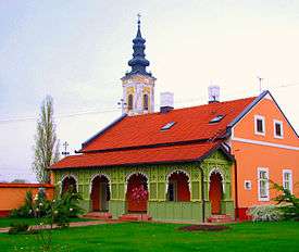
Eparchy of Osječko polje and Baranja, Dalj on the D519 road
The road, as well as all other state roads in Croatia, is managed and maintained by Hrvatske ceste, state owned company.[2]
Traffic volume
Traffic is regularly counted and reported by Hrvatske ceste, operator of the road.[3]
| D519 traffic volume | ||||
| Road | Counting site | AADT | ASDT | Notes |
| 3704 Borovo - north | 1,539 | 1,954 | Adjacent to the L46003 junction. | |
Road junctions and populated areas
| D519 junctions/populated areas | |
| Type | Slip roads/Notes |
The northern terminus of the road. | |
| Dalj | |
| Borovo | |
| Ž4068 to Nemetin and Osijek. | |
| Borovo Naselje L46003 to D2 state road as an alternate connection. The southern terminus of the road. | |
Sources
- "Decision on categorization of public roads as state roads, county roads and local roads". Narodne novine (in Croatian). February 17, 2010.
- "Public Roads Act". Narodne novine (in Croatian). December 14, 2004.
- "Traffic counting on the roadways of Croatia in 2009 - digest" (PDF). Hrvatske ceste. May 1, 2010. Archived from the original (PDF) on July 21, 2011.
- "Map of border crossings and customs office areas" (PDF). Customs Administration of the Republic of Croatia (in Croatian). March 6, 2008.
gollark: I do have a physical set somewhere.
gollark: I didn't get round to checking the code beyond skimming it yet.
gollark: Interestingly, the AI in the tic tac toe entry isn't unbeatable and actually quite bad.
gollark: https://media.discordapp.net/attachments/472556733995155458/927376939159793724/unknown.png
gollark: If you give me enough money, I can buy a shinier, newer, more RAM-having server.
This article is issued from Wikipedia. The text is licensed under Creative Commons - Attribution - Sharealike. Additional terms may apply for the media files.
