D43 road (Croatia)
D43 is a state road in the central Croatia connecting Đurđevac, Bjelovar, Čazma and Ivanić Grad to the A3 motorway at its southern terminus, within Ivanić Grad interchange.[1][maps 1] The road is 78.1 km (48.5 mi) long.[2]
| |
|---|---|
| Route information | |
| Length | 78.1 km (48.5 mi) |
| Major junctions | |
| From | |
| To | |
| Location | |
| Counties | Koprivnica-Križevci, Bjelovar-Bilogora, Zagreb County |
| Major cities | Đurđevac, Bjelovar, Čazma, Ivanić Grad |
| Highway system | |
| State roads in Croatia | |

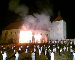
Đurđevac, at the northern terminus of the D43 road

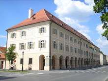
Bjelovar, on the D43 road route
Čazma, on the D43 road route
Ivanić Grad, near the southern terminus of the D43 road
The road, as well as all other state roads in Croatia, is managed and maintained by Hrvatske ceste, state owned company.[3]
Traffic volume
Traffic is regularly counted and reported by Hrvatske ceste, operator of the road.[4]
| D43 traffic volume | ||||
| Road | Counting site | AADT | ASDT | Notes |
| 1314 Hampovica | 3,218 | 3,549 | Adjacent to the Ž3049 junction. | |
| 2105 Markovac | 2,363 | 2,461 | Adjacent to the D28 junction. | |
| 2108 Narta - north | 3,674 | 3,650 | Adjacent to the Ž3084 junction. | |
| 2015 Caginec | 7,025 | 7,351 | Between the Ž3074 and Ž3124 junctions. | |
Road junctions and populated areas
| D43 junctions/populated areas | |
| Type | Slip roads/Notes |
| Đurđevac The northern terminus of the road. | |
| Šemovci Ž2183 to Virje (D2). | |
| Hampovica | |
| Ž3049 to Ćurlovac and Remetovac (the road loops to Ćurlovac and back to the D3 forming two junctions with the latter). | |
| Ž2236 to Babotok, Donje Zdjelice, Miholjanec and Virje (D2). | |
| Kupinovac | |
The D28 and D43 are concurrent to the south. | |
| Letičani | |
| Trojstveni Markovac | |
| Bjelovar The D28 and D43 are concurrent to the north. | |
| Ž3084 to Paljevine, Ivanska and Berek. | |
| Narta | |
| Štefanje Ž3081 to Ivanska. Ž3283 to Zdenčec and Sišćani. | |
| Daskatica | |
| Vagovina | |
| Gornji Draganec Ž2231 to Sišćani, Farkaševac, Crikvena and Kenđelovac (D28). | |
| Čazma Ž3128 to Rečica Kriška. | |
| Bosiljevo | |
| Palančani | |
| Dapci | |
| Ž3284 to Sovari, Marčani, Donji Lipovčani and Cerina (D26). | |
| Šumećani | |
| Graberje Ivaničko Ž3124 to Bunjani, Voloder, Kutina (D45) and Novska (D47). Ž3125 to Deanovec | |
| Caginec Ž3074 to Kloštar Ivanić and Lupoglav. | |
| Ivanić Grad Ž3123 within the town to the Ž3041. | |
Maps
- Overview map of the D43 (Map). OpenStreetMap. Retrieved August 23, 2014.
Sources
- "Regulation on motorway markings, chainage, interchange/exit/rest area numbers and names". Narodne novine (in Croatian). April 24, 2003. Archived from the original on October 4, 2011. Retrieved August 12, 2010.
- Ministry of Sea, Transport and Infrastructure (Croatia) (May 10, 2013). "Odluka o razvrstavanju javnih cesta" [Decision on categorization of public roads]. Narodne novine (in Croatian) (066/2013).
- "Public Roads Act". Narodne novine (in Croatian). December 14, 2004.
- "Traffic counting on the roadways of Croatia in 2013 - digest" (PDF). Hrvatske ceste. May 2014. Archived from the original (PDF) on 2014-07-29. Retrieved 2014-08-23.
gollark: That's cool, but my keyboard has 100ish buttons on it.
gollark: That's *probably* many orders of magnitude more power than the entire sun.
gollark: Wait, 500-decibel fans? Decibels are logarithmic.
gollark: Don't worry, they aren't actually bound to anything.
gollark: My mouse has a bunch of spare buttons on it. Maybe I could bind one of those to it.
This article is issued from Wikipedia. The text is licensed under Creative Commons - Attribution - Sharealike. Additional terms may apply for the media files.
