D40 road (Croatia)
D40 is a state road connecting A7 motorway at Sveti Kuzam interchange,[1] to D8 state road and to Port of Bakar.[maps 1] The road is 3.1 km (1.9 mi) long.[2]
| |
|---|---|
| Route information | |
| Length | 3.1 km (1.9 mi) |
| Major junctions | |
| From | |
| To | |
| Location | |
| Counties | Primorje-Gorski Kotar |
| Major cities | Bakar |
| Highway system | |
| State roads in Croatia | |
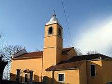
Sveti Kuzam, adjacent to the D40 road
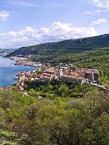
Bakar, immediately to the south of the southern D40 terminus
The road, as well as all other state roads in Croatia, is managed and maintained by Hrvatske ceste, a state owned company.[3]
Road junctions and populated areas
| D40 junctions/populated areas | |
| Type | Slip roads/Notes |
Ž5205 to Škrljevo and Čavle (D3). Northern terminus of the road. | |
| Port of Bakar (West) Southern terminus of the road. | |
Maps
- Overview map of the D40 (Map). OpenStreetMap. Retrieved August 19, 2014.
Sources
- "Regulation on motorway markings, chainage, interchange/exit/rest area numbers and names". Narodne novine (in Croatian). May 6, 2003.
- Ministry of Sea, Transport and Infrastructure (Croatia) (May 10, 2013). "Odluka o razvrstavanju javnih cesta" [Decision on categorization of public roads]. Narodne novine (in Croatian) (66/2013).
- "Public Roads Act". Narodne novine (in Croatian). December 14, 2004.
gollark: There goes my very slightly better strategy!
gollark: You could use 5 bits to signal with only a 1/32 chance of a mistake, but then you just waste 1/20 of the round doing suboptimal things.
gollark: However, [REDACTED] apiomemetic protocols.
gollark: Rounds are 100 iterations and you get 1 bit an iteration, I don't think in-band signalling is very practical.
gollark: Dilemmous implementational time!
This article is issued from Wikipedia. The text is licensed under Creative Commons - Attribution - Sharealike. Additional terms may apply for the media files.