D314 road
D314 branches off to the south from D2 between Čačinci and Feričanci towards the city of Orahovica. The road is 2.9 km (1.8 mi) long.[1]
| |
|---|---|
| Route information | |
| Length | 2.9 km (1.8 mi) |
| Major junctions | |
| From | |
| To | Orahovica |
| Location | |
| Counties | Virovitica-Podravina |
| Highway system | |
| State roads in Croatia | |
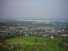
Orahovica, at the southern terminus of the D314 road
The road, as well as all other state roads in Croatia, is managed and maintained by Hrvatske ceste, state owned company.[2]
Road junctions and populated areas
| D417 junctions/populated areas | |
| Type | Slip roads/Notes |
The northern terminus of the road. | |
| Orahovica Ž4070 to the Ž4030 within the city and then via the Ž4030 Zdenci and to Kutjevo and Pleternica (D38). The southern terminus of the road. | |
Sources
- "Decision on categorization of public roads as state roads, county roads and local roads". Narodne novine (in Croatian). February 17, 2010.
- "Public Roads Act". Narodne novine (in Croatian). December 14, 2004.
gollark: ++magic py await ctx.message.delete()
gollark: ++magic py ctx.message.delete()
gollark: ++magic py ctx
gollark: Finally I can do evil autonomously!
gollark: Finally I can do evil!
This article is issued from Wikipedia. The text is licensed under Creative Commons - Attribution - Sharealike. Additional terms may apply for the media files.