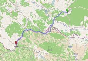
D47 road (Croatia)
D47 is a state road in central Croatia connecting Lipik, Novska and Una River valley area to Croatian motorway network at the A3 motorway Novska interchange and to the D6 state road in Dvor.[1][maps 1] The road is 94.5 km (58.7 mi) long.[2]
| |
|---|---|
 | |
| Route information | |
| Length | 94.5 km (58.7 mi) |
| Major junctions | |
| From | |
| To | |
| Location | |
| Counties | Požega-Slavonia, Sisak-Moslavina |
| Major cities | Lipik, Novska, Hrvatska Kostajnica |
| Highway system | |
| State roads in Croatia | |


Hrvatska Kostajnica fortress, next to the D47 road
The road, as well as all other state roads in Croatia, is managed and maintained by Hrvatske ceste, state owned company.[3]
Traffic volume
Traffic is regularly counted and reported by Hrvatske ceste, operator of the road.[4]
| D47 traffic volume | ||||
| Road | Counting site | AADT | ASDT | Notes |
| 3402 Dobrovac | 801 | 812 | Adjacent to the Ž4236 junction. | |
| 3306 Bročice | 1,896 | 2,548 | Adjacent to the Ž3250 junction. | |
| 3308 Slabinja | 930 | 1,151 | Adjacent to the Ž3264 junction. | |
| 3207 Hrvatska Kostajnica - west | 946 | 1,076 | Adjacent to the D30 junction. | |
Road junctions and populated areas
| D47 junctions/populated areas | |
| Type | Slip roads/Notes |
| Lipik The northern terminus of the road. | |
| Dobrovac Ž4236 to Kukunjevac, Gaj and Poljana. | |
| Ž4112 to Jagma and Subocka. | |
| Korita | |
| Bair | |
| Ž3217 to Kozarice. | |
| Novska Ž3124 to Kutina, Voloder and Bunjani. | |
| Ž3250 to Bročice and Novska (D312). | |
| Ž3253 to Košutarica and Mlaka. | |
| Jasenovac Ž3209 to Puska and Gušće. | |
| Uštica | |
| Tanac | |
| Hrvatska Dubica Ž3294 to Sunja (D224) (to the north) and Hrvatska Dubica border crossing to Bosnia and Herzegovina[5] (to the south). | |
| Slabinja | |
| Ž3264 to Utolica and Šaš. | |
| Hrvatska Kostajnica | |
| Kuljani | |
| Kozibrod | |
| Divuša Ž3263 to Gornja Oraovica and Zrin. | |
| Golubovac Divuški | |
| Unčani | |
| Struga Banska | |
| Zamlača | |
| Dvor The southern terminus of the road. | |
Maps
- Overview map of the D47 (Map). OpenStreetMap. Retrieved September 16, 2014.
Sources
- "Regulation on motorway markings, chainage, interchange/exit/rest area numbers and names". Narodne novine (in Croatian). May 6, 2003.
- Ministry of Sea, Transport and Infrastructure (Croatia) (September 16, 2014). "Odluka o razvrstavanju javnih cesta" [Decision on categorization of public roads]. Narodne novine (in Croatian) (094/2014). Archived from the original on 2016-03-04.
- "Public Roads Act". Narodne novine (in Croatian). December 14, 2004.
- "Traffic counting on the roadways of Croatia in 2013 - digest" (PDF). Hrvatske ceste. May 2014. Archived from the original (PDF) on 2014-07-29. Retrieved 2014-09-16.
- "Map of border crossings and customs office areas" (PDF). Customs Administration of the Republic of Croatia (in Croatian). March 6, 2008.
gollark: What % of the budget is America "spending on Europe"?
gollark: I don't think the problems of America are very explicable by spending on Europe.
gollark: Well, firecubez, the horse *is* a noble animal.
gollark: COVID-26.
gollark: OH BEE PHP hypertext processing.
This article is issued from Wikipedia. The text is licensed under Creative Commons - Attribution - Sharealike. Additional terms may apply for the media files.