Alberta Highway 628
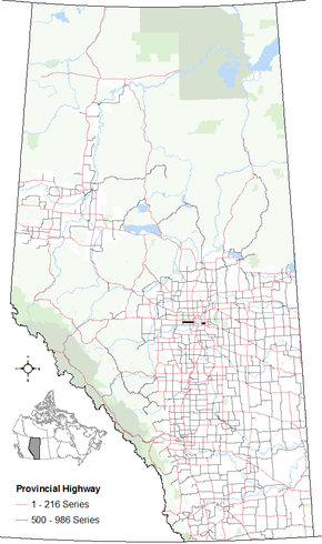
Alberta Provincial Highway No. 628,[2] commonly referred to as Highway 628, is a highway in the province of Alberta, Canada that runs west to east through the Edmonton Capital Region in two sections. The western 19-kilometre-long (12 mi) section runs from the town of Stony Plain to the Edmonton city limits at 231 Street (Range Road 261). The eastern 6-kilometre-long (4 mi) section, also known as a Whitemud Extension, runs from Anthony Henday Drive to Highway 21 just south of Sherwood Park.[3] It continues further past Half Moon Lake to Wye Road (Highway 630) near North Cooking Lake.
| ||||
|---|---|---|---|---|
| Whitemud Drive | ||||
 | ||||
| Route information | ||||
| Maintained by Alberta Transportation | ||||
| West section | ||||
| Length | 19.1 km[1] (11.9 mi) | |||
| West end | ||||
| Major junctions | ||||
| East end | Whitemud Drive (Edmonton west city limits) | |||
| East section | ||||
| Length | 6.4 km[1] (4.0 mi) | |||
| West end | ||||
| East end | ||||
| Location | ||||
| Specialized and rural municipalities | Parkland County, Strathcona County | |||
| Highway system | ||||
Provincial highways in Alberta
| ||||
Whitemud Drive (79 Avenue west of Winterburn Road) connects both sections directly through Edmonton city limits, though it is not signed as Highway 628. It is also known as 79 Avenue in Stony Plain.
Major intersections
From west to east:
| Rural/specialized municipality | Location | km[1] | mi | Destinations | Notes | ||
|---|---|---|---|---|---|---|---|
| Parkland County | Stony Plain | 0.0 | 0.0 | Continues as Township Road 524 towards Spring Lake | |||
| Hwy 628 western terminus | |||||||
| 1.2 | 0.75 | Golf Course Road | |||||
| | 6.1 | 3.8 | Range Road 273 (Golden Spike Road) – Spruce Grove | Former Hwy 788 | |||
| Enoch Cree Nation 135 | 15.8 | 9.8 | |||||
| City of Edmonton | 19.1 | 11.9 | 231 Street (Range Road 261) | Hwy 628 eastern terminus; continues as Whitemud Drive | |||
| 28 km (17 mi) gap in Highway 628; see Whitemud Drive § Exit list | |||||||
| Strathcona County | | 47.3 | 29.4 | Interchange (Hwy 216 Exit 64); Hwy 628 western terminus | |||
| 48.8 | 30.3 | Range Road 233 – Sherwood Park | |||||
| 53.7 | 33.4 | Hwy 628 eastern terminus | |||||
| Continues as Township Road 522 | |||||||
| 1.000 mi = 1.609 km; 1.000 km = 0.621 mi | |||||||
References
- Google (April 2, 2018). "Highway 628 in Alberta" (Map). Google Maps. Google. Retrieved April 2, 2018.
- Provincial Highways Designation Order, Alberta Transportation, p. 20
- 2017 Provincial Highways 500 - 986 Progress Chart (PDF) (Map). Alberta Transportation. March 2017. Retrieved April 2, 2018.
