Alberta Highway 45
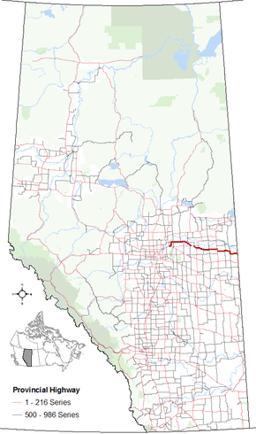
Alberta Provincial Highway No. 45, commonly referred to as Highway 45, is an east-west highway in central Alberta, Canada that extends from Highway 15 northeast of Edmonton to the Saskatchewan border. It runs generally parallel to Highway 16 (Yellowhead Highway).[1][2]
| ||||
|---|---|---|---|---|
 | ||||
| Route information | ||||
| Length | 230.0 km[1] (142.9 mi) | |||
| Major junctions | ||||
| West end | ||||
| ||||
| East end | ||||
| Location | ||||
| Specialized and rural municipalities | Lamont County, County of Two Hills No. 21, County of Vermilion River | |||
| Towns | Bruderheim, Two Hills | |||
| Villages | Willingdon, Myrnam, Marwayne | |||
| Highway system | ||||
Provincial highways in Alberta
| ||||

Major intersections
From west to east:[3]
| Rural/specialized municipality | Location | km[1] | mi | Destinations | Notes |
|---|---|---|---|---|---|
| Lamont County | | 0.0 | 0.0 | ||
| Bruderheim | 3.2 | 2.0 | 48 Street / 52 Avenue | Hwy 45 branches east, then turns north | |
| | 16.0 | 9.9 | Hwy 45 branches east | ||
| 22.5 | 14.0 | ||||
| 32.3 | 20.1 | Range Road 184 – St. Michael | |||
| 43.7 | 27.2 | West end of Hwy 855 concurrency | |||
| Andrew | 51.8 | 32.2 | East end of Hwy 855 concurrency | ||
| | 56.5 | 35.1 | |||
| County of Two Hills No. 21 | Willingdon | 66.8 | 41.5 | West end of Hwy 857 concurrency | |
| | 73.1 | 45.4 | East end of Hwy 857 concurrency | ||
| 77.0 | 47.8 | West end in Hwy 29 concurrency; former Hwy 637 west | |||
| 79.1 | 49.2 | UAR 150 south – Hairy Hill | |||
| 86.9 | 54.0 | East end of Hwy 29 concurrency; former Hwy 637 east | |||
| Two Hills | 97.6 | 60.6 | West end of Hwy 36 concurrency | ||
| | 101.5 | 63.1 | East end of Hwy 36 concurrency | ||
| Morecambe | 118.0 | 73.3 | |||
| Myrnam | 133.4 | 82.9 | |||
| Derwent | 151.6 | 94.2 | UAR 155 south | ||
| | 158.0 | 98.2 | Hwy 45 branches south; west end of Hwy 41 concurrency | ||
| 164.5 | 102.2 | Hwy 45 branches east; east end of Hwy 41 concurrency | |||
| County of Vermilion River | | 173.9 | 108.1 | UAR 57 south – Clandonald | |
| 185.7 | 115.4 | West end of Hwy 893 concurrency | |||
| Dewberry | 187.3 | 116.4 | East end of Hwy 893 concurrency | ||
| | 200.9 | 124.8 | Hwy 45 branches south; west end of Hwy 897 concurrency | ||
| Marwayne | 208.3 | 129.4 | Hwy 45 turns east; east end of Hwy 897 concurrency | ||
| | 230.0 | 142.9 | |||
| Saskatchewan border Continues as | |||||
1.000 mi = 1.609 km; 1.000 km = 0.621 mi
| |||||
gollark: AARCH64 IS INCREASINGLY POPULAR
gollark: DOWNLOAD/COMPILE YDOTOOL BINARIES WITHOUT INSTALLING IT AS ROOT?
gollark: AS IN, IGNORE IT
gollark: DISABLE THE CAPS LOCK KEY IN SOFTWARE SOMEHOW?
gollark: Nvidia does, at least, almost have working Wayland-compatible drivers after just 9 years.
References
- Google (January 17, 2018). "Highway 45 in Alberta" (Map). Google Maps. Google. Retrieved January 17, 2018.
- "2015 Provincial Highway 1-216 Progress Chart" (PDF). Alberta Transportation. March 2015. Archived (PDF) from the original on April 10, 2016. Retrieved October 12, 2016.
- Alberta Road Atlas (2005 ed.). Oshawa, ON: MapArt Publishing Corp. pp. 57-59.
This article is issued from Wikipedia. The text is licensed under Creative Commons - Attribution - Sharealike. Additional terms may apply for the media files.