Alberta Highway 884
Alberta Provincial Highway No. 884, commonly referred to as Highway 884, is a highway in the province of Alberta, Canada. It runs south-north from Highway 1 in Suffield to Highway 13 in Amisk, between Highway 36 and Highway 41. This route is also known as 3 Street E in Youngstown.[1][2] Its southern portion passes alongside and through CFB Suffield.
| ||||
|---|---|---|---|---|
 | ||||
| Route information | ||||
| Maintained by Alberta Transportation | ||||
| Length | 280 km[1] (170 mi) | |||
| Major junctions | ||||
| South end | ||||
| North end | ||||
| Location | ||||
| Specialized and rural municipalities | Cypress County, Special Areas, Paintearth County No. 18, Provost M.D. No. 52 | |||
| Villages | Youngstown, Veteran, Amisk | |||
| Highway system | ||||
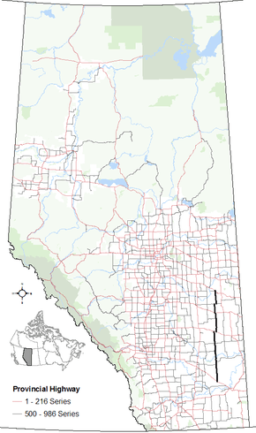
Provincial highways in Alberta
| ||||

Major intersections
Starting from the south end of Highway 884:
| Rural/specialized municipality | Location | km[1] | mi | Destinations | Notes |
|---|---|---|---|---|---|
| Cypress County | Suffield | 0 | 0.0 | Hwy 884 southern terminus 50.22056°N 111.17444°W | |
| | 49 | 30 | 50.65972°N 111.18167°W | ||
| Special Area No. 2 | Jenner | 59 | 37 | 50.74583°N 111.18167°W | |
| ↑ / ↓ | | 69 | 43 | Crosses the Red Deer River — 50.83833°N 111.17667°W | |
| Special Area No. 3 | | 92 | 57 | 51.03750°N 111.19111°W | |
| 111 | 69 | 51.21222°N 111.19083°W | |||
| Youngstown | 146 | 91 | Hwy 884 branches east; Hwy 9 concurrency begins 51.52500°N 111.20056°W | ||
| | 153 | 95 | Hwy 884 branches north; Hwy 9 concurrency ends 51.50333°N 111.10694°W | ||
| Special Area No. 4 | | 192 | 119 | 51.85250°N 111.09167°W | |
| 209 | 130 | Hwy 884 branches west; Hwy 12 concurrency begins 51.99722°N 111.10028°W | |||
| Veteran | 210 | 130 | Hwy 884 branches north; Hwy 12 concurrency ends 51.99722°N 111.11250°W | ||
| County of Paintearth No. 18 | | 236 | 147 | Hwy 884 branches east; Hwy 599 concurrency begins 52.23028°N 111.12389°W | |
| 241 | 150 | Hwy 884 branches north; Hwy 599 concurrency ends 52.23000°N 111.05250°W | |||
| M.D. of Provost No. 52 | | 273 | 170 | 52.50667°N 111.06056°W | |
| Amisk | 279 | 173 | 52.56472°N 111.06639°W | ||
| 280 | 170 | Hwy 884 northern terminus 52.57083°N 111.06722°W | |||
1.000 mi = 1.609 km; 1.000 km = 0.621 mi
| |||||
gollark: I think to be a valid maximum/minimum it has to be >/< but *not* equal?
gollark: This is quite complicated. I may need a while.
gollark: I "can" read it "for" you?
gollark: So what would you say your favourite alleged features are and what are the most important unimplemented ones to you?
gollark: SQLite is highly reliable.
References
- Google (November 4, 2016). "Highway 884 in Alberta" (Map). Google Maps. Google. Retrieved November 4, 2016.
- "Provincial Highways 500 - 986 Progress Chart" (PDF). Alberta Transportation. March 2015. Retrieved December 26, 2016.
This article is issued from Wikipedia. The text is licensed under Creative Commons - Attribution - Sharealike. Additional terms may apply for the media files.