Alberta Highway 44
Alberta Provincial Highway No. 44, commonly referred to as Highway 44, is a highway in northern Alberta, Canada that extends from Hondo to Highway 16 (Yellowhead Highway) east of Spruce Grove. It is the primary route between the Edmonton area and the Lesser Slave Lake region. The stretch between Highway 16 and Westlock was formerly Secondary Highway 794, but due to a large increase in traffic it was upgraded to Highway 44 in 1999.[2] Highway 44 is approximately 172 kilometres (107 mi) long.[1]
| ||||
|---|---|---|---|---|
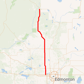
Highway 44 highlighted in red | ||||
| Route information | ||||
| Length | 171.63 km[1] (106.65 mi) | |||
| Major junctions | ||||
| South end | ||||
| North end | ||||
| Location | ||||
| Specialized and rural municipalities | Parkland County, Sturgeon County, Westlock County, Lesser Slave River No. 124 M.D. | |||
| Towns | Westlock | |||
| Highway system | ||||
Provincial highways in Alberta
| ||||

Major intersections
From south to north:
| Rural/specialized municipality | Location | km[3] | mi | Destinations | Notes |
|---|---|---|---|---|---|
| Parkland County | Acheson | 0.0 | 0.0 | Interchange; Hwy 16 exit 368 | |
| Sturgeon County | Villeneuve | 9.9 | 6.2 | Roundabout | |
| | 16.5 | 10.3 | |||
| Rivière Qui Barre | 23.3 | 14.5 | Township Road 544 | ||
| | 26.8 | 16.7 | |||
| Alcomdale | 36.6 | 22.7 | Township Road 570 | Former Hwy 650 west | |
| Westlock County | | 43.0 | 26.7 | ||
| 54.4 | 33.8 | Township Road 585 – Pickardville | |||
| Westlock | 65.8 | 40.9 | |||
| | 77.2 | 48.0 | UAR 73 west – Pibroch | ||
| 86.9 | 54.0 | South end of Hwy 601 concurrency | |||
| 88.5 | 55.0 | North end of Hwy 601 concurrency | |||
| 102.3 | 63.6 | UAR 81 west – Jarvie | |||
| Fawcett | 115.5 | 71.8 | UAR 83 west | ||
| | 117.7 | 73.1 | |||
| M.D. of Lesser Slave River No. 124 | | 132.3 | 82.2 | UAR 82 west – Flatbush | |
| 157.9 | 98.1 | Township Road 684 – Chisholm | |||
| 171.6 | 106.6 | Through traffic follows Hwy 2 north | |||
1.000 mi = 1.609 km; 1.000 km = 0.621 mi
| |||||
gollark: Computers could certainly not send their ID with every ping, but as of now they, well, do send it.
gollark: It runs on raw `modem`. For distances.
gollark: Nope!
gollark: `gps`, not `rednet`.
gollark: (or even, by multilaterating the position of the computer sending the GPS ping, break GPS for *specific locations*, to make them... possibly harder to target for some things, I don't know)
References
- "Provincial Highways 1-216 Progress Chart" (PDF) (Map). Alberta Transportation. Government of Alberta. March 2017. Retrieved March 19, 2018.
- "Secondary Hwy 794 status changed". Government of Alberta. September 15, 1999. Retrieved June 10, 2011.
- Google (March 19, 2018). "Highway 44" (Map). Google Maps. Google. Retrieved March 19, 2018.
This article is issued from Wikipedia. The text is licensed under Creative Commons - Attribution - Sharealike. Additional terms may apply for the media files.