Thauron
Thauron is a commune in the Creuse department in the Nouvelle-Aquitaine region in central France.
Thauron | |
|---|---|
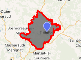
Location of Thauron 
| |
 Thauron  Thauron | |
| Coordinates: 46°00′03″N 1°49′07″E | |
| Country | France |
| Region | Nouvelle-Aquitaine |
| Department | Creuse |
| Arrondissement | Guéret |
| Canton | Ahun |
| Intercommunality | CC Creuse Sud Ouest |
| Government | |
| • Mayor (2008–2014) | Michel Couffy |
| Area 1 | 22.34 km2 (8.63 sq mi) |
| Population (2017-01-01)[1] | 174 |
| • Density | 7.8/km2 (20/sq mi) |
| Time zone | UTC+01:00 (CET) |
| • Summer (DST) | UTC+02:00 (CEST) |
| INSEE/Postal code | 23253 /23250 |
| Elevation | 390–632 m (1,280–2,073 ft) (avg. 532 m or 1,745 ft) |
| 1 French Land Register data, which excludes lakes, ponds, glaciers > 1 km2 (0.386 sq mi or 247 acres) and river estuaries. | |
Geography
An area of forestry and farming comprising the village and several hamlets situated in the Taurion river valley some 13 miles (21 km) south of Guéret, at the junction of the D10, D60 and the D43 roads.
Population
| Year | Pop. | ±% |
|---|---|---|
| 1962 | 162 | — |
| 1968 | 225 | +38.9% |
| 1975 | 197 | −12.4% |
| 1982 | 169 | −14.2% |
| 1990 | 190 | +12.4% |
| 1999 | 189 | −0.5% |
| 2008 | 185 | −2.1% |
Sights
- The church, dating from the fifteenth century.
- The ruins of the thirteenth-century church of the abbey du Palais.
- The chapel de Bonneville
- The chapel in the park du Palais
- A monument to members of the French Resistance at the crossroads of the hamlet of Combeauvert.
gollark: nobody's system is NOT very good.
gollark: ddg! rust "tokio"
gollark: Tokio is on crates.io.
gollark: I would probably just limit it to sending people through cheap metal detectors before they board, or something.
gollark: It does not. But there are other defenses against that which have been implemented.
See also
References
- "Populations légales 2017". INSEE. Retrieved 6 January 2020.
| Wikimedia Commons has media related to Thauron. |
This article is issued from Wikipedia. The text is licensed under Creative Commons - Attribution - Sharealike. Additional terms may apply for the media files.