Saint-Loup, Creuse
Saint-Loup is a commune in the Creuse department in central France.
Saint-Loup | |
|---|---|
Location of Saint-Loup 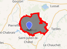
| |
 Saint-Loup  Saint-Loup | |
| Coordinates: 46°08′15″N 2°16′16″E | |
| Country | France |
| Region | Nouvelle-Aquitaine |
| Department | Creuse |
| Arrondissement | Aubusson |
| Canton | Gouzon |
| Intercommunality | CC Creuse Confluence |
| Government | |
| • Mayor (2001–2008) | Anne Bridoux |
| Area 1 | 18.82 km2 (7.27 sq mi) |
| Population (2017-01-01)[1] | 182 |
| • Density | 9.7/km2 (25/sq mi) |
| Time zone | UTC+01:00 (CET) |
| • Summer (DST) | UTC+02:00 (CEST) |
| INSEE/Postal code | 23209 /23130 |
| Elevation | 383–462 m (1,257–1,516 ft) (avg. 430 m or 1,410 ft) |
| 1 French Land Register data, which excludes lakes, ponds, glaciers > 1 km2 (0.386 sq mi or 247 acres) and river estuaries. | |
Geography
The Voueize forms part of the commune's western border.
Population
| Year | Pop. | ±% |
|---|---|---|
| 1962 | 286 | — |
| 1968 | 310 | +8.4% |
| 1975 | 250 | −19.4% |
| 1982 | 234 | −6.4% |
| 1990 | 186 | −20.5% |
| 1999 | 175 | −5.9% |
| 2008 | 177 | +1.1% |
gollark: https://www.accton.com/Technology-Brief/the-new-world-of-400-gbps-ethernet/
gollark: I think there are 400Gbit/s things around. Probably hilariously expensive though.
gollark: Although said calculator is deliberately crippled in a few ways due to exams...
gollark: I still use an actual hardware calculator because I don't have anything I can run on a computer with the same featureset.
gollark: This isn't actually an economic crash at this point. reddit will probably run out of money.
See also
References
- "Populations légales 2017". INSEE. Retrieved 6 January 2020.
| Wikimedia Commons has media related to Saint-Loup (Creuse). |
| Authority control |
|
|---|
This article is issued from Wikipedia. The text is licensed under Creative Commons - Attribution - Sharealike. Additional terms may apply for the media files.