Montboucher
Montboucher is a commune in the Creuse department in the Nouvelle-Aquitaine region in central France.
Montboucher | |
|---|---|
Location of Montboucher 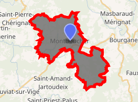
| |
 Montboucher  Montboucher | |
| Coordinates: 45°57′15″N 1°40′55″E | |
| Country | France |
| Region | Nouvelle-Aquitaine |
| Department | Creuse |
| Arrondissement | Guéret |
| Canton | Bourganeuf |
| Intercommunality | CC Creuse Sud Ouest |
| Government | |
| • Mayor (2008–2014) | Christian Pateyron |
| Area 1 | 27.68 km2 (10.69 sq mi) |
| Population (2017-01-01)[1] | 349 |
| • Density | 13/km2 (33/sq mi) |
| Time zone | UTC+01:00 (CET) |
| • Summer (DST) | UTC+02:00 (CEST) |
| INSEE/Postal code | 23133 /23400 |
| Elevation | 379–627 m (1,243–2,057 ft) (avg. 516 m or 1,693 ft) |
| 1 French Land Register data, which excludes lakes, ponds, glaciers > 1 km2 (0.386 sq mi or 247 acres) and river estuaries. | |
Geography
An area of streams, lakes and farming comprising the village and several hamlets situated some 18 miles (29 km) southwest of Guéret at the junction of the D36, D44 and the D941 roads. The commune is on the border with the departement of Haute-Vienne.
Population
| Year | Pop. | ±% |
|---|---|---|
| 1962 | 422 | — |
| 1968 | 484 | +14.7% |
| 1975 | 428 | −11.6% |
| 1982 | 377 | −11.9% |
| 1990 | 356 | −5.6% |
| 1999 | 344 | −3.4% |
| 2008 | 367 | +6.7% |
Sights
- The neo-gothic church, dating from the nineteenth century.
- The nineteenth-century Château de Vedrenas .
gollark: It's an elegant, generalizable end efficient solution.
gollark: Simply flee the scene as fast as possible.
gollark: (this is a rhetorical question as I have access to chat history)
gollark: Were you not just complaining about not progressing 3 days ago?
gollark: Not everyone knows all things ever. There's not much cost to saying a thing people might already know.
See also
References
- "Populations légales 2017". INSEE. Retrieved 6 January 2020.
| Wikimedia Commons has media related to Montboucher. |
| Authority control |
|
|---|
This article is issued from Wikipedia. The text is licensed under Creative Commons - Attribution - Sharealike. Additional terms may apply for the media files.