Reterre
Reterre is a commune in the Creuse department in the Nouvelle-Aquitaine region in central France.
Reterre | |
|---|---|
 Coat of arms | |
Location of Reterre 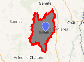
| |
 Reterre  Reterre | |
| Coordinates: 46°06′14″N 2°28′28″E | |
| Country | France |
| Region | Nouvelle-Aquitaine |
| Department | Creuse |
| Arrondissement | Aubusson |
| Canton | Évaux-les-Bains |
| Intercommunality | CC Marche et Combraille en Aquitaine |
| Government | |
| • Mayor (2008–2014) | Daniel Gatier |
| Area 1 | 17.54 km2 (6.77 sq mi) |
| Population (2017-01-01)[1] | 291 |
| • Density | 17/km2 (43/sq mi) |
| Time zone | UTC+01:00 (CET) |
| • Summer (DST) | UTC+02:00 (CEST) |
| INSEE/Postal code | 23160 /23110 |
| Elevation | 450–617 m (1,476–2,024 ft) (avg. 530 m or 1,740 ft) |
| 1 French Land Register data, which excludes lakes, ponds, glaciers > 1 km2 (0.386 sq mi or 247 acres) and river estuaries. | |
Geography
A farming area comprising the village and a few hamlets situated by the banks of the Chat-Cros river, some 18 miles (29 km) northeast of Aubusson, at the junction of the D24 and the D27 roads.
Population
| Year | Pop. | ±% |
|---|---|---|
| 1962 | 433 | — |
| 1968 | 476 | +9.9% |
| 1975 | 424 | −10.9% |
| 1982 | 380 | −10.4% |
| 1990 | 365 | −3.9% |
| 1999 | 319 | −12.6% |
| 2008 | 307 | −3.8% |
Sights
- The church, dating from the nineteenth century.
- The ruins of a twelfth-century church.
- The ruins of a feudal castle at Malleville.
gollark: I didn't know we had one.
gollark: Wait, rail system?
gollark: Good news! PotatOS has improved logging systems!
gollark: And crafting?
gollark: How goes the switching?
See also
References
- "Populations légales 2017". INSEE. Retrieved 6 January 2020.
External links
| Wikimedia Commons has media related to Reterre. |
- Official website of Reterre (in French)
- Reterre on the Quid website (in French)
| Authority control |
|
|---|
This article is issued from Wikipedia. The text is licensed under Creative Commons - Attribution - Sharealike. Additional terms may apply for the media files.