Mainsat
Mainsat is a commune in the Creuse department in the Nouvelle-Aquitaine region in central France.
Mainsat | |
|---|---|
Location of Mainsat 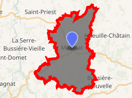
| |
 Mainsat  Mainsat | |
| Coordinates: 46°03′12″N 2°23′15″E | |
| Country | France |
| Region | Nouvelle-Aquitaine |
| Department | Creuse |
| Arrondissement | Aubusson |
| Canton | Aubusson |
| Intercommunality | CC Marche et Combraille en Aquitaine |
| Government | |
| • Mayor (2008–2014) | Jacqueline Jary |
| Area 1 | 34.81 km2 (13.44 sq mi) |
| Population (2017-01-01)[1] | 564 |
| • Density | 16/km2 (42/sq mi) |
| Time zone | UTC+01:00 (CET) |
| • Summer (DST) | UTC+02:00 (CEST) |
| INSEE/Postal code | 23116 /23700 |
| Elevation | 478–670 m (1,568–2,198 ft) (avg. 610 m or 2,000 ft) |
| 1 French Land Register data, which excludes lakes, ponds, glaciers > 1 km2 (0.386 sq mi or 247 acres) and river estuaries. | |
Geography
An area of farming and forestry, lakes and streams, comprising the village and several hamlets situated some 12 miles (19 km) northeast of Aubusson, at the junction of the D4, D19 and the D38 roads.
Population
| Year | Pop. | ±% |
|---|---|---|
| 1962 | 695 | — |
| 1968 | 820 | +18.0% |
| 1975 | 743 | −9.4% |
| 1982 | 752 | +1.2% |
| 1990 | 748 | −0.5% |
| 1999 | 682 | −8.8% |
| 2008 | 627 | −8.1% |
Sights
- The church, dating from the nineteenth century.
- The fifteenth-century château.
- A dolmen at Pellevoisin.
- The remains of several Roman villas.
- The Château des Portes.
- Vestiges of a château at Montgrenier.
gollark: For obvious reasons.
gollark: I like laser bees.
gollark: I can apparently middleclick on my laptop but it is irritating to do.
gollark: Which is again sort of but not really.
gollark: Hmm. Hmm. Hmm. Hmm. Hmm. Hmm. Hmm. Hmm. Hmm. Hmm.
See also
References
- "Populations légales 2017". INSEE. Retrieved 6 January 2020.
| Wikimedia Commons has media related to Mainsat. |
| Authority control |
|
|---|
This article is issued from Wikipedia. The text is licensed under Creative Commons - Attribution - Sharealike. Additional terms may apply for the media files.