Saint-Fiel
Saint-Fiel is a commune in the Creuse department in central France.
Saint-Fiel | |
|---|---|
.svg.png) Coat of arms | |
Location of Saint-Fiel 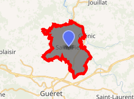
| |
 Saint-Fiel  Saint-Fiel | |
| Coordinates: 46°12′51″N 1°53′46″E | |
| Country | France |
| Region | Nouvelle-Aquitaine |
| Department | Creuse |
| Arrondissement | Guéret |
| Canton | Saint-Vaury |
| Intercommunality | CA Grand Guéret |
| Government | |
| • Mayor (2008–2014) | Bernard de Froment |
| Area 1 | 16.72 km2 (6.46 sq mi) |
| Population (2017-01-01)[1] | 1,036 |
| • Density | 62/km2 (160/sq mi) |
| Time zone | UTC+01:00 (CET) |
| • Summer (DST) | UTC+02:00 (CEST) |
| INSEE/Postal code | 23195 /23000 |
| Elevation | 297–396 m (974–1,299 ft) (avg. 360 m or 1,180 ft) |
| 1 French Land Register data, which excludes lakes, ponds, glaciers > 1 km2 (0.386 sq mi or 247 acres) and river estuaries. | |
Population
| Year | Pop. | ±% |
|---|---|---|
| 1962 | 377 | — |
| 1968 | 403 | +6.9% |
| 1975 | 492 | +22.1% |
| 1982 | 548 | +11.4% |
| 1990 | 709 | +29.4% |
| 1999 | 769 | +8.5% |
gollark: Well, it's pretty known that they do go around intercepting lots of stuff. There are many problems with this:- having private data like your internet traffic stored somewhere is kind of bad in itself.- if it's not abused yet it's basically only a matter of time.- there's no transparency anywhere and even a system of secret courts to judge things- it may help slightly to stop terrorists (no transparency so we can't check really) but is just a massive breach of privacy
gollark: GNU+Windows?
gollark: We'll see who's a fool when I backtrace your IP with Visual Basic!
gollark: That's one broken printer.
gollark: ... wait, what?
See also
References
- "Populations légales 2017". INSEE. Retrieved 6 January 2020.
| Wikimedia Commons has media related to Saint-Fiel. |
| Authority control |
|---|
This article is issued from Wikipedia. The text is licensed under Creative Commons - Attribution - Sharealike. Additional terms may apply for the media files.