Mautes
Mautes is a commune in the Creuse department in the Nouvelle-Aquitaine region in central France.
Mautes | |
|---|---|
Location of Mautes 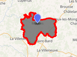
| |
 Mautes  Mautes | |
| Coordinates: 45°56′41″N 2°23′07″E | |
| Country | France |
| Region | Nouvelle-Aquitaine |
| Department | Creuse |
| Arrondissement | Aubusson |
| Canton | Aubusson |
| Intercommunality | CC Marche et Combraille en Aquitaine |
| Government | |
| • Mayor (2008–2014) | Yolande Plas |
| Area 1 | 22.67 km2 (8.75 sq mi) |
| Population (2017-01-01)[1] | 210 |
| • Density | 9.3/km2 (24/sq mi) |
| Time zone | UTC+01:00 (CET) |
| • Summer (DST) | UTC+02:00 (CEST) |
| INSEE/Postal code | 23127 /23190 |
| Elevation | 568–727 m (1,864–2,385 ft) (avg. 651 m or 2,136 ft) |
| 1 French Land Register data, which excludes lakes, ponds, glaciers > 1 km2 (0.386 sq mi or 247 acres) and river estuaries. | |
Geography
A farming area comprising a small village and several hamlets, situated by the banks of the Roudeau river, some 12 miles (19 km) east of Aubusson, at the junction of the D39, D995 and the D25 roads.
Population
| Year | Pop. | ±% |
|---|---|---|
| 1962 | 319 | — |
| 1968 | 370 | +16.0% |
| 1975 | 313 | −15.4% |
| 1982 | 298 | −4.8% |
| 1990 | 262 | −12.1% |
| 1999 | 220 | −16.0% |
| 2008 | 218 | −0.9% |
Sights
- The church, dating from the thirteenth century.
- The feudal castles at Barmont and Puy-de-Barmont.
- Traces of Roman villas.
- A menhir.
gollark: ++remind 13h at least do a STEP question or something
gollark: ++remind 19h "BAHFest" videos, actually watch bench press videos you LITERAL apio form
gollark: ++remind 21h research further, do STEP
gollark: ++remind 12h BAHfest
gollark: ++remind 13h continue tab queues
See also
References
- "Populations légales 2017". INSEE. Retrieved 6 January 2020.
| Wikimedia Commons has media related to Mautes. |
| Authority control |
|
|---|
This article is issued from Wikipedia. The text is licensed under Creative Commons - Attribution - Sharealike. Additional terms may apply for the media files.