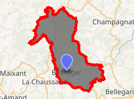
Bosroger
Bosroger is a commune in the Creuse department in the Nouvelle-Aquitaine region in central France.
Bosroger | |
|---|---|
Location of Bosroger 
| |
 Bosroger  Bosroger | |
| Coordinates: 45°59′42″N 2°15′03″E | |
| Country | France |
| Region | Nouvelle-Aquitaine |
| Department | Creuse |
| Arrondissement | Aubusson |
| Canton | Aubusson |
| Intercommunality | CC Marche et Combraille en Aquitaine |
| Government | |
| • Mayor (2008–2014) | Jean-Paul Joulot |
| Area 1 | 7.56 km2 (2.92 sq mi) |
| Population (2017-01-01)[1] | 110 |
| • Density | 15/km2 (38/sq mi) |
| Time zone | UTC+01:00 (CET) |
| • Summer (DST) | UTC+02:00 (CEST) |
| INSEE/Postal code | 23028 /23200 |
| Elevation | 515–663 m (1,690–2,175 ft) (avg. 625 m or 2,051 ft) |
| 1 French Land Register data, which excludes lakes, ponds, glaciers > 1 km2 (0.386 sq mi or 247 acres) and river estuaries. | |
Geography
An area of lakes, forestry and farming comprising a small village and one hamlet situated just 5 miles (8.0 km) northeast of Aubusson, at the junction of the D39, D40 and the D993 roads.
The Voueize flows northward through the western part of the commune.
Population
| Year | Pop. | ±% |
|---|---|---|
| 1962 | 105 | — |
| 1968 | 114 | +8.6% |
| 1975 | 101 | −11.4% |
| 1982 | 98 | −3.0% |
| 1990 | 80 | −18.4% |
| 1999 | 76 | −5.0% |
| 2008 | 99 | +30.3% |
Sights
- The church, dating from the thirteenth century.
- The chapel at Léon-le-Franc, dating from the fifteenth century.
gollark: There are no good programming languages, sadly.
gollark: I would either use Rust or Nim. But both are annoying in some ways.
gollark: The project is currently shelved due to the caching interacting poorly with dynamic sites and the lack of programming languages sufficient to contain the power it wields.
gollark: I could also make live-updating things, make the theming actually good, A/B-test unsuspecting users, and make achievements work better.
gollark: No JS, server rendering of comment sections.
See also
References
- "Populations légales 2017". INSEE. Retrieved 6 January 2020.
| Wikimedia Commons has media related to Bosroger. |
This article is issued from Wikipedia. The text is licensed under Creative Commons - Attribution - Sharealike. Additional terms may apply for the media files.