Strike-a-Light River
The Strike-a-Light River, a perennial stream that is part of the Murrumbidgee catchment within the Murray–Darling basin, is located in the Snowy Monaro Regional Council area of New South Wales, Australia.
| Strike-a-Light Tinderry Creek, Strike-A-Light Creek[1] | |
|---|---|
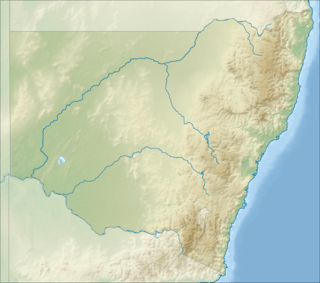
 Location of the Strike-a-Light River mouth in New South Wales | |
| Location | |
| Country | Australia |
| State | New South Wales |
| Region | South Eastern Highlands (IBRA), Monaro |
| Municipality | Snowy Monaro |
| Physical characteristics | |
| Source | Great Dividing Range |
| • location | near Jerangle |
| • elevation | 1,200 m (3,900 ft) |
| Mouth | Bredbo River |
• location | east of Bredbo |
• coordinates | 35°58′17″S 149°13′49″E |
• elevation | 733 m (2,405 ft) |
| Length | 38 km (24 mi) |
| Basin features | |
| River system | Murrumbidgee catchment, Murray–Darling basin |
| [2] | |
The river rises on the western slopes of the Great Dividing Range, near Jerangle, and flows generally north north-west, north-west, south-west and then south, joined by three minor tributaries, before reaching its confluence with the Bredbo River, east of Bredbo; descending 464 metres (1,522 ft) over its 38-kilometre (24 mi) course.[2]
Flora and fauna
Strike-a-Light River flows through the Strike-a-Light Nature Reserve.
The Strike-a-Light River is inhabited by a number of amphibian species Bibron's toadlet (Pseudophryne bibronii), common eastern froglet (Crinia signifera), pobblebonk (Limnodynastes dumerilii), spotted grass frog (Limnodynastes tasmaniensis) and Verreaux's tree frog (Litoria verreauxii).[3]
Vegetation communities through which the river passes include Scribbly Gum/Apple Box - Dry Shrub Forest, Ribbon Gum - Valley Forest as well as partially cleared areas of natural vegetation.[4]
See also
- List of rivers of Australia
- List of rivers of New South Wales (L-Z)
- Rivers of New South Wales
References
- "Strike-a-Light River". Geographical Names Register (GNR) of NSW. Geographical Names Board of New South Wales. Retrieved 10 February 2013.

- "Map of Strike A Light River, NSW". Bonzle.com. Retrieved 10 February 2013.
- "Burnt School and Strike-a-Light Nature Reserves - Plan of Management" (PDF). NSW National Parks and Wildlife Service. October 2007. Retrieved 7 September 2009.
- "Burnt School and Strike-a-Light Nature Reserves Fire Management Strategy" (PDF). South West Slopes Region. NSW National Parks and Wildlife Service. 2006. Retrieved 7 September 2009.