Pinchgut Creek
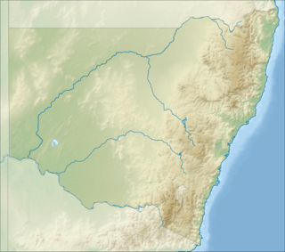
The Pinchgut Creek, a non–perennial stream[2] that is part of the Murrumbidgee catchment within the Murray–Darling basin, is located in the South West Slopes region of New South Wales, Australia.
| Pinchgut | |
|---|---|
 Location of the Pinchgut Creek mouth in New South Wales | |
| Location | |
| Country | Australia |
| State | New South Wales |
| Region | Riverina (IBRA), South West Slopes |
| LGA | Junee |
| Physical characteristics | |
| Source | Dudauman Range, Great Dividing Range |
| • location | south of Stockinbingal |
| • coordinates | 34°34′11″S 147°47′43″E |
| • elevation | 370 m (1,210 ft) |
| Mouth | confluence with the Houlaghans Creek |
• location | north of Junee Reefs |
• coordinates | 34°40′50″S 147°36′00″E |
• elevation | 276 m (906 ft) |
| Length | 31 km (19 mi) |
| Basin features | |
| River system | Murrumbidgee catchment, Murray–Darling basin |
| [1] | |
Course and features
The Pinchgut Creek (technically a river[2]) rises below Dudauman Range, part of the Great Dividing Range. The creek flows generally southwest before reaching its confluence with the Houlaghans Creek (itself a tributary of the Murrumbidgee River), near the locality of Junee Reefs. The creek descends 94 metres (308 ft) over its 31-kilometre (19 mi) course.[1]
gollark: I haven't seen any evidence that human behavior arises from anything more than, well, physics.
gollark: What does the "infinite" have to do with anything, also?
gollark: I would not mind patches for cognitive biases and stuff.
gollark: Well, you could fix some of the more egregious bugs in humans without losing anything important, surely.
gollark: ...
References
- "Map of Pinchgut Creek, NSW". Bonzle Digital Atlas of Australia. Retrieved 3 January 2015.
- "Pinchgut Creek". Geographical Names Register (GNR) of NSW. Geographical Names Board of New South Wales. Retrieved 3 January 2015.

External links
- Murrumbidgee Catchment Management Authority website
- "Murrumbidgee and Lake George catchments" (map). Office of Environment and Heritage. Government of New South Wales.
This article is issued from Wikipedia. The text is licensed under Creative Commons - Attribution - Sharealike. Additional terms may apply for the media files.