Rock Flat Creek
The Rock Flat Creek, a watercourse[1] that is part of the Murrumbidgee catchment within the Murray–Darling basin, is located in the Monaro region of New South Wales, Australia.
| Rock Flat Flat, Tolbar[1] | |
|---|---|
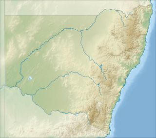 Location of the Rock Flat Creek mouth in New South Wales | |
| Location | |
| Country | Australia |
| State | New South Wales |
| Region | Snowy Mountains (IBRA), Monaro |
| LGA | Snowy Monaro |
| Physical characteristics | |
| Source | Australian Alps, Great Dividing Range |
| • location | below One Tree Hill |
| • coordinates | 36°26′5″S 149°13′10″E |
| • elevation | 1,060 m (3,480 ft) |
| Mouth | confluence with the Cooma Creek |
• location | north of Cooma |
• coordinates | 36°7′27″S 149°11′21″E |
• elevation | 719 m (2,359 ft) |
| Length | 41 km (25 mi) |
| Basin features | |
| River system | Murrumbidgee catchment, Murray–Darling basin |
| [2] | |
Course and features
The Rock Flat Creek (technically a river[1]) rises below One Tree Hill, on the lower slopes of the Snowy Mountains, part of the Great Dividing Range. The creek flows generally north by west before reaching its confluence with the Cooma Creek just upstream from that creek's confluence to form the Numeralla River (itself a tributary of the Murrumbidgee River), north of the town of Cooma. The creek descends 336 metres (1,102 ft) over its 41-kilometre (25 mi) course.[2]
The Monaro Highway crosses the creek near the locality of Milton Park.[2]
There is a mineral spring that comes to the surface on the bank of Rock Flat Creek about 16km south-east of Cooma. The spring water issues from near the base of a small rocky mount composed of highly inclined beds of quartzite and the surface of the flat in the vicinity of the spring is tufaceous limestone that has been deposited there by the spring water. The flow rate of the spring is about 245-litres per hour. The spring water has a pleasant taste and is carbonated.[3]
References
- "Rock Flat Creek". Geographical Names Register (GNR) of NSW. Geographical Names Board of New South Wales. Retrieved 4 January 2015.

- "Map of Rock Flat Creek, NSW". Bonzle Digital Atlas of Australia. Retrieved 4 January 2015.
- "Mining Industries on the Monaro MINERAL SPRINGS". www.monaropioneers.com. Retrieved 19 February 2019.
External links
- Murrumbidgee Catchment Management Authority website
- "Murrumbidgee and Lake George catchments" (map). Office of Environment and Heritage. Government of New South Wales.
Rivers of the Murrumbidgee River catchment, New South Wales and the Australian Capital Territory, Australia | |||||
|---|---|---|---|---|---|
| |||||
| |||||