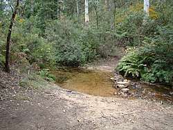
Bedford Creek
The Bedford Creek, a perennial stream of the Hawkesbury-Nepean catchment, is located in the Blue Mountains region of New South Wales, Australia.
| Bedford | |
|---|---|
 | |
| Location | |
| Country | Australia |
| State | New South Wales |
| Region | Sydney Basin (IBRA), Blue Mountains |
| Municipality | City of Blue Mountains |
| Physical characteristics | |
| Source | Bodington Hill |
| • location | between Bullaburra and Wentworth Falls |
| • elevation | 590 m (1,940 ft) |
| Mouth | confluence with Glen Erskine Creek to form the Erskine Creek |
• location | near Mount Gibson, south of Woodford |
• elevation | 323 m (1,060 ft) |
| Length | 22 km (14 mi) |
| Basin features | |
| River system | Hawkesbury-Nepean catchment |
| National park | Blue Mountains NP |
| [1][2] | |
Course
The Bedford Creek (officially designated as a river[3]) rises near Bodington Hill, between Bullaburra and Wentworth Falls, and flows generally south-east and south, before reaching its confluence with the Glen Erskine Creek to form the Erskine Creek, in remote country south-east of Mount Gibson, south of Woodford. The river descends 267 metres (876 ft) over its 22-kilometre (14 mi) course.[2]
The river is entirely contained within the world heritage-listed Blue Mountains National Park.[4]
gollark: ?remind 11d Protocol Beta executed. Activating Protocol Gamma.
gollark: nope!¡
gollark: I think in general it's been *actively harmful*.
gollark: "Useful" how?
gollark: ···
See also
- List of rivers of Australia
- List of rivers in New South Wales (A-K)
- Rivers of New South Wales
References
- "Place Name Search: Bedford Creek". Geoscience Australia. Commonwealth of Australia. 2010. Archived from the original on 24 December 2013. Retrieved 24 December 2013.
- "Map of Bedford Creek". Bonzle Digital Atlas of Australia. Digital Atlas Pty Limited. 2013. Retrieved 24 December 2013.
- "Bedford Creek". Geographical Names Register (GNR) of NSW. Geographical Names Board of New South Wales. Retrieved 24 December 2013.

- "Blue Mountains National Park: Sector map: Woodford". NSW National Parks & Wildlife Service. Government of New South Wales. Retrieved 24 December 2013.
This article is issued from Wikipedia. The text is licensed under Creative Commons - Attribution - Sharealike. Additional terms may apply for the media files.