Robeson County, North Carolina
Robeson County is a county in the southern part of the U.S. state of North Carolina. As of the 2010 census, the population was 134,168.[1] Its county seat is Lumberton.[2] The county was formed in 1787 from part of Bladen County. It was named in honor of Col. Thomas Robeson of Tar Heel, a hero of the Revolutionary War.
Robeson County | |
|---|---|
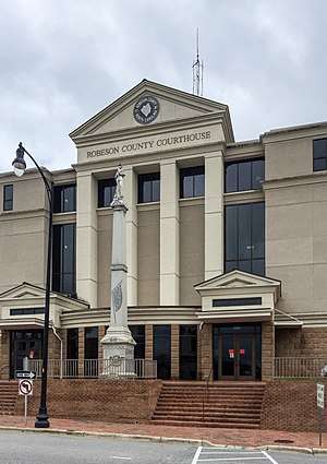 Robeson County Courthouse in Lumberton | |
 Seal | |
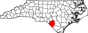 Location within the U.S. state of North Carolina | |
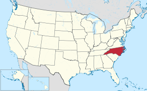 North Carolina's location within the U.S. | |
| Coordinates: 34°38′N 79°07′W | |
| Country | |
| State | |
| Founded | 1787 |
| Named for | Colonel Thomas Robeson |
| Seat | Lumberton |
| Largest city | Lumberton |
| Area | |
| • Total | 951 sq mi (2,460 km2) |
| • Land | 949 sq mi (2,460 km2) |
| • Water | 1.8 sq mi (5 km2) 0.2%% |
| Population | |
| • Estimate (2019) | 130,625 |
| • Density | 141/sq mi (54/km2) |
| Time zone | UTC−5 (Eastern) |
| • Summer (DST) | UTC−4 (EDT) |
| Congressional district | 9th |
| Website | www |
Robeson County comprises the Lumberton, NC Micropolitan Statistical Area, which is included in the Fayetteville–Lumberton–Laurinburg, NC Combined Statistical Area.
Since 2008, Robeson County has been identified as among the 10% of United States counties that are majority-minority;[3] its combined population of American Indian, African American and Hispanic residents constitute more than 68 percent of the total. Members of the state-recognized Lumbee Tribe of North Carolina, make up most of the 38 percent of the population who identify as Native American.
The University of North Carolina at Pembroke is located in the county. It developed from a normal school established here in the late 19th century for the training of teachers of students classified as Indian, from mixed-race families who had been free before the Civil War. In the late 1880s local state legislator Hamilton McMillan gained state authorization for separate schools for this population, which he theorized were descended from Croatan Indians. The public system was otherwise racially segregated into blacks (mostly freedmen's children), and whites.
History
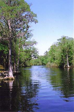
Archaeological excavation performed in Robeson County reveals widespread, continuous occupation of the region by various cultures of indigenous peoples since the end of the last Ice Age. They had camps and settlements near the Lumber River for its water, transportation, fish and related wildlife resources. Local excavations reveal that Native American peoples made stone tools, using materials brought to present-day Robeson County from the Carolina Piedmont. The large amounts of ancient pottery found at some Robeson County sites have been dated to the early Archaic Woodland period. Materials show that local settlements were part of an extensive Native American trade network with other regions. Portions of the river basin show that Robeson County was a "zone of cultural interactions."
Swamps, streams, and artesian wells provided an excellent supply of water for Native peoples. Fish were plentiful, and the region's lush vegetation included numerous food crops. "Carolina bays" continue to dot the landscape. Numerous 10,000-year-old Clovis points found along their banks indicate indigenous peoples used these depressions as campsites.
Colonial era
Early written sources specific to the territory of Robeson County region are few for the post-contact period of European colonization until the later 18th century and after.
Governor Arthur Dobbs related a report from his agent, Col. Rutherford, head of a Bladen County militia, that a "mixed crew" of 50 families were living along Drowning Creek. They were referred to as "mullatos," generally meaning people of African and European descent.[4]
The anthropologist John R. Swanton of the Smithsonian Institution tried to identify the origin of the ethnic group known as Croatan Indians since the late 19th century. Swanton posited that the multi-racial people were the descendants of Siouan-speaking peoples, of which the most prominent in the area were the Cheraw and Keyauwee.[5]
After the American Revolution, the newly established state used a lottery to dispose of lots for developing Lumberton. The town was incorporated in 1788, and John Willis proposed the name "Lumberton", after the important lumber and naval stores industry. This dominated the otherwise agricultural economy of Robeson County throughout the nineteenth century
Lumberton was developed at a section known throughout that century as "Drowning Creek," a term still used for the headwater portions of the river. The first Robeson County courthouse was erected on land of the Red Bluff Plantation, donated for that purpose by Lumberton founder John Willis. Robeson County's post office was established in 1794. In 1809, the state legislature renamed Drowning Creek as the Lumber River, after the area's major industry.
In the 1790–1810 censuses, descendants of these families were classified as both white (European American) and free people of color, a classification which included people of African-European, African-Native American, and tri-racial ancestry. These settlers were subsistence farmers and held few slaves.
In the nineteenth century, mixed-race people sometimes identified as Indian, Portuguese or Arab, to account for physical differences from northern Europeans and to escape the racial segregation associated with descendants of Africans. Some may have descended from Atlantic Creoles, men of mixed African-Portuguese ancestry identified by the historian Ira Berlin as part of the "charter generation" of slaves. Some likely intermarried with remnants of Indian tribes who remained in the area. Names on early land deeds and other historic documents in Robeson County correspond to many of the families of free people of color, including ancestors of contemporary Lumbee.[6] Settlements included Prospect and Red Banks.
Nineteenth century
By the beginning of the American Civil War, many remnant Native Americans in the Upper South struggled to survive and their status continued to decline. Since 1790, Native Americans in the southern states were enumerated as "free persons of color" on the local and federal census, included with free African Americans.
By 1835, in the wake of Nat Turner's Slave Rebellion of 1831, North Carolina like other southern states reduced the rights of free people of color. Out of fear of slave rebellion aided by free blacks, the legislature withdrew the rights of free people of color to vote, serve on juries, own and use firearms, and learn to read and write.
During the 1830s, the federal government forced Indian Removal, relocating the Cherokee and other of the Five Civilized Tribes of the Deep South and lower Southeast to Indian Territory west of the Mississippi River. Native Americans who stayed in the Southeast tended to live in frontier and marginal areas to avoid white supervision.
Civil War

North Carolina seceded from the Union in 1861. A major yellow fever epidemic in 1862 killed 10 percent of the Cape Fear region's population. Most white men of military age had either enlisted with the Confederacy or left the region. The Confederate Army conscripted African-American slaves as workers to build a system of forts to defend Fort Fisher, near Wilmington. Some free people of color from as far away as Robeson County (80–90 miles) were also impressed as laborers.
Robeson County's home guard included county magistrates, clergymen, and lawyers, who mainly represented the interests of the planter class. During the war, large slaveholders were exempted from participation in the army. The Home Guard raided local farmers, taking food supplies and livestock for the Confederate Army and their own use. When they raided the farmstead of Allen Lowrie, they killed Lowrie and his son William.
His surviving son Henry Berry Lowrie, a mixed-race man of Amerindian and White heritage, swore revenge and led an insurgency against the upper class, raiding homesteads and driving off livestock.
Late in the Civil War, General William Tecumseh Sherman and his army began to push their way toward Robeson County as they headed north. After hearing of the Union Army's burning of Columbia, South Carolina on February 17, 1865, residents of Robeson County worried about the troops' advance. Washington Sandford Chaffin, a Methodist minister in Lumberton speculated in his diary about how the county might be treated by Sherman and his Yankees. Chaffin noted that Henry Berry Lowry and his gang were "doing much mischief in this country." Lowry's gang had "torn up and destroyed" Confederate white homesteads. In the late stages of the war, such gangs and insurgents carried out private feuds.
During the next seven years, Henry Lowry led a group of free people of color, poor whites and blacks in one of many postwar insurgent movements during years of social disruption. He campaigned against the white elite. His activities made him a folk hero to many of the poorer folk.[7]
In a county with a high proportion of people of color, both Native Americans and African Americans were oppressed by the Jim Crow system established in the state after white conservative Democrats regained power following the Reconstruction era. The state legislature passed laws to raise barriers to voter registration and disenfranchise minorities. In 1900 the Democrats adopted a constitutional suffrage amendment which lengthened the residence period required before registration (which worked against sharecroppers and tenant farmers), and enacted both an educational qualification (to be assessed by a registrar, who were white and applied it subjectively) and prepayment of a poll tax (difficult for poor people to raise who did not use much cash). A grandfather clause exempted from the poll tax those entitled to vote on January 1, 1867.[8] The effect in North Carolina was the complete elimination of black and mixed-race voters from voter rolls by 1904. Contemporary accounts estimated that 75,000 black male citizens across the state lost the vote.[9]
Twentieth century
Racial segregation continued through the 20th century, affecting the criminal justice system and the administration of federal aid programs in the state and county. Racial discrimination has been documented in farm and other aid programs.
During the Great Depression of the 1930s, local farmers in 1938 formed a mutual-aid cooperative, known as the Red Banks Mutual Association. They made a 99-year lease on a large plot of land, which they farmed together through the association until 1968. Historian Ryan K. Anderson explored this association for its contributions not only to members' survival during the Depression, but its influence in building stability and networks within the community.[10]
As in other southern states, local Ku Klux Klan chapters persisted in North Carolina into the late 20th century (and some still likely exist). In early 1958 they called for a gathering in Maxton, intended to intimidate the Lumbee and other people of color. On January 18, 1958, armed Lumbee responded by gathering many more men and they chased off an estimated 50 Klansmen and supporters led by grand wizard James W. "Catfish" Cole in what became known as the Battle of Hayes Pond, after the site of the action.[11]
Geography
According to the U.S. Census Bureau, the county has a total area of 951 square miles (2,460 km2), of which 949 square miles (2,460 km2) is land and 1.8 square miles (4.7 km2) (0.2%) is water.[12] It is the largest county in North Carolina by land area, but not by total area, that title going to Dare County.
Robeson County is bordered by the state of South Carolina, and the North Carolina counties of Bladen, Columbus, Cumberland, Hoke, and Scotland.
The topography is mostly level to undulating coastal plain, largely made up of sandhills and coastal dunes with elevations above mean sea level that vary from 60 feet in the extreme southeastern portion of the county to 250 feet in the north, to the west of Parkton, North Carolina. Moreover, numerous swamps that generally flow in a northwest to southeast course, characterize the area and eventually drain into the Lumber River. The highest density of swamps is in that part of the county that is most populated by the Lumbee Tribe of North Carolina, a state recognized tribe.[13]
Major highways
Adjacent counties
- Cumberland County – northeast
- Bladen County – east
- Columbus County – southeast
- Horry County, South Carolina – south
- Dillon County, South Carolina – southwest
- Marlboro County, South Carolina – west
- Scotland County – northwest
- Hoke County – northwest
Demographics
| Historical population | |||
|---|---|---|---|
| Census | Pop. | %± | |
| 1790 | 5,343 | — | |
| 1800 | 6,839 | 28.0% | |
| 1810 | 7,528 | 10.1% | |
| 1820 | 8,204 | 9.0% | |
| 1830 | 9,433 | 15.0% | |
| 1840 | 10,370 | 9.9% | |
| 1850 | 12,826 | 23.7% | |
| 1860 | 15,489 | 20.8% | |
| 1870 | 16,262 | 5.0% | |
| 1880 | 23,880 | 46.8% | |
| 1890 | 31,483 | 31.8% | |
| 1900 | 40,371 | 28.2% | |
| 1910 | 51,945 | 28.7% | |
| 1920 | 54,674 | 5.3% | |
| 1930 | 66,512 | 21.7% | |
| 1940 | 76,860 | 15.6% | |
| 1950 | 87,769 | 14.2% | |
| 1960 | 89,102 | 1.5% | |
| 1970 | 84,842 | −4.8% | |
| 1980 | 101,610 | 19.8% | |
| 1990 | 105,179 | 3.5% | |
| 2000 | 123,339 | 17.3% | |
| 2010 | 134,168 | 8.8% | |
| Est. 2019 | 130,625 | [14] | −2.6% |
| U.S. Decennial Census[15] 1790–1960[16] 1900–1990[17] 1990–2000[18] 2010–2019[1] | |||
As of the census[19] of 2010, there were 134,168 people. In 2000 there were 43,677 households, and 32,015 families residing in the county. The population density was 130 people per square mile (50/km²). There were 47,779 housing units at an average density of 50 per square mile (19/km²).
As of 2000, the racial makeup of the county was:
- 38.02% American Indian
- 32.80% White
- 25.11% Black or African-American
- 4.86% Hispanic or Latino of any race
- 0.33% Asian
- 0.06% Pacific Islander
- 2.26% from other races
- 1.41% from two or more races
In 2005 38.5% of the population identified as Native American, likely mostly associated with the state-recognized Lumbee Tribe of North Carolina, which is prominent in the county. Some 29.1% of the county population was non-Hispanic whites. 24.3% of the population identified as African American. 7.4% of the population identified as Latino.
Native Americans
The Lumbees of North Carolina, a state-recognized tribe, constitutes more than one-half the state of North Carolina's indigenous population of 101,000. With a population of 58,443 (reflecting a 34.5% increase from the 1980 population of 43,465 members), the Lumbee reside primarily in Robeson, Hoke, Cumberland, and Scotland counties. In Robeson County, people identifying as Native Americans number 46,869 out of a total county population of 123,339. Most identify as Lumbee. The Lumbees make up 38.02%, comprising the largest ethnic group in the county. The Lumbees are the amalgamation of various Siouan, Algonquian, and Iroquoian speaking tribes.
The Lumbee comprise the largest non-federally recognized tribe east of the Mississippi River, and the ninth largest non-federally recognized tribe in the United States. Several majority-Lumbee communities are located within Robeson County.
Households
There were 43,677 households out of which 37.00% had children under the age of 18 living with them, 46.60% were married couples living together, 20.60% had a female householder with no husband present, and 26.70% were non-families. 22.70% of all households were made up of individuals and 8.30% had someone living alone who was 65 years of age or older. The average household size was 2.75 and the average family size was 3.20.
In the county, the population was spread out with 29.00% under the age of 18, 10.60% from 18 to 24, 29.30% from 25 to 44, 21.10% from 45 to 64, and 10.00% who were 65 years of age or older. The median age was 32 years. For every 100 females there were 94.70 males. For every 100 females age 18 and over, there were 91.20 males.
The median income for a household in the county was $28,202, and the median income for a family was $32,514. Males had a median income of $26,646 versus $20,599 for females. The per capita income for the county was $13,224. About 19.60% of families and 28.20% of the population were below the poverty line, including 30.00% of those under age 18 and 25.30% of those age 65 or over. It is ranked as North Carolina's poorest county. Industrial, technological and professional jobs are lacking in the area.
Law and government
A County Council, with members elected from single-member districts, forms the government of the county.
Robeson County is a member of the regional Lumber River Council of Governments.
| Year | Republican | Democratic | Third parties |
|---|---|---|---|
| 2016 | 50.8% 20,762 | 46.5% 19,016 | 2.6% 1,080 |
| 2012 | 40.8% 17,510 | 58.2% 24,988 | 1.0% 448 |
| 2008 | 42.7% 17,433 | 56.5% 23,058 | 0.8% 343 |
| 2004 | 47.0% 15,909 | 52.8% 17,868 | 0.3% 94 |
| 2000 | 39.4% 11,721 | 60.0% 17,834 | 0.7% 192 |
| 1996 | 29.4% 8,146 | 62.7% 17,361 | 7.8% 2,164 |
| 1992 | 25.5% 7,777 | 63.6% 19,378 | 10.9% 3,319 |
| 1988 | 36.7% 9,908 | 62.9% 16,988 | 0.4% 104 |
| 1984 | 45.8% 12,947 | 53.9% 15,257 | 0.3% 87 |
| 1980 | 27.9% 6,982 | 70.4% 17,618 | 1.7% 430 |
| 1976 | 19.1% 4,907 | 80.5% 20,695 | 0.4% 97 |
| 1972 | 60.0% 11,362 | 39.0% 7,391 | 1.0% 188 |
| 1968 | 23.6% 4,526 | 42.9% 8,248 | 33.5% 6,441 |
| 1964 | 20.7% 3,591 | 79.4% 13,796 | |
| 1960 | 23.6% 3,580 | 76.5% 11,623 | |
| 1956 | 20.9% 2,785 | 79.1% 10,516 | |
| 1952 | 30.7% 4,127 | 69.3% 9,311 | |
| 1948 | 11.3% 1,036 | 77.3% 7,056 | 11.4% 1,041 |
| 1944 | 13.3% 1,118 | 86.7% 7,278 | |
| 1940 | 9.1% 931 | 90.9% 9,251 | |
| 1936 | 6.7% 732 | 93.4% 10,280 | |
| 1932 | 9.0% 783 | 90.5% 7,860 | 0.5% 44 |
| 1928 | 36.9% 2,767 | 63.1% 4,730 | |
| 1924 | 7.2% 314 | 92.5% 4,064 | 0.3% 14 |
| 1920 | 26.4% 2,220 | 73.6% 6,183 | |
| 1916 | 33.4% 1,453 | 66.6% 2,894 | |
| 1912 | 4.4% 154 | 76.9% 2,706 | 18.8% 660 |
Communities
City
- Lumberton, the county seat
Towns
Townships
- Alfordsville
- Back Swamp
- Barnesville
- Britts
- Burnt Swamp
- East Howellsville
- Gaddy
- Parkton
- Philadelphus
- Raft Swamp
- Rennert
- Saddletree
- Shannon
- Smiths
- Smyrna
- Sterlings
- Thompson
- Union
- West Howellsville
- Whitehouse
- Wishart
Census-designated places
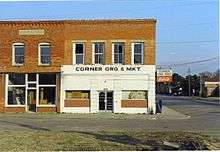
Barnesville
Unincorporated communities
Education
Public Schools of Robeson County operates public schools.
Notable people
- John Beard, a former Los Angeles television news anchor grew up in St. Pauls.
- Chris Chavis , professional wrestler better known as "Tatanka" and "The War Eagle"; he is a member of the World Wrestling Entertainment (WWE)
- Vonta Leach, born in Lumberton and raised in Rowland, is a former [NFL) player.
- Sean Locklear, born in Lumberton, is a former starting offensive lineman for the Seattle Seahawks of the NFL.
- Henry Berry Lowrie, referred to as part-Tuscarora, was a cultural hero of the Lumbee of North Carolina, who led insurgents against the planter elite during the Reconstruction era.
- James McCallum, 1806–1889, Representative from Tennessee in the Confederate Congress, 1864–65, Grandmaster of the Tennessee Masons, and mayor
- Mike McIntyre served as the U.S. Representative of North Carolina's 7th Congressional District from 1997 to 2015. He was born and raised in Lumberton and practiced law with offices in both Lumberton and Maxton prior to his election to Congress.
- Angus McLean – Governor of North Carolina 1924–1928
- Malcom McLean, entrepreneur from Maxton, often called "the father of containerization".
- Joseph Mitchell, journalist for The New Yorker.
- Margaret Marley Modlin, surrealist painter, sculptor and photographer, spent most of her adult life in Spain.
- Kelvin Sampson, men's basketball coach of the Houston Cougars at the University of Houston
- Afeni Shakur, mother of the late rapper Tupac Shakur, was an early member of the Black Panther Party.
See also
Sources
- "State & County QuickFacts". United States Census Bureau. Retrieved October 29, 2013.
- "Find a County". National Association of Counties. Retrieved June 7, 2011.
- Kelvin Pollard and Mark Mather, "10% of U.S. Counties Now 'Majority-Minority'", 2008
- Colonial Records: North Carolina 1890; 768 and North Carolina 1887; 161, respectively
- John R. Swanton, The Indian Tribes of North America, Smithsonian Institution, Bureau of American Ethnology Bulletin, No. 145. Washington: GPO, 1952
- Paul Heinegg, Free African Americans in Virginia, North Carolina, South Carolina, Maryland and Delaware, 2005
- Evans, William McKee (1996). To Die Game: The Story of the Lowry Band, Indian Guerrillas of Reconstructioin. Syracuse University Press. ISBN 0815603592.
- Richard H. Pildes, ‘Democracy, Anti-Democracy, and the Canon’, Constitutional Commentary, Vol. 17, 2000
- Albert Shaw, The American Monthly Review of Reviews, Vol.XXII, Jul–Dec 1900, p.274
- Ryan K. Anderson, "Lumbee Kinship, Community, and the Success of the Red Banks Mutual Association", American Indian Quarterly Vol. 23, No. 2 (Spring, 1999), pp. 39–58; Published by: University of Nebraska Press, DOI: 10.2307/1185966; available via JSTOR. Retrieved May 8, 2017
- Peng, Ilena, "The Day the Native Americans Drove the KKK Out of Town", Narratively, October 14, 2019.
- "2010 Census Gazetteer Files". United States Census Bureau. August 22, 2012. Archived from the original on January 12, 2015. Retrieved January 19, 2015.
- "Population and Housing Unit Estimates". Retrieved May 21, 2020.
- "U.S. Decennial Census". United States Census Bureau. Retrieved January 19, 2015.
- "Historical Census Browser". University of Virginia Library. Retrieved January 19, 2015.
- Forstall, Richard L., ed. (March 27, 1995). "Population of Counties by Decennial Census: 1900 to 1990". United States Census Bureau. Retrieved January 19, 2015.
- "Census 2000 PHC-T-4. Ranking Tables for Counties: 1990 and 2000" (PDF). United States Census Bureau. April 2, 2001. Retrieved January 19, 2015.
- "U.S. Census website". United States Census Bureau. Retrieved January 31, 2008.
- Leip, David. "Dave Leip's Atlas of U.S. Presidential Elections". uselectionatlas.org. Retrieved March 17, 2018.
- Chaffin, Washington Sandford. "February 25 – March 1, 1865", in Diary. Durham, North Carolina: Duke University Archives.
- Evans, William McKee. To Die Game: The Story of the Lowry Band: Indian Guerillas of Reconstruction. Baton Rouge: Louisiana State University Press, 1971.
- Glatthaar, Joseph T. The March to the Sea and Beyond: Sherman's Troops in the Savannah and Carolinas Campaigns. New York: New York University Press, 1985.
- Gorman, John C. "Recollections." Thomas A. Norment affidavit, December 8, 1865. Superior Court of North Carolina Records: Criminal action papers concerning Henry Berry Lowry, Robeson County, 1862–1865.
- Gragg, Rod. Confederate Goliath: The Battle of Fort Fisher. New York: Harper Collins, 1991.
- Hauptman, Lawrence M. "River Pilots and Swamp Guerillas: Pamunkee and Lumbee Unionists." In Between Two Fires: American Indians in the Civil War. New York: Free Press, 1995.
- McKinnon, Henry A. Jr. Historical Sketches of Robeson County. N.P.: Historic Robeson, Inc., 2001.
- "North Carolina: Indian raid." Newsweek 51 (Jan 27, 1958): 27.
- Swanton, John R. "Probable Identity of the 'Croatan' Indians." [National Anthropological Archives, Smithsonian Institution, Washington, D.C. MS 4126].
- Taukchiray, Wesley D., "American Indian References in the South Carolina Gazette and Country Journal, Royal South Carolina Gazette, South Carolina Gazette and Public Advertiser, and State Gazette of South Carolina, 1766–1792", South Carolina Historical Magazine 100 (Oct. 1999), pp. 319–27.
- U.S. Bureau of the Census. The First Census of the U.S.: 1790. Heads of Families at the First Census of the United States: North Carolina. Washington, D.C.: Government Printing Office, 1908.
- U.S. Bureau of the Census. We the People: https://www.census.gov/main/www/cen2000.html
- William McKee Evans, "To Die Game: The Story of the Lowry Band, Indian Guerrillas of Reconstruction", Syracuse University Press, 1995
- Adolph L. Dial, David K. Eliades, "The Only Land I Know: A History of the Lumbee Indians", Syracuse University Press, 1996
- Karen I. Blu, "The Lumbee Problem: The Making of an American Indian", University of Nebraska Press, 2001
- E. Stanly Godbold, Jr. and Mattie U. Russell, "Confederate Colonel And Cherokee Chief: The Life Of William Holland Thomas", University of Tennessee Press, 1990
External links
- Official website
- NCGenWeb Robeson County – free genealogy resources for the county
- Online News for Lumberton (www.lumbertontimes.com)
