History of urban planning
This article delineates the history of urban planning, a technical and political process concerned with the use of land and design of the urban environment, including air, water, and the infrastructure passing into and out of urban areas such as transportation and distribution networks.
The history of urban planning runs parallel to the history of the city, as planning is in evidence at some of the earliest known urban sites.
Pre-classical
The pre-Classical and Classical periods saw a number of cities laid out according to fixed plans, though many tended to develop organically. Designed cities were characteristic of the Minoan, Mesopotamian, Harrapan, and Egyptian civilisations of the third millennium BC (see Urban planning in ancient Egypt). The first recorded description of urban planning appears in the Epic of Gilgamesh: "Go up on to the wall of Uruk and walk around. Inspect the foundation platform and scrutinise the brickwork. Testify that its bricks are baked bricks, And that the Seven Counsellors must have laid its foundations. One square mile is city, one square mile is orchards, one square mile is claypits, as well as the open ground of Ishtar's temple.Three square miles and the open ground comprise Uruk. Look for the copper tablet-box, Undo its bronze lock, Open the door to its secret, Lift out the lapis lazuli tablet and read." [1]
Distinct characteristics of urban planning from remains of the cities of Harappa, Lothal, Dholavira, and Mohenjo-daro in the Indus Valley Civilisation (in modern-day northwestern India and Pakistan) lead archeologists to interpret them as the earliest known examples of deliberately planned and managed cities.[2][3] The streets of many of these early cities were paved and laid out at right angles in a grid pattern, with a hierarchy of streets from major boulevards to residential alleys. Archaeological evidence suggests that many Harrapan houses were laid out to protect from noise and to enhance residential privacy; many also had their own water wells, probably both for sanitary and for ritual purposes. These ancient cities were unique in that they often had drainage systems, seemingly tied to a well-developed ideal of urban sanitation.[2] Cities laid out on the grid plan could have been an outgrowth of agriculture based on rectangular fields.[4]
Many Central American civilisations also planned their cities, including sewage systems and running water. In Mexico, Tenochtitlan, built on an island in Lake Texcoco in the present-day Mexico City in central Mexico, served as the capital of the Aztec empire. At its height, Tenochtitlan was one of the largest cities in the world, with over 200,000 inhabitants.[5]
China
China has a tradition of urban planning dating back thousands of years.
Greco-Roman empires
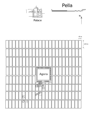
Traditionally, the Greek philosopher Hippodamus (5th century BC) is regarded as the first town planner and ‘inventor’ of the orthogonal urban layout. Aristotle called him "the father of city planning",[6] and until well into the 20th century, he was indeed regarded as such. This is, however, only partly justified. The Hippodamian plan that was called after him, is an orthogonal urban layout with more or less square street blocks. Archaeological finds from ancient Egypt—among others—demonstrate that Hippodamus cannot truly have been the inventor of this layout.[7] Aristotle's critique and indeed ridicule of Hippodamus, which appears in Politics 2. 8, is perhaps the first known example of a criticism of urban planning.
From about the late 8th century on, Greek city-states started to found colonies along the coasts of the Mediterranean, which were centred on newly created towns and cities with more or less regular orthogonal plans. Gradually, the new layouts became more regular.[8] After the city of Miletus was destroyed by the Persians in 494 BC, it was rebuilt in a regular form that, according to tradition, was determined by the ideas of Hippodamus of Miletus.[9] Regular orthogonal plans particularly appear to have been laid out for new colonial cities and cities that were rebuilt in a short period of time after destruction.
Following in the tradition of Hippodamus about a century later, Alexander commissioned the architect Dinocrates to lay out his new city of Alexandria, the grandest example of idealised urban planning of the ancient Hellenistic world, where the city's regularity was facilitated by its level site near a mouth of the Nile.
The ancient Romans also employed regular orthogonal structures on which they molded their colonies.[10] They probably were inspired by Greek and Hellenic examples, as well as by regularly planned cities that were built by the Etruscans in Italy.[11] (See Marzabotto.) The Roman engineer Vitruvius established principles of good design whose influence is still felt today.[12]
The Romans used a consolidated scheme for city planning, developed for civil convenience. The basic plan consisted of a central forum with city services, surrounded by a compact, rectilinear grid of streets. A river sometimes flowed near or through the city, providing water, transport, and sewage disposal.[13] Hundreds of towns and cities were built by the Romans throughout their empire. Many European towns, such as Turin, preserve the remains of these schemes, which show the very logical way the Romans designed their cities. They would lay out the streets at right angles, in the form of a square grid. All roads were equal in width and length, except for two, which were slightly wider than the others. The decumanus, running east–west, and the cardo, running north–south, intersected in the middle to form the centre of the grid. All roads were made of carefully fitted flag stones and filled in with smaller, hard-packed rocks and pebbles. Bridges were constructed where needed. Each square marked by four roads was called an insula, the Roman equivalent of a modern city block.
Each insula was about 80 yards (73 m) square. As the city developed, it could eventually be filled with buildings of various shapes and sizes and criss-crossed with back roads and alleys.
The city may have been surrounded by a wall to protect it from invaders and to mark the city limits. Areas outside city limits were left open as farmland. At the end of each main road was a large gateway with watchtowers. A portcullis covered the opening when the city was under siege, and additional watchtowers were constructed along the city walls. An aqueduct was built outside the city walls.
The development of Greek and Roman urbanisation is relatively well-known, as there are relatively many written sources, and there has been much attention to the subject since the Romans and Greeks are generally regarded as the main ancestors of modern Western culture. It should not be forgotten, though, that there were also other cultures with more or less urban settlements in Europe, primarily of Celtic origin.[14] Among these, there are also cases that appear to have been newly planned, such as the Lusatian town of Biskupin in Poland.
Medieval Europe

After the gradual disintegration and fall of the West-Roman empire in the 5th century and the devastation by the invasions of Huns, Germanic peoples, Byzantines, Moors, Magyars, and Normans in the next five centuries, little remained of urban culture in western and central Europe. In the 10th and 11th centuries, though, there appears to have been a general improvement in the political stability and economy. This made it possible for trade and craft to grow and for the monetary economy and urban culture to revive. Initially, urban culture recovered particularly in existing settlements, often in remnants of Roman towns and cities, but later on, ever more towns were created anew. Meanwhile, the population of western Europe increased rapidly and the utilised agricultural area grew with it. The agricultural areas of existing villages were extended and new villages and towns were created in uncultivated areas as cores for new reclamations.[15]
Urban development in the early Middle Ages, characteristically focused on a fortress, a fortified abbey, or a (sometimes abandoned) Roman nucleus, occurred "like the annular rings of a tree",[16] whether in an extended village or the centre of a larger city. Since the new centre was often on high, defensible ground, the city plan took on an organic character, following the irregularities of elevation contours like the shapes that result from agricultural terracing.
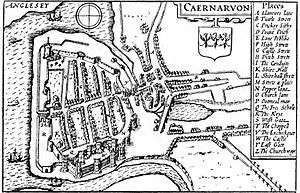
In the 9th to 14th centuries, many hundreds of new towns were built in Europe, and many others were enlarged with newly planned extensions. These new towns and town extensions have played a very important role in the shaping of Europe's geographical structures as they in modern times. New towns were founded in different parts of Europe from about the 9th century on, but most of them were realised from the 12th to 14th centuries, with a peak-period at the end of the 13th. All kinds of landlords, from the highest to the lowest rank, tried to found new towns on their estates, in order to gain economical, political or military power. The settlers of the new towns generally were attracted by fiscal, economic, and juridical advantages granted by the founding lord, or were forced to move from elsewhere from his estates. Most of the new towns were to remain rather small (as for instance the bastides of southwestern France), but some of them became important cities, such as Cardiff, Leeds, ‘s-Hertogenbosch, Montauban, Bilbao, Malmö, Lübeck, Munich, Berlin, Bern, Klagenfurt, Alessandria, Warsaw and Sarajevo.[17]
From the evidence of the preserved towns, it appears that the formal structure of many of these towns was willfully planned. The newly founded towns often show a marked regularity in their plan form, in the sense that the streets are often straight and laid out at right angles to one another, and that the house lots are rectangular, and originally largely of the same size.[18] One very clear and relatively extreme example is Elburg in the Netherlands, dating from the end of the 14th century. (see illustration) Looking at town plans such as the one of Elburg, it clearly appears that it is impossible to maintain that the straight street and the symmetrical, orthogonal town plan were new inventions from ‘the Renaissance,' and, therefore, typical of ‘modern times.'
The deep depression around the middle of the 14th century marked the end of the period of great urban expansion. Only in the parts of Europe where the process of urbanisation had started relatively late, as in eastern Europe, was it still to go on for one or two more centuries. It would not be until the Industrial Revolution that the same level of expansion of urban population would be reached again, although the number of newly created settlements would remain much lower than in the 12th and 13th centuries.
Renaissance Europe (1300-1600)
Florence was an early model of the new urban planning, which took on a star-shaped layout adapted from the new star fort, designed to resist cannon fire. This model was widely imitated, reflecting the enormous cultural power of Florence in this age; "[t]he Renaissance was hypnotised by one city type which for a century and a half – from Filarete to Scamozzi – was impressed upon utopian schemes: this is the star-shaped city".[19] Radial streets extend outward from a defined centre of military, communal or spiritual power.
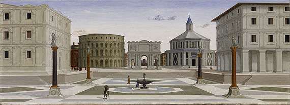
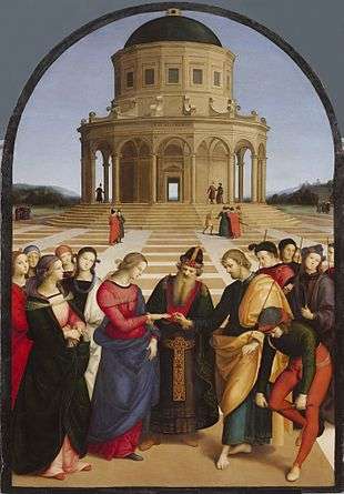
Only in ideal cities did a centrally planned structure stand at the heart, as in Raphael's Sposalizio (Illustration) of 1504. As built, the unique example of a rationally planned quattrocento new city centre, that of Vigevano (1493–95), resembles a closed space instead, surrounded by arcading.
Filarete's ideal city, building on Leon Battista Alberti's De re aedificatoria, was named "Sforzinda" in compliment to his patron; its twelve-pointed shape, circumscribable by a "perfect" Pythagorean figure, the circle, took no heed of its undulating terrain in Filarete's manuscript.[20] This process occurred in cities, but ordinarily not in the industrial suburbs characteristic of this era (see Braudel, The Structures of Everyday Life), which remained disorderly and characterised by crowding and organic growth.
Following the 1695 bombardment of Brussels by the French troops of King Louis XIV, in which a large part of the city centre was destroyed, Governor Max Emanuel proposed using the reconstruction to completely change the layout and architectural style of the city. His plan was to transform the medieval city into a city of the new Baroque style, modeled on Turin, with a logical street layout, with straight avenues offering long, uninterrupted views flanked by buildings of a uniform size. This plan was opposed by residents and municipal authorities, who wanted a rapid reconstruction, did not have the resources for grandiose proposals, and resented what they considered the imposition of a new, foreign, architectural style. In the actual reconstruction, the general layout of the city was conserved, but it was not identical to that before the cataclysm. Despite the necessity of rapid reconstruction and the lack of financial means, authorities did take several measures to improve traffic flow, sanitation, and the aesthetics of the city. Many streets were made as wide as possible to improve traffic flow.
Enlightenment Europe and America
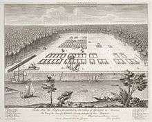
During this period, rulers often embarked on ambitious attempts at redesigning their capital cities as a showpiece for the grandeur of the nation. Disasters were often a major catalyst for planned reconstruction. An exception to this was in London after the Great Fire of 1666 when, despite many radical rebuilding schemes from architects such as John Evelyn and Christopher Wren, no large-scale redesigning was achieved due to the complexities of rival ownership claims. However, improvements were made in hygiene and fire safety with wider streets, stone construction and access to the river.
The Great Fire did, however, stimulate thinking about urban design that influenced city planning in North America. The Grand Model for the Province of Carolina, developed in the aftermath of the Great Fire, established a template for colonial planning. The famous Oglethorpe Plan for Savannah (1733) was in part influenced by the Grand Model.

In contrast, after the 1755 Lisbon earthquake, King Joseph I of Portugal and his ministers immediately launched efforts to rebuild the city. The architect Manuel da Maia boldly proposed razing entire sections of the city and "laying out new streets without restraint". This last option was chosen by the king and his minister.[21] Keen to have a new and perfectly ordered city, the king commissioned the construction of big squares, rectilinear, large avenues and widened streets – the new mottos of Lisbon. The Pombaline buildings were among the earliest seismically protected constructions in Europe.
An even more ambitious reconstruction was carried out in Paris. In 1852, Georges-Eugène Haussmann was commissioned to remodel the Medieval street plan of the city by demolishing swathes of the old quarters and laying out wide boulevards, extending outwards beyond the old city limits. Haussmann's project encompassed all aspects of urban planning, both in the centre of Paris and in the surrounding districts, with regulations imposed on building façades, public parks, sewers and water works, city facilities, and public monuments. Beyond aesthetic and sanitary considerations, the wide thoroughfares facilitated troop movement and policing.[22]
A concurrent plan to extend Barcelona was based on a scientific analysis of the city and its modern requirements. It was drawn up by the Catalan engineer Ildefons Cerdà to fill the space beyond the city walls after they were demolished from 1854. He is credited with inventing the term ‘urbanisation’ and his approach was codified in his General Theory of Urbanisation (1867). Cerdà's Eixample (Catalan for 'extension') consisted of 550 regular blocks with chamfered corners to facilitate the movement of trams, crossed by three wider avenues. His objectives were to improve the health of the inhabitants, towards which the blocks were built around central gardens and orientated NW-SE to maximise the sunlight they received, and assist social integration.[23]
Modern urban planning
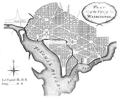
Planning and architecture went through a paradigm shift at the turn of the 20th century. The industrialised cities of the 19th century had grown at a tremendous rate, with the pace and style of building largely dictated by private business concerns. The evils of urban life for the working poor were becoming increasingly evident as a matter for public concern. The laissez-faire style of government management of the economy, in fashion for most of the Victorian era, was starting to give way to a New Liberalism that championed intervention on the part of the poor and disadvantaged. Around 1900, theorists began developing urban planning models to mitigate the consequences of the industrial age, by providing citizens, especially factory workers, with healthier environments.
Modern zoning, which enabled planners to legally demarcate sections of cities for different functions, originated in Prussia, and spread to Britain, the US, and Scandinavia.[24] Public health was cited as a rationale for keeping cities organized.[25]
Garden city movement

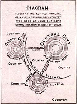
The first major urban planning theorist was Sir Ebenezer Howard, who initiated the garden city movement in 1898. This was inspired by earlier planned communities built by industrial philanthropists in the countryside, such as Cadburys' Bournville, Lever's Port Sunlight and George Pullman's eponymous Pullman in Chicago. All these settlements decentralised the working environment from the centre of the cities, and provided a healthy living space for the factory workers. Howard generalised this achievement into a planned movement for the country as a whole. He was also influenced by the work of economist Alfred Marshall who argued in 1884 that industry needed a supply of labour that could in theory be supplied anywhere, and that companies have an incentive to improve workers living standards as the company bears much of the cost inflicted by the unhealthy urban conditions in the big cities.[26]
Howard's ideas, although utopian, were also highly practical and were adopted around the world in the ensuing decades. His garden cities were intended to be planned, self-contained communities surrounded by parks, containing proportionate and separate areas of residences, industry, and agriculture. Inspired by the Utopian novel Looking Backward and Henry George's work Progress and Poverty, Howard published his book Garden Cities of To-morrow in 1898, commonly regarded as the most important book in the history of urban planning.[27] His idealised garden city would house 32,000 people on a site of 6,000 acres (2,428 ha), planned on a concentric pattern with open spaces, public parks and six radial boulevards, 120 ft (37 m) wide, extending from the centre. The garden city would be self-sufficient and when it reached full population, another garden city would be developed nearby. Howard envisaged a cluster of several garden cities as satellites of a central city of 50,000 people, linked by road and rail.[28]
He founded First Garden City, Ltd. in 1899 to create the first garden city at Letchworth, Hertfordshire.[29] Donors to the project collected interest on their investment if the garden city generated profits through rents or, as Fishman calls the process, ‘philanthropic land speculation’.[30] Howard tried to include working class cooperative organisations, which included over two million members, but could not win their financial support.[31] In 1904, Raymond Unwin, a noted architect and town planner, along with his partner Richard Barry Parker, won the competition run by the First Garden City, Limited to plan Letchworth, an area 34 miles outside London.[32] Unwin and Parker planned the town in the centre of the Letchworth estate with Howard's large agricultural greenbelt surrounding the town, and they shared Howard's notion that the working class deserved better and more affordable housing. However, the architects ignored Howard's symmetric design, instead replacing it with a more ‘organic’ design.[33]
Welwyn Garden City, also in Hertfordshire was also built on Howard's principles. His successor as chairman of the Garden City Association was Sir Frederic Osborn, who extended the movement to regional planning.[34]
The principles of the garden city were soon applied to the planning of city suburbs. The first such project was the Hampstead Garden Suburb founded by Henrietta Barnett[35] and planned by Parker and Unwin. The scheme's utopian ideals were that it should be open to all classes of people with free access to woods and gardens and that the housing should be of low density with wide, tree-lined roads.
In North America, the Garden City movement was also popular, and evolved into the "Neighbourhood Unit" form of development. In the early 1900s, as cars were introduced to city streets for the first time, residents became increasingly concerned with the number of pedestrians being injured by car traffic. The response, seen first in Radburn, New Jersey, was the Neighbourhood Unit-style development, which oriented houses toward a common public path instead of the street. The neighbourhood is distinctively organised around a school, with the intention of providing children a safe way to walk to school.[36][37]
Urban planning profession
Urban planning became professionalised at this period, with input from utopian visionaries as well as from the practical minded infrastructure engineers and local councillors combining to produce new design templates for political consideration. The Town and Country Planning Association was founded in 1899 and the first academic course on urban planning was offered by the University of Liverpool in 1909.[38]
The first official consideration of these new trends was embodied in the Housing and Town Planning Act of 1909 that compelled local authorities to introduce coherent systems of town planning across the country using the new principles of the 'garden city', and to ensure that all housing construction conformed to specific building standards.[39]
Following this Act, surveyors, civil engineers, architects, lawyers and others began working together within local government in the UK to draw up schemes for the development of land and the idea of town planning as a new and distinctive area of expertise began to be formed. In 1910, Thomas Adams was appointed as the first Town Planning Inspector at the Local Government Board, and began meeting with practitioners. The Town Planning Institute was established in 1914 with a mandate to advance the study of town-planning and civic design.[40] The first university course in America was established at Harvard University in 1924.
The Tudor Walters Committee that recommended the building of housing estates after World War One incorporated the ideas of Howard's disciple Raymond Unwin, who demonstrated that homes could be built rapidly and economically whilst maintaining satisfactory standards for gardens, family privacy and internal spaces. Unwin diverged from Howard by proposing that the new developments should be peripheral 'satellites' rather than fully-fledged garden cities.[41]
Modernism

.jpg)
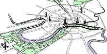
In the 1920s, the ideas of modernism began to surface in urban planning. The influential modernist architect Le Corbusier presented his scheme for a "Contemporary City" for three million inhabitants (Ville Contemporaine) in 1922. The centrepiece of this plan was the group of sixty-story cruciform skyscrapers, steel-framed office buildings encased in huge curtain walls of glass. These skyscrapers were set within large, rectangular, park-like green spaces. At the centre was a huge transportation hub that on different levels included depots for buses and trains, as well as highway intersections, and at the top, an airport. Le Corbusier had the fanciful notion that commercial airliners would land between the huge skyscrapers. He segregated pedestrian circulation paths from the roadways and glorified the automobile as a means of transportation. As one moved out from the central skyscrapers, smaller low-story, zig-zag apartment blocks (set far back from the street amid green space) housed the inhabitants. Le Corbusier hoped that politically minded industrialists in France would lead the way with their efficient Taylorist and Fordist strategies adopted from American industrial models to re-organise society.[42]
In 1925, he exhibited his Plan Voisin, in which he proposed to bulldoze most of central Paris north of the Seine and replace it with his sixty-story cruciform towers from the Contemporary City, placed within an orthogonal street grid and park-like green space. In the 1930s, Le Corbusier expanded and reformulated his ideas on urbanism, eventually publishing them in La Ville radieuse (The Radiant City) in 1935. Perhaps the most significant difference between the Contemporary City and the Radiant City is that the latter abandoned the class-based stratification of the former; housing was now assigned according to family size, not economic position.[43] Le Corbusier's theories were sporadically adopted by the builders of public housing in Europe and the United States.
Many of his disciples became notable in their own right, including painter-architect Nadir Afonso, who absorbed Le Corbusier's ideas into his own aesthetics theory. Lúcio Costa's city plan of Brasília and the industrial city of Zlín planned by František Lydie Gahura in the Czech Republic are notable plans based on his ideas, while the architect himself produced the plan for Chandigarh in India. Le Corbusier's thinking also had been profoundly effected by the philosophy of Futurism and Constructivism in Russia at the turn of the 20th century.
Another important theorist was Sir Patrick Geddes who understood the importance of taking the regional environment into account and the relationship between social issues and town planning, and foresaw the emergence of huge urban conurbations. In 1927, he was commissioned to plan the city of Tel Aviv, then in Mandatory Palestine. It consisted of about 40 blocks, sized around 150 metres squared. The block contained an inner small public garden, disposed into a windmill configuration of inner access roads, making it awkward for car traffic. The big blocks form a gently undulating street pattern, north–south commercial, east–west arranged to catch the sea breeze. This was a simple and efficient manner to modernise the historical fixed grid patterns. A series of shaded boulevards short cuts the system, with some public squares, accessing the sea front. The plan of the new town became a success.
Urban planning in communist countries has often modeled itself on Western modernism, using the authority of the state to implement efficient urban designs produced in administrative centers. (In Russia this process was nominally decentralized after the end of the USSR, but Moscow remains the source of much of the country's urban planning expertise.)[44] Germany under national socialism also undertook grandiose schemes for urban redesign.[45]
New Towns
Ebenezer Howard's urban planning concepts were only adopted on a large scale after World War II. The damage brought on by the war provoked significant public interest in what post-war Britain would be like, which was encouraged by the government, who facilitated talk about a ‘Better Britain’ to boost morale. Post-war rebuilding initiatives saw new plans drafted for London, which, for the first time, addressed the issue of de-centralisation. Firstly, the County of London Plan 1943 recognised that displacement of population and employment was necessary if the city was to be rebuilt at a desirable density. Moreover, the Greater London Plan of 1944 went further by suggesting that over one million people would need to be displaced into a mixture of satellite suburbs, existing rural towns, and new towns.[46]
The New Towns Act 1946 resulted in many New Towns being constructed in Britain over the following decades.[47][48]
New towns were built in the United States from the 1960s – examples include Reston, Virginia; Columbia, Maryland; Jonathan, Minnesota and Riverside Plaza. This construction effort was combined with extensive federal government grants for slum clearance, improved and increased housing and road construction and comprehensive urban renewal projects. Other European countries such as France, Germany, Italy and Sweden also had some successes with new towns, especially as part of post-war reconstruction efforts.
Contemporary
Urban planning has grown in prominence with rising urbanization.[49]
Reaction against modernism
By the late 1960s and early 1970s, many planners felt that modernism's clean lines and lack of human scale sapped vitality from the community, blaming them for high crime rates and social problems.[50]
Modernist planning fell into decline in the 1970s when the construction of cheap, uniform tower blocks ended in most countries, such as Britain and France. Since then many have been demolished and replaced by other housing types. Rather than attempting to eliminate all disorder, planning now concentrates on individualism and diversity in society and the economy; this is the post-modernist era.[50]
Minimally planned cities still exist. Houston is a large city (with a metropolitan population of 5.5 million) in a developed country without a comprehensive zoning ordinance. Houston does, however, restrict development densities and mandate parking, even though specific land uses are not regulated. Also, private-sector developers in Houston use subdivision covenants and deed restrictions to effect land-use restrictions resembling zoning laws. Houston voters have rejected comprehensive zoning ordinances three times since 1948.
Behaviorism
Behaviorist psychology influenced urban planning especially in the 1960s and after, manifesting in such theories as defensible space and crime prevention through environmental design.[51]
New Urbanism
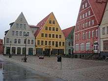
Various current movements in urban design seek to create sustainable urban environments with long-lasting structures, buildings and a great liveability for its inhabitants. The most clearly defined form of walkable urbanism is known as the Charter of New Urbanism. It is an approach for successfully reducing environmental impacts by altering the built environment to create and preserve smart cities that support sustainable transport. Residents in compact urban neighbourhoods drive fewer miles and have significantly lower environmental impacts across a range of measures compared with those living in sprawling suburbs.[52] The concept of Circular flow land use management has also been introduced in Europe to promote sustainable land use patterns that strive for compact cities and a reduction of greenfield land taken by urban sprawl.
In sustainable construction, the recent movement of New Classical Architecture promotes a sustainable approach towards urban construction that appreciates and develops smart growth, walkability, architectural tradition, and classical design.[53][54] This is in contrast to modernist and short-lived globally uniform architecture, as well as opposing solitary housing estates and suburban sprawl.[55] Both trends started in the 1980s.[56]
Critics of New Urbanism have argued that its environmental aspect is too focused on transport and excessive individual mobility. The real problem with the unsustainable nature of modern cities is not just about cars and too much driving - it is about the entire urban metabolism of the city (of which auto-mobility is less than half of the overall ecological footprint and accounts for about half of the GHG emissions/carbon footprint). They have also argued that land-use planning can do little to achieve sustainability without regulating the design and associated technology of the actual development within a zoned area. Distances and density are relatively unimportant; it is the total metabolism of the development that determines the environmental impact. Also, the emphasis needs to shift from sustainability to resilience, and the spatial scope from the city to the whole urban region.[57] A further criticism is that the New Urbanist project of compacting urban form is a difficult and slow process. In the new global situation, with the horizontal, low-density growth irreversibly dominant, and climate change already happening, it would be wiser to focus efforts on the resilience of whole city-regions, retrofitting the existing sprawl for sustainability and self-sufficiency, and investing heavily in 'green infrastructure'.[58]
Sustainable development and sustainability
Sustainable development has emerged in recent decades as guiding themes for urban planning. This term was defined and advocated in 1987 report Our Common Future, published by the World Commission on Environment and Development.[59]
Some planners argue that modern lifestyles use too many natural resources, polluting or destroying ecosystems, increasing social inequality, creating urban heat islands, and causing climate change. Many urban planners, therefore, advocate sustainable cities.[56][60]
However, sustainable development is a recent, controversial concept.[60] Wheeler, in his 2004 book, defines sustainable urban development as "development that improves the long-term social and ecological health of cities and towns." He sketches a 'sustainable' city's features: compact, efficient land use; less automobile use, yet better access; efficient resource use; less pollution and waste; the restoration of natural systems; good housing and living environments; a healthy social ecology; a sustainable economy; community participation and involvement; and preservation of local culture and wisdom.[60] Urban planners are now promoting a sustainable city model, which consists of cities that are designed with consideration of environmental impacts, such as minimising the uses of energy, water, and the outputs of waste and pollution.[56]
Because of political and governance structures in most jurisdictions, sustainable planning measures must be widely supported before they can affect institutions and regions. Actual implementation is often a complex compromise.[61]
Nature in cities Often an integral party of sustainable cities is the Incorporation of nature within a city.
Car free sustainability in city planning can include large pedestrian zones or be a totally Car free.
Collaborative planning in the United States
Collaborative planning arose in the US in response to the inadequacy of traditional public participation techniques to provide real opportunities for the public to make decisions affecting their communities. Collaborative planning is a method designed to empower stakeholders by elevating them to the level of decision-makers through direct engagement and dialogue between stakeholders and public agencies, to solicit ideas, active involvement, and participation in the community planning process. Active public involvement can help planners achieve better outcomes by making them aware of the public's needs and preferences and by using local knowledge to inform projects. When properly administered, collaboration can result in more meaningful participation and better, more creative outcomes to persistent problems than traditional participation methods. It enables planners to make decisions that reflect community needs and values, it fosters faith in the wisdom and utility of the resulting project, and the community is given a personal stake in its success.[62]
Experiences in Portland and Seattle have demonstrated that successful collaborative planning depends on a number of interrelated factors: the process must be truly inclusive, with all stakeholders and affected groups invited to the table; the community must have final decision-making authority; full government commitment (of both financial and intellectual resources) must be manifest; participants should be given clear objectives by planning staff, who facilitate the process by providing guidance, consultancy, expert opinions, and research; and facilitators should be trained in conflict resolution and community organisation.[63][64]
See also
References
Citations
- Dalley 1989, p.120.
- Davreu, Robert (1978). "Cities of Mystery: The Lost Empire of the Indus Valley". The World’s Last Mysteries. (second edition). Sydney: Readers’ Digest. pp. 121-129. ISBN 978-0-909486-61-7.
- Kipfer, Barbara Ann (2000). Encyclopedic Dictionary of Archaeology. (Illustrated edition). New York: Springer. p. 229. ISBN 978-0-3064-6158-3.
- Eran Ben-Joseph, "Codes and Standards"; in Weber & Crane (2012), p. 357: "Other excavations, such as those in the Indus Valley, at Mohenjo-Daro and at Harappa in Punjam, show that the valley had cities planned and built in rectangular blocks lined with two-story houses along broad, straight streets. Such evidence of the pervasive use of orthogonal arrangements tells of an enduring continuity of farm, village, and city. The farmer's custom of long narrow fields and right-angled boundaries carried easily to streets and squares. However, the innovative geometry of towns and cities was influenced more by the mechanics of supplying water and draining sewage than in the imposition of right-angled street corners."
- Smith, Michael E. (May 2005). "City Size in Late Post-Classic Mesoamerica" (PDF). Journal of Urban History. Beverley Hills, CA: SAGE Publications. 31 (4): 403–434. doi:10.1177/0096144204274396. OCLC 1798556. Retrieved 1 February 2008.
- Aristotle, Politica II
- Urban planning in ancient Egypt
- Kolb, Frank (1984). Die Stadt im Altertum. München: Verlag C.H. Beck. pp. 51-141: Morris, A.E.J. (1972). History of Urban Form. Prehistory to the Renaissance. London. pp. 22-23.
- Hippodamus is also reported to have played an important role in the (re-)planning of the city of Piraeus, and he is also associated to Thurii and Rhodes. It seems that the importance of Hippodamus’ ideas was not so much in the orthogonal plan, but rather in the distribution of functions and social classes across the city. (Kolb 1984, pp. 115-120; Cahill, Nicholas (2002). Household and City Organization at Olynthus. New Haven. par. 1.2)
- Morris 1972, pp. 39-41, 51-60; Kolb 1984, pp. 169-238; Benevolo, Leonardo (1993). Die Geschichte der Stadt. Frankfurt am Main/New York. pp. 256-267.
- Harris, W. (1989). "Invisible Cities: the Beginning of Etruscan Urbanization". Atti del Secondo Congresso Internazionale Etrusco. Roma, 1989. pp. 375-392. p. 85. The Etruscans were, in their turn, probably also influenced in this respect by Greek and Hellenic culture.
- Jerke, Porter & Lassar (2008), pp. 8–9: "In his [Mark Salette of Gehry Partners] view, the core qualities of good design—loosely based on principles laid down by Vitruvius in the first century B.C. and countless reconceptualizations since—generally are functionality and durability, contextual compatibility, and enduring respect and value."
- Vitrivius (1914). The Ten Books on Architecture, Bk I. Morris H. Morgan (translator). Harvard University Press.
- Demandt, Alexander (1998) ‘’Die Kelten’’. München: Verlag Ch. Beck. In fact, many sites where the Romans created towns, such as Paris, Vienna and Bratislava, had previously been Celtic settlements of more or less urban character.
- Bartlett, Robert (1993) ‘’The Making of Europe. Conquest, Colonization and Cultural Change 950-1350’’. London/New York. pp. 5-60, 106-197; Gutkind, A.E. (1964) ‘’International History of City Development. Vol.I: Urban Development in Central-Europe’’. New York / London. pp. 13-20, 63.
- Siegfried Giedion, Space, Time and Architecture (1941) 1962, in reference to an air view (fig.8) of the medieval Italian town of Bagnocavallo. Giedion's source was Luigi Piccinati, "Urbanistica Medioevale" in Urbanistica deal Antichità ad Oggi (Florence 1943).
- Boerefijn, Wim (2010) ‘’The foundation, planning and building of new towns in the 13th and 14th centuries in Europe. An architectural-historical research into urban form and its creation’’. Phd. thesis Universiteit van Amsterdam. ISBN 978-90-9025157-8 ().
- Beresford, Maurice (1967) ‘’New Towns of the Middle Ages. Town Plantation in England, Wales and Gascony’’. London ; Gutkind, E.A. (1972) ‘’International History of City Development. Vol.VII: Urban Development in East-Central Europe: Poland, Czechoslovakia and Hungary’’. New York/Londen ; Lavedan, Pierre & Jeanne Hugueney (1974) ‘’L'Urbanisme au Moyen Age’’. Geneva/Paris ; Friedman, David (1988) ‘’Florentine New Towns. Urban Design in the late Middle Ages’’. New York/Cambridge (Mass.)/London ; Lauret, Alain, Raymond Malebranche & Gilles Séraphin (1988) ‘’Bastides, villes nouvelles du moyen-age’’. Toulouse ; Guidoni, Enrico (1992) ‘’Storia dell’urbanistica. Il Duecento’’. Roma/Bari.
- Siegfried Giedion, Space, Time and Architecture (1941) 1962 p 43.
- The undulating terrace of housing makes its appearance surprisingly late: Giedion's example is Lansdown Crescent, Bath, 1794; Giedion 1962, fig. 83.
- Shrady, The Last Day pp. 152–155.
- Girouard, Mark, Cities and People, 1985, London, p. 285.
- Busquets, Joan Barcelona, the urban evolution of a compact city, 2005, ISBN 978-88-8447-204-5, Harvard University, p. 122.
- Eran Ben-Joseph, "Codes and Standards"; in Weber & Crane (2012), p. 359: "In their search for a scientific model for the American city, these newly formed experts looked overseas. According to Frederick Law Olmsted, Jr. (1870–1957), the president of the National Planning Conference and the first president of the American City Planning Institute (1917), the model was found in Prussia (Germany). After the Franco-Prussian war (1870–1871), many Prussian cities experienced uncontrolled buildup of inner-city factories and housing, followed by dangerous health hazards and pollution. Citizens protested the deteriorating environmental conditions. Thereupon, Prussian city officials responded with a zone system that assigned particular land uses to designated locations."
- Jason Corburn, "Reconnecting Urban Planning and Public Health"; in Weber & Crane (2012), p. 398: "Consistent with the emerging aesthetic and technocratic ideals of planning, tools to classify and segment city functions took hold and land-use zoning emerged as one such powerful tool. Local zoning ordinances were often couched as both protecting public health and benefiting private landowners. For example, in the landmark 1926 Supreme Court case Village of Euclid, Ohio, et al. v. Ambler Reality Company, zoning was characterized as promoting health: 'the exclusion of buildings devoted to business, trade, etc., from residential districts, bears a rational relation to the health and safety of the community...by excluding from residential areas the confusion and danger of fire, contagion and disorder, which in greater or less degree attach to the location of stores, shops, and factories' (272 U.S. 365, 392). Yet, there was little to no epidemiologic evidence at the time suggesting that health improvements would come about by physically separating land uses, and some have suggested that zoning tended to concentrate health hazards and perpetuate disadvantages in poor urban communities (Maantay 2001)".
- Peter Hall, Mark Tewdwr-Jones (2010). Urban and Regional Planning. Routledge. ISBN 978-0-203-86142-4.
- "To-morrow: A Peaceful Path to Real Reform".
- Goodall, B (1987), Dictionary of Human Geography, London: Penguin
- Hardy 1999, p. 4.
- Fainstein & Campbell 2003, p. 43.
- Fainstein & Campbell 2003, p. 46.
- Hall 2002, p. 68.
- Fainstein & Campbell 2003, p. 48.
- History 1899–1999 (PDF), TCPA, archived from the original (PDF) on 27 July 2011
- Gayler, Hih J. (1996). Geographical excursions in London. University Press of America. p. 176. ISBN 978-0-7618-0328-7. Retrieved 24 August 2011.
- Carol Ann Christensen, The American garden city and the new towns movement (1986).
- Daniel Schaffer, Garden Cities for America: The Radburn Experience (Temple University Press, 1982)
- "urban planning".
- "The birth of town planning".
- RTPI.org.uk, About the RTPI. Retrieved 17 January 2013
- Hall, Peter (2002). Cities of Tomorrow. Oxford: Blackwell. p. 74. ISBN 978-0-631-23252-0.
- Evenson, Norma. Le Corbusier: The Machine and the Grand Design. George Braziller, Pub: New York, 1969 (p.7).
- Robert Fishman, Urban Utopias in the Twentieth Century: Ebenezer Howard, Frank Lloyd Wright, and Le Corbusier (Cambridge, MA: MIT Press, 1982), 231.
- John Friedman, "Varieties of Planning Experience: Toward a Globalized Planning Culture?"; in Weber & Crane (2012).
- Cuthbert (2006), p. 56: "Rationalist architecture and urbanism reached its zenith in its coincidence with functionalist social science and the eugenic strategies of fascism, particularly with Hitler and his architect Albert Speer, and with Mussolini (Marcello Piacentini, Giuseppi Terragni)."
- Osborn, J and Whittick, A. 1977. ‘New Towns: Their Origins, Achievements, and Progress’. Third Ed. Leonard Hill, London. First Pub 1963.pp 55
- Osborn, J and Whittick, A. 1977. ‘New Towns: Their Origins, Achievements, and Progress’. Third Ed. Leonard Hill, London. First Pub 1963.pp56.
- Hall, P and Ward, C. 1998. ‘Sociable Cities: the Legacy of Ebenezer Howard’. John Wiley and Sons, Chichester pp. 41-69.
- Rachel Weber & Randall Crane, "Planning as Scholarship: Origins and Prospects"; in Weber & Crane (2012).
- Smith Morris et al. British Town Planning and Urban Design, 1997, ISBN 978-0-582-23496-3, Longman, Singapore.
- Cuthbert (2006), pp. 102–104.
- Ewing, R "Growing Cooler - the Evidence on Urban Development and Climate Change" Archived 24 December 2010 at the Wayback Machine. Retrieved on: 2009-03-16.
- "Charter of the New Urbanism". Cnu.org. Retrieved 11 August 2014.
- "Beauty, Humanism, Continuity between Past and Future". Traditional Architecture Group. Archived from the original on 5 March 2018. Retrieved 23 March 2014.
- Issue Brief: Smart-Growth: Building Livable Communities. American Institute of Architects. Retrieved on 2014-03-23.
- Fainstein, Susan S (2000). New Directions in Planning Theory.
- Bogunovich, D "From planning sustainable cities to designing resilient urban regions ". Retrieved on: 2014-12-06.
- Bogunovich, D "Urban Sustainability 2.0: Resilient regions, sustainable sprawl and green infrastructure". Retrieved on: 2014-12-06.
- Jerke, Porter & Lassar (2008), p. 11: "Recognition that the economic and social future of the planet would require maintaining the integrity of natural systems led, in the 1980s, to international efforts to promote economic development that respects the functions of national systems while advancing social equity. The Brundtland Commission, a United Nations entity, formulated a mission statement for sustainable development in its 1987 report that expresses the guiding spirit of sustainability: 'development that integrates environmental, economic, and social concerns and can meet the needs of the present without compromising the ability of future generations to meet their own needs.' This mission statement has launched a multitude of activities and interests focused on overcoming issues such as international trade barriers, widespread poverty, overpopulation, and climate change."
- Wheeler, Stephen (2004). Planning Sustainable and Livable Cities. New York: Routledge. ISBN 978-0-415-27173-8.
- Oregon Ballot Measures 37 (2004) and 49 (2007)
- Innes, Judith; Booher, David (2000). "Public Participation in Planning: New Strategies for the 21st Century". Working Paper 2000-2007. University of California, Berkeley: Institute of Urban and Regional Development.
- Shandas, Vivek; Messer, W. Barry (2008). "Fostering Green Communities Through Civic Engagement, Community-Based Environmental Stewardship in the Portland Area". JAPA. 74 (4): 408–418. doi:10.1080/01944360802291265.
- Sirianni, Carmen (2007). "Neighborhood Planning as Collaborative Democratic Design, The Case of Seattle". JAPA. 73 (4): 373–387. doi:10.1080/01944360708978519.
Bibliography
- Allmendinger, Phil and Michael Gunder, 2005, "Applying Lacanian Insight and a Dash of Derridean Deconstruction to Planning's 'Dark Side'," Planning Theory, vol. 4, pp. 87–112.
- Atmospheric Environment Volume 35, Issue 10, April 2001, Pages 1717–1727. "Traffic pollution in a downtown site of Buenos Aires City"
- Garvin, Alexander (2002). The American City: What Works and What Doesn't. New York: McGraw Hill. ISBN 978-0-07-137367-8. (A standard text for many college and graduate courses in city planning in America)
- Cuthbert, Alexander R. (2006). The Form of Cities: Political Economy and Urban Design. Malden, MA: Blackwell Publishing. ISBN 978-1-4051-1639-8
- Dalley, Stephanie, 1989, Myths from Mesopotamia: Creation, the Flood, Gilgamesh, and Others, Oxford World's Classics, London, pp. 39–136
- Gunder, Michael, 2003, "Passionate Planning for the Others' Desire: An Agonistic Response to the Dark Side of Planning," Progress in Planning, Vol. 60, no. 3, October, pp. 235–319.
- Hoch, Charles, Linda C. Dalton and Frank S. So, editors (2000). The Practice of Local Government Planning, Intl City County Management Assn; 3rd edition. ISBN 978-0-87326-171-5 (The "Green Book")
- James, Paul; Holden, Meg; Lewin, Mary; Neilson, Lyndsay; Oakley, Christine; Truter, Art; Wilmoth, David (2013). "Managing Metropolises by Negotiating Mega-Urban Growth". In Harald Mieg and Klaus Töpfer (ed.). Institutional and Social Innovation for Sustainable Urban Development. Routledge.
- Jerke, Dennis; Douglas R. Porter; and Terry J. Lassar (2008). Urban Design and the Bottom Line: Optimizing the Return on Perception. Washington, DC: Urban Land Institute. ISBN 978-0-87420-996-9.
- Kemp, Roger L. and Carl J. Stephani (2011). "Cities Going Green: A Handbook of Best Practices." McFarland and Co., Inc., Jefferson, NC, USA, and London, England, UK. ISBN 978-0-7864-5968-1.
- Oke, T. R. (1982). "The energetic basis of the urban heat island". Quarterly Journal of the Royal Meteorological Society 108: 1–24.
- Pløger, John, 2001, "Public Participation and the Art of Governance," Environment and Planning B: Planning and Design, vol. 28, no. 2, pp. 219–241.
- Roy, Ananya, 2008, "Post-Liberalism: On the Ethico-Politics of Planning," Planning Theory, vol. 7, no. 1, pp. 92–102.
- Santamouris, Matheos (2006). Environmental Design of Urban Buildings: An Integrated Approach.
- Shrady, Nicholas, The Last Day: Wrath, Ruin & Reason in The Great Lisbon Earthquake of 1755, Penguin, 2008, ISBN 978-0-14-311460-4
- Tang, Wing-Shing, 2000, "Chinese Urban Planning at Fifty: An Assessment of the Planning Theory Literature," Journal of Planning Literature, vol. 14, no. 3, pp. 347–366.
- Tunnard, Christopher and Boris Pushkarev (1963). Man-Made America: Chaos or Control?: An Inquiry into Selected Problems of Design in the Urbanized Landscape, New Haven: Yale University Press. (This book won the National Book Award, strictly America; a time capsule of photography and design approach.)
- Weber, Rachel, and Randall Crane (2012). The Oxford Handbook of Urban Planning. Oxford University Press. ISBN 978-0-19-537499-5
- Wheeler, Stephen (2004). "Planning Sustainable and Livable Cities", Routledge; 3rd edition.
- Yiftachel, Oren, 1995, "The Dark Side of Modernism: Planning as Control of an Ethnic Minority," in Sophie Watson and Katherine Gibson, eds., Postmodern Cities and Spaces (Oxford and Cambridge, MA: Blackwell), pp. 216–240.
- Yiftachel, Oren, 1998, "Planning and Social Control: Exploring the Dark Side," Journal of Planning Literature, vol. 12, no. 4, May, pp. 395–406.
- Yiftachel, Oren, 2006, "Re-engaging Planning Theory? Towards South-Eastern Perspectives," Planning Theory, vol. 5, no. 3, pp. 211–222.
Further reading
- Urban Planning, 1794-1918: An International Anthology of Articles, Conference Papers, and Reports, Selected, Edited, and Provided with Headnotes by John W. Reps, Professor Emeritus, Cornell University.
- City Planning According to Artistic Principles, Camillo Sitte, 1889
- Missing Middle Housing: Responding to the Demand for Walkable Urban Living by Daniel Parolek of Opticos Design, Inc., 2012
- Kemp, Roger L. and Carl J. Stephani (2011). "Cities Going Green: A Handbook of Best Practices." McFarland and Co., Inc., Jefferson, NC, USA, and London, England, UK. (ISBN 978-0-7864-5968-1).
- Tomorrow: A Peaceful Path to Real Reform, Ebenezer Howard, 1898
- The Improvement of Towns and Cities, Charles Mulford Robinson, 1901
- Town Planning in practice, Raymond Unwin, 1909
- The Principles of Scientific Management, Frederick Winslow Taylor, 1911
- Cities in Evolution, Patrick Geddes, 1915
- The Image of the City, Kevin Lynch, 1960
- The Concise Townscape, Gordon Cullen, 1961
- The Death and Life of Great American Cities, Jane Jacobs, 1961
- The City in History, Lewis Mumford, 1961
- The City is the Frontier, Charles Abrams, Harper & Row Publishing, New York, 1965.
- A Pattern Language, Christopher Alexander, Sara Ishikawa and Murray Silverstein, 1977
- What Do Planners Do?: Power, Politics, and Persuasion, Charles Hoch, American Planning Association, 1994. ISBN 978-0-918286-91-8
- Planning the Twentieth-Century American City, Christopher Silver and Mary Corbin Sies (Eds.), Johns Hopkins University Press, 1996
- "The City Shaped: Urban Patterns and Meanings Through History", Spiro Kostof, 2nd Edition, Thames and Hudson Ltd, 1999 ISBN 978-0-500-28099-7
- The American City: A Social and Cultural History, Daniel J. Monti, Jr., Oxford, England and Malden, Massachusetts: Blackwell Publishers, 1999. 391 pp. ISBN 978-1-55786-918-0.
- Urban Development: The Logic Of Making Plans, Lewis D. Hopkins, Island Press, 2001. ISBN 978-1-55963-853-1
- Readings in Planning Theory, Susan Fainstein and Scott Campbell, Oxford, England and Malden, Massachusetts: Blackwell Publishers, 2003.
- Taylor, Nigel, (2007), Urban Planning Theory since 1945, London, Sage.
- Planning for the Unplanned: Recovering from Crises in Megacities, by Aseem Inam (published by Routledge USA, 2005). ISBN 978-0-415-95130-2
External links
| Wikimedia Commons has media related to Urban planning. |
- Urban and Regional Planning at Curlie
- International Planning History Society
- Reps, John W. (27 November 2002). "Urban Planning, 1794-1918: An International Anthology of Articles, Conference Papers, and Reports". Research Guides.
.jpg)
