Hickory Island, Indiana
Hickory Island is an unincorporated community in Vigo and Clay counties, in the U.S. state of Indiana.[2]
Hickory Island, Indiana | |
|---|---|
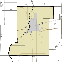 Hickory Island Hickory Island, as seen in a map of Vigo County | |
| Coordinates: 39°19′46″N 87°14′22″W | |
| Country | United States |
| State | Indiana |
| County | Vigo, Clay |
| Township | Pierson, Perry |
| Elevation | 548 ft (167 m) |
| Time zone | UTC-5 (Eastern (EST)) |
| • Summer (DST) | UTC-4 (EDT) |
| ZIP code | 47802 |
| Area code(s) | 812, 930 |
| GNIS feature ID | 436107 |
It is part of the Terre Haute metropolitan area.
Geography
Hickory Island is located at 39°19′46″N 87°14′22″W at an elevation of 548 feet.
gollark: 32 bytes at once are bubblesorted, and then a 16-way merge of the chunks is done.
gollark: SIMD is excellent for performance. I have a highly good SIMD bubblesort/mergesort implementation.
gollark: True.
gollark: The good mining things are fancy and GPU-accelerated, so it probably isn't worth writing your own code for this unless you can GPUs.
gollark: It's a hex string.
References
- "US Board on Geographic Names". United States Geological Survey. October 25, 2007. Retrieved 2016-07-14.
- "Hickory Island, Indiana". Geographic Names Information System. United States Geological Survey. Retrieved 2010-06-24.
Municipalities and communities of Clay County, Indiana, United States | ||
|---|---|---|
| City | Map of Indiana highlighting Clay County | |
| Towns | ||
| Townships | ||
| CDP | ||
| Other unincorporated communities |
| |
| Ghost towns | ||
| Footnotes | ‡This populated place also has portions in an adjacent county or counties | |
Municipalities and communities of Vigo County, Indiana, United States | ||
|---|---|---|
| City | Map of Indiana highlighting Vigo County | |
| Towns | ||
| Townships | ||
| CDPs | ||
| Other unincorporated communities |
| |
| Footnotes | ‡This populated place also has portions in an adjacent county or counties | |
This article is issued from Wikipedia. The text is licensed under Creative Commons - Attribution - Sharealike. Additional terms may apply for the media files.