Asherville, Indiana
Asherville is an unincorporated community in Jackson Township, Clay County, Indiana. It is part of the Terre Haute Metropolitan Statistical Area.
Asherville | |
|---|---|
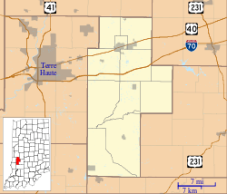 Asherville Location in Clay County | |
| Coordinates: 39°28′29″N 87°03′44″W | |
| Country | United States |
| State | Indiana |
| County | Clay |
| Township | Jackson |
| Elevation | 659 ft (201 m) |
| ZIP code | 47834 |
| FIPS code | 18-02368[1] |
| GNIS feature ID | 447632[2] |
History
John Asher laid out Asherville in 1873.[3] And at the same time, a post office was built and remained in operation until it was discontinued in 1912.[4]
Geography
Asherville is located at 39°28′29″N 87°03′44″W.
gollark: No, it just manages the folder structure for you in a specific way.
gollark: I use Calibre, but it is very opinionated about how you organize your library.
gollark: I think people underestimate how complex biology is a lot.
gollark: This whole coronavirus thing has made me worry that my slightly sore throat is a sign of some horrible disease. Which it probably isn't, but still.
gollark: Well, iPhones are basically customizability-free, so definitely not #1.
References
- "U.S. Census website". United States Census Bureau. Retrieved 2008-01-31.
- "Asherville, Indiana". Geographic Names Information System. United States Geological Survey. Retrieved 2009-10-10.
- Blanchard, Charles (1884). Counties of Clay and Owen, Indiana: Historical and Biographical. F.A. Battey & Company. pp. 298.
- "Clay County". Jim Forte Postal History. Retrieved 30 August 2014.
Municipalities and communities of Clay County, Indiana, United States | ||
|---|---|---|
| City | Map of Indiana highlighting Clay County | |
| Towns | ||
| Townships | ||
| CDP | ||
| Other unincorporated communities |
| |
| Ghost towns | ||
| Footnotes | ‡This populated place also has portions in an adjacent county or counties | |
This article is issued from Wikipedia. The text is licensed under Creative Commons - Attribution - Sharealike. Additional terms may apply for the media files.