Twelve Points, Indiana
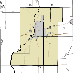
Twelve Points is an unincorporated community in southern Harrison Township, Vigo County, in the U.S. state of Indiana.[2]
Twelve Points, Indiana | |
|---|---|
 Vigo County's location in Indiana | |
 Twelve Points location in Vigo County, Indiana | |
| Coordinates: 39°29′32″N 87°23′52″W | |
| Country | United States |
| State | Indiana |
| County | Vigo |
| Township | Harrison |
| Elevation | 489 ft (149 m) |
| Time zone | UTC-5 (Eastern (EST)) |
| • Summer (DST) | UTC-4 (EDT) |
| ZIP code | 47804 |
| Area code(s) | 812, 930 |
| GNIS feature ID | 445001 |
Now within the city boundaries of Terre Haute, it is part of the Terre Haute metropolitan area.
History
A post office was established at Twelve Points in 1916, and remained in operation until it was discontinued in 1979.[3]
Geography
Twelve Points is located at 39°29′32″N 87°23′52″W at an elevation of 489 feet.
gollark: The Network pane tells me that it accesses `https://tio.run/cgi-bin/static/b666d85ff48692ae95f24a66f7612256-run/80b0beb0eead937c782d5036d9ec46ca`, but that doesn't explain why it does any of this madness.
gollark: Well, obviously that bit then calls into and uses values from other code.
gollark: But WHY?
gollark: That was also unhelpful.
gollark: It was near the top.
References
- "US Board on Geographic Names". United States Geological Survey. October 25, 2007. Retrieved 2016-07-14.
- "Twelve Points, Indiana". Geographic Names Information System. United States Geological Survey. Retrieved August 7, 2017.
- "Vigo County". Jim Forte Postal History. Retrieved July 14, 2016.
This article is issued from Wikipedia. The text is licensed under Creative Commons - Attribution - Sharealike. Additional terms may apply for the media files.