Taylorville, Indiana
Taylorville, also known as Taylorsville or Dresser, is an unincorporated community in eastern Sugar Creek Township, Vigo County, in the U.S. state of Indiana.[2] It is part of the Terre Haute metropolitan area. Though the United States Board on Geographic Names has officially designated the area as Taylorville, the 2010 United States Census considered the area a census designated place called Dresser.[3]
Taylorville, Indiana | |
|---|---|
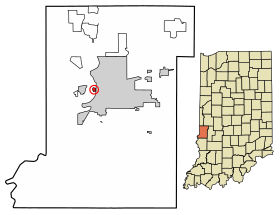 Location of Taylorville in Vigo County, Indiana. | |
| Coordinates: 39°27′45″N 87°25′25″W | |
| Country | United States |
| State | Indiana |
| County | Vigo |
| Township | Sugar Creek |
| Elevation | 469 ft (143 m) |
| Time zone | UTC-5 (Eastern (EST)) |
| • Summer (DST) | UTC-4 (EDT) |
| ZIP code | 47885 |
| Area code(s) | 812, 930 |
| FIPS code | 18-18658 |
| GNIS feature ID | 444608 |
History
Taylorville was founded in 1908, and was named after a local farmer named Taylor.[4] A post office was established under the name Dresser in 1932, and remained in operation until it was discontinued in 1935.[5] Residents use the names Taylorville and Dresser interchangeably.[6]
Taylorville has historically had a reputation of being extremely poor and insular. A 1930s history of the village described it as “a breeding ground for all that was repugnant to American standards.”[7] Residents of Taylorville have recalled being bullied as children for being from the village. Residents do acknowledge that the village is extremely close-knit but also say they are simply independent and keep to themselves.[6][7]
Taylorville has declined in population in recent decades. The village is located in a floodplain and acquiring a permit to build a home in the village is difficult.[6] As of 2013, Vigo County officials were attempting to purchase properties in Taylorville in an effort to remove residents from flood-prone residences. This plan has been met with resistance from Taylorville residents.[7]
Geography
Taylorville is located at 39°27′45″N 87°25′25″W at an elevation of 591 feet. Located very near the Wabash River, the town is nestled between Terre Haute and West Terre Haute.
Demographics
| Historical population | |||
|---|---|---|---|
| Census | Pop. | %± | |
| 2010 | 104 | — | |
| U.S. Decennial Census[8] | |||
As of the 2010 Census, the CDP of Dresser had 104 residents. All 104 residents were White and the median age was 38 years old.[9]
References
- "US Board on Geographic Names". United States Geological Survey. October 25, 2007. Retrieved 2016-07-13.
- "Taylorville, Indiana". Geographic Names Information System. United States Geological Survey. Retrieved August 6, 2017.
- "Dresser Census Designated Place". Geographic Names Information System. United States Geological Survey. Retrieved 2010-06-25.
- Baker, Ronald L. (October 1995). From Needmore to Prosperity: Hoosier Place Names in Folklore and History. Indiana University Press. p. 320. ISBN 978-0-253-32866-3.
...was named in 1908 for a farmer called Captain Taylor.
- "Vigo County". Jim Forte Postal History. Retrieved July 13, 2016.
- McKee, Deb. "A look at the history behind the village of Taylorville". www.tribstar.com. Tribune-Star. Retrieved January 26, 2020.
- Foulkes, Arthur. "Dresser: A town disappearing". www.tribstar.com. Tribune-Star. Retrieved January 26, 2020.
- "Census of Population and Housing". Census.gov. Retrieved June 4, 2016.
- "U.S. Census website". census.gov. United States Census Bureau. Retrieved January 26, 2020.
Municipalities and communities of Vigo County, Indiana, United States | ||
|---|---|---|
| City | Map of Indiana highlighting Vigo County | |
| Towns | ||
| Townships | ||
| CDPs | ||
| Other unincorporated communities |
| |
| Footnotes | ‡This populated place also has portions in an adjacent county or counties | |