Riley Township, Vigo County, Indiana
Riley Township is one of twelve townships in Vigo County, Indiana, United States. As of the 2010 census, its population was 3,123 and it contained 1,260 housing units.[1]
Riley Township | |
|---|---|
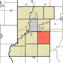 Location in Vigo County | |
| Coordinates: 39°23′22″N 87°17′45″W | |
| Country | United States |
| State | Indiana |
| County | Vigo |
| Government | |
| • Type | Indiana township |
| Area | |
| • Total | 35.86 sq mi (92.9 km2) |
| • Land | 35.23 sq mi (91.2 km2) |
| • Water | 0.63 sq mi (1.6 km2) 1.76% |
| Elevation | 548 ft (167 m) |
| Population (2010) | |
| • Total | 3,123 |
| • Density | 88.6/sq mi (34.2/km2) |
| ZIP codes | 47802, 47803 |
| GNIS feature ID | 453802 |
Geography
According to the 2010 census, the township has a total area of 35.86 square miles (92.9 km2), of which 35.23 square miles (91.2 km2) (or 98.24%) is land and 0.63 square miles (1.6 km2) (or 1.76%) is water.[1]
Cities, towns, villages
- Riley
- Terre Haute (southeast edge)
Unincorporated communities
Adjacent townships
- Lost Creek Township (north)
- Posey Township, Clay County (northeast)
- Perry Township, Clay County (east)
- Pierson Township (south)
- Linton Township (southwest)
- Honey Creek Township (west)
- Harrison Township (northwest)
Cemeteries
The township contains six cemeteries: Cooper, Jones, Liberty, Mewhinney, Miner, and Oak Hill.
Lakes
- Lee Lake
- Wonder Lake
School districts
Political districts
- Indiana's 8th congressional district
- State House District 46
- State Senate District 39
gollark: Which is odd, because it appears to be a water pistol.
gollark: Please explain.
gollark: What is maths doing here?
gollark: How is that related to π?!
gollark: Something something beauty of maths something something deep connections between complex numbers and whatever else.
References
- United States Census Bureau 2007 TIGER/Line Shapefiles
- United States Board on Geographic Names (GNIS)
- IndianaMap
- "Population, Housing Units, Area, and Density: 2010 - County -- County Subdivision and Place -- 2010 Census Summary File 1". United States Census. Archived from the original on 2020-02-10. Retrieved 2013-05-10.
External links
Municipalities and communities of Vigo County, Indiana, United States | ||
|---|---|---|
| City | Map of Indiana highlighting Vigo County | |
| Towns | ||
| Townships | ||
| CDPs | ||
| Other unincorporated communities |
| |
| Footnotes | ‡This populated place also has portions in an adjacent county or counties | |
This article is issued from Wikipedia. The text is licensed under Creative Commons - Attribution - Sharealike. Additional terms may apply for the media files.