Nevins Township, Vigo County, Indiana
Nevins Township is one of twelve townships in Vigo County, Indiana, United States. As of the 2010 census, its population was 1,975 and it contained 881 housing units.[1]
Nevins Township | |
|---|---|
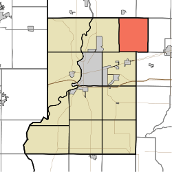 Location in Vigo County | |
| Coordinates: 39°33′51″N 87°14′54″W | |
| Country | United States |
| State | Indiana |
| County | Vigo |
| Government | |
| • Type | Indiana township |
| Area | |
| • Total | 30.74 sq mi (79.6 km2) |
| • Land | 30.56 sq mi (79.2 km2) |
| • Water | 0.18 sq mi (0.5 km2) 0.59% |
| Elevation | 594 ft (181 m) |
| Population (2010) | |
| • Total | 1,975 |
| • Density | 64.6/sq mi (24.9/km2) |
| ZIP codes | 47805, 47834, 47874 |
| GNIS feature ID | 453659 |
Geography
According to the 2010 census, the township has a total area of 30.74 square miles (79.6 km2), of which 30.56 square miles (79.2 km2) (or 99.41%) is land and 0.18 square miles (0.47 km2) (or 0.59%) is water.[1]
Unincorporated communities
Adjacent townships
- Raccoon Township, Parke County (northeast)
- Dick Johnson Township, Clay County (east)
- Posey Township, Clay County (southeast)
- Lost Creek Township (southwest)
- Otter Creek Township (west)
- Florida Township, Parke County (northwest)
Cemeteries
The township contains these four cemeteries: Cress, Harpold, Richer and Sullian.
Lakes
- Morey Lake
- Spring Lake
School districts
Political districts
- Indiana's 8th congressional district
- State House District 44
- State Senate District 38
gollark: 80-ish on my phone.
gollark: I'm at 380 open tabs on my laptop alone.
gollark: Why close tabs when you could *not* close tabs?
gollark: You may not need a massively expensive mesh network.
gollark: My phone doesn't show the same problem, so it might be a hardware issue with my laptop, a *software* issue with my laptop, me not checking on it for long enough, or an issue with my router/modem/thingy's 5GHz WiFi (laptop supports that, phone doesn't).
References
- United States Census Bureau 2007 TIGER/Line Shapefiles
- United States Board on Geographic Names (GNIS)
- IndianaMap
- "Population, Housing Units, Area, and Density: 2010 - County -- County Subdivision and Place -- 2010 Census Summary File 1". United States Census. Archived from the original on 2020-02-10. Retrieved 2013-05-10.
External links
Municipalities and communities of Vigo County, Indiana, United States | ||
|---|---|---|
| City | Map of Indiana highlighting Vigo County | |
| Towns | ||
| Townships | ||
| CDPs | ||
| Other unincorporated communities |
| |
| Footnotes | ‡This populated place also has portions in an adjacent county or counties | |
This article is issued from Wikipedia. The text is licensed under Creative Commons - Attribution - Sharealike. Additional terms may apply for the media files.