Garza County, Texas
Garza County is a county located in the U.S. state of Texas. As of the 2010 census, its population was 6,461.[1] Its county seat is Post.[2] The county was created in 1876 and later organized in 1907.[3] Garza is named for a pioneer Bexar County family, as it was once a part of that county. It is located southeast of Lubbock.
Garza County | |
|---|---|
County | |
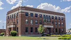
 Garza County Courthouse in Post | |
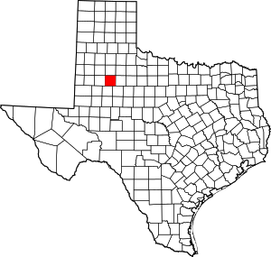
 Location within the U.S. state of Texas | |
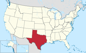
 Texas's location within the U.S. | |
| Coordinates: 33°11′N 101°18′W | |
| Country | |
| State | |
| Founded | 1907 |
| Seat | Post |
| Largest city | Post |
| Area | |
| • Total | 896 sq mi (2,320 km2) |
| • Land | 893 sq mi (2,310 km2) |
| • Water | 2.8 sq mi (7 km2) 0.3%% |
| Population (2010) | |
| • Total | 6,461 |
| • Density | 7.2/sq mi (2.8/km2) |
| Time zone | UTC−6 (Central) |
| • Summer (DST) | UTC−5 (CDT) |
| Congressional district | 19th |
| Website | www |
A leading civic figure in Garza County was until his death in 2011 Giles McCrary, a rancher, oil developer, investor, and art collector. McCrary's OS Ranch Museum is a popular attraction in the county seat of Post, which has made an extended effort to attract tourism.
Republican Drew Springer, Jr., a businessman from Muenster in Cooke County, has since January 2013 represented Garza County in the Texas House of Representatives.[4]
History timeline
- 2000 b.c. – Indigenous peoples of the Americas are the first inhabitants. Later inhabitants were the Kiowa, Comanche.[5]
- 1875 W. C. Young of Fort Worth and Illinois Irishman Ben Galbraith establish the beginnings of the Curry Comb Ranch in the northwest part of Garza County.[6]
- 1876 Garza County is formed from Bexar County, and named for the prominent Bexar County family of José Antonio de la Garza.[7][8]
- 1880 County census count is 36 people.[5]
- 1882 The Square and Compass Ranch is started by the Nave and McCord Cattle Company. They put up the first barbed wire fence two years later.[9]
- 1884 OS Ranch is founded by brothers Andrew J. Long and Frank M. Long of Lexington, Kentucky.[10]
- 1900 County population is 185 persons.[5]
- 1907 Post is founded as a utopian venture by, and named for, cereal king Charles William Post.[5][11]
- 1909-1913 C.W. Post builds a cotton gin, a cotton mill, and attempts to improve agriculture production through rainmaking, involving the heavy use of explosives fired from kites and towers along the rim of the Caprock Escarpment.[5][12]
- 1926 Oil is discovered in the county.[5][13]
- 1934 Quanah and Bryan Maxey discover a sixteen-foot-long tusk of a prehistoric imperial mammoth. This tusk is currently located in the American Museum of Natural History, New York City, NY.[5]
- 1957 A Prehistoric Indian site at Cowhead Mesa is recorded by Emmet Shedd of Post.[14]
- 1960-1965 South Plains Archaeological Society excavations of Cowhead Mesa find artifacts to date inhabitation back to 2000 b.c.[14]
- 1980 The most important business in the county are agribusiness, oil and gas extraction, and textile mills.[5]
Geography
According to the U.S. Census Bureau, the county has a total area of 896 square miles (2,320 km2), of which 893 square miles (2,310 km2) are land and 2.8 square miles (7.3 km2) (0.3%) are covered by water.[15]
Major roads and highways


Adjacent counties
- Crosby County (north)
- Kent County (east)
- Scurry County (southeast)
- Borden County (south)
- Lynn County (west)
- Lubbock County (northwest)
- Dickens County (northeast)
Demographics
| Historical population | |||
|---|---|---|---|
| Census | Pop. | %± | |
| 1880 | 36 | — | |
| 1890 | 14 | −61.1% | |
| 1900 | 185 | 1,221.4% | |
| 1910 | 1,995 | 978.4% | |
| 1920 | 4,253 | 113.2% | |
| 1930 | 5,586 | 31.3% | |
| 1940 | 5,678 | 1.6% | |
| 1950 | 6,281 | 10.6% | |
| 1960 | 6,611 | 5.3% | |
| 1970 | 5,289 | −20.0% | |
| 1980 | 5,336 | 0.9% | |
| 1990 | 5,143 | −3.6% | |
| 2000 | 4,872 | −5.3% | |
| 2010 | 6,461 | 32.6% | |
| Est. 2019 | 6,229 | [16] | −3.6% |
| U.S. Decennial Census[17] 1850–2010[18] 2010–2014[1] | |||
As of the census[19] of 2000, 4,872 people, 1,663 households, and 1,217 families resided in the county. The population density was 5 people per square mile (2/km²). The 1,928 housing units averaged 2 per square mile (1/km²). The racial makeup of the county was 56.7% White, 4.8 African American, 0.2% Native American, 0.1% Asian, 17.1 from other races, and 3.00% from two or more races. Hispanics or Latinos of any race were 37.2% of the population.
Of the 1,663 households, 36.00% had children under the age of 18 living with them, 58.50% were married couples living together, 11.20% had a female householder with no husband present, and 26.80% were not families. About 23.80% of all households were made up of individuals and 12.00% had someone living alone who was 65 years of age or older. The average household size was 2.65 and the average family size was 3.15.
In the county, the population was distributed as 28.00% under the age of 18, 7.90% from 18 to 24, 28.60% from 25 to 44, 21.30% from 45 to 64, and 14.10% who were 65 years of age or older. The median age was 35 years. For every 100 females, there were 112.30 males. For every 100 females age 18 and over, there were 111.30 males.
The median income for a household in the county was $27,206, and for a family was $31,173. Males had a median income of $26,604 versus $18,105 for females. The per capita income for the county was $12,704. About 17.50% of families and 22.30% of the population were below the poverty line, including 29.60% of those under age 18 and 18.60% of those age 65 or over.
Politics
| Year | Republican | Democratic | Third parties |
|---|---|---|---|
| 2016 | 82.6% 1,225 | 15.5% 230 | 2.0% 29 |
| 2012 | 81.0% 1,263 | 17.9% 279 | 1.2% 18 |
| 2008 | 77.5% 1,356 | 21.4% 375 | 1.1% 19 |
| 2004 | 81.7% 1,480 | 18.0% 326 | 0.3% 6 |
| 2000 | 73.6% 1,302 | 25.7% 454 | 0.8% 14 |
| 1996 | 53.9% 946 | 40.1% 703 | 6.0% 105 |
| 1992 | 52.0% 982 | 29.6% 558 | 18.4% 348 |
| 1988 | 54.0% 1,183 | 45.2% 989 | 0.8% 18 |
| 1984 | 69.7% 1,219 | 29.8% 521 | 0.6% 10 |
| 1980 | 62.6% 1,188 | 35.7% 677 | 1.7% 32 |
| 1976 | 43.8% 755 | 55.5% 957 | 0.8% 13 |
| 1972 | 72.1% 1,153 | 27.9% 446 | |
| 1968 | 37.1% 615 | 39.9% 662 | 23.1% 383 |
| 1964 | 31.0% 567 | 68.6% 1,254 | 0.3% 6 |
| 1960 | 46.8% 737 | 52.6% 829 | 0.6% 10 |
| 1956 | 44.4% 628 | 55.6% 786 | 0.1% 1 |
| 1952 | 48.2% 742 | 51.7% 797 | 0.1% 2 |
| 1948 | 15.9% 176 | 77.6% 861 | 6.6% 73 |
| 1944 | 12.4% 144 | 72.7% 842 | 14.9% 173 |
| 1940 | 15.5% 198 | 84.0% 1,073 | 0.6% 7 |
| 1936 | 14.0% 132 | 85.7% 807 | 0.3% 3 |
| 1932 | 9.6% 87 | 89.8% 812 | 0.6% 5 |
| 1928 | 73.6% 794 | 26.4% 285 | |
| 1924 | 35.1% 331 | 62.3% 588 | 2.7% 25 |
| 1920 | 5.9% 28 | 82.9% 392 | 11.2% 53 |
| 1916 | 3.9% 14 | 92.2% 330 | 3.9% 14 |
| 1912 | 4.3% 7 | 87.8% 144 | 7.9% 13 |
See also
|
|
References
- "State & County QuickFacts". United States Census Bureau. Archived from the original on October 18, 2011. Retrieved December 16, 2013.
- "Find a County". National Association of Counties. Archived from the original on 2011-05-31. Retrieved 2011-06-07.
- "Texas: Individual County Chronologies". Texas Atlas of Historical County Boundaries. The Newberry Library. 2008. Retrieved May 23, 2015.
- "State Rep. Springer announces district tour July 30". Lubbock Avalanche-Journal, July 16, 2013. Retrieved July 18, 2013.
- Leffler, John (2010-06-15). "Garza County, Texas". Handbook of Texas Online. Texas State Historical Association. Retrieved 17 December 2010.
- Holden, William Curry (2010-06-12). "Curry Comb Ranch". Handbook of Texas Online. Texas State Historical Association. Retrieved 17 December 2010.
- Orozco, Cynthia E (2010-06-15). "José Antonio de la Garza". Handbook of Texas Online. Texas State Historical Association. Retrieved 17 December 2010.
- Gannett, Henry (1905). The Origin of Certain Place Names in the United States. Govt. Print. Off. p. 135.
- Holden, William Curry (2010-06-15). "Square and Compass Ranch". Handbook of Texas Online. Texas State Historical Association. Retrieved 17 December 2010.
- Woolley, Bryan (2004). "Pack Rat". Texas Road Trip. Texas Christian University Press. pp. 25–36. ISBN 978-0-87565-291-7.
- "Post, Texas". Texas Escapes. Texas Escapes - Blueprints For Travel, LLC. Retrieved 17 December 2010.
- Pearce, William M (2010-06-15). "Charles William Post". Handbook of Texas Online. Texas State Historical Association. Retrieved 17 December 2010.
- "Alumni Notes". The Alcade: 52. Sep–Oct 1985.
- Howard, Margaret Ann (2010-06-12). "Cowhead Mesa". Handbook of Texas Online. Texas State Historical Association. Retrieved 17 December 2010.
- "2010 Census Gazetteer Files". United States Census Bureau. August 22, 2012. Retrieved April 27, 2015.
- "Population and Housing Unit Estimates". United States Census Bureau. May 24, 2020. Retrieved May 27, 2020.
- "U.S. Decennial Census". United States Census Bureau. Retrieved April 27, 2015.
- "Texas Almanac: Population History of Counties from 1850–2010" (PDF). Texas Almanac. Retrieved April 27, 2015.
- "U.S. Census website". United States Census Bureau. Retrieved 2011-05-14.
- Leip, David. "Dave Leip's Atlas of U.S. Presidential Elections". uselectionatlas.org. Retrieved 2018-07-24.
External links
| Wikimedia Commons has media related to Garza County, Texas. |
