Coltines
Coltines is a commune in the Cantal department in south-central France.
Coltines | |
|---|---|
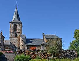 The church in Coltines | |
Location of Coltines 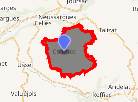
| |
 Coltines  Coltines | |
| Coordinates: 45°05′39″N 2°59′19″E | |
| Country | France |
| Region | Auvergne-Rhône-Alpes |
| Department | Cantal |
| Arrondissement | Saint-Flour |
| Canton | Saint-Flour-1 |
| Intercommunality | la Planèze |
| Government | |
| • Mayor (2008–2014) | Joseph Boudou |
| Area 1 | 19.02 km2 (7.34 sq mi) |
| Population (2017-01-01)[1] | 454 |
| • Density | 24/km2 (62/sq mi) |
| Time zone | UTC+01:00 (CET) |
| • Summer (DST) | UTC+02:00 (CEST) |
| INSEE/Postal code | 15053 /15170 |
| Elevation | 913–1,010 m (2,995–3,314 ft) (avg. 943 m or 3,094 ft) |
| 1 French Land Register data, which excludes lakes, ponds, glaciers > 1 km2 (0.386 sq mi or 247 acres) and river estuaries. | |
Population
| Year | Pop. | ±% |
|---|---|---|
| 1775 | 724 | — |
| 1831 | 747 | +3.2% |
| 1841 | 734 | −1.7% |
| 1851 | 728 | −0.8% |
| 1861 | 682 | −6.3% |
| 1871 | 666 | −2.3% |
| 1881 | 665 | −0.2% |
| 1901 | 602 | −9.5% |
| 1906 | 629 | +4.5% |
| 1936 | 467 | −25.8% |
| 1946 | 393 | −15.8% |
| 1954 | 406 | +3.3% |
| 1962 | 348 | −14.3% |
| 1968 | 312 | −10.3% |
| 1975 | 298 | −4.5% |
| 1982 | 314 | +5.4% |
| 1990 | 358 | +14.0% |
| 1999 | 404 | +12.8% |
| 2008 | 433 | +7.2% |
gollark: * list
gollark: I have 35 domains in the ist now.
gollark: Yes.
gollark: I have now found 22 in total.
gollark: ```6t.lco4.lc8w.nz6r.lt7q.lt6v.six6.lcp5.lv7a.lc5u.lc6l.vci9.lc7q.si```
See also
References
- "Populations légales 2017". INSEE. Retrieved 6 January 2020.
| Wikimedia Commons has media related to Coltines. |
| Authority control |
|
|---|
This article is issued from Wikipedia. The text is licensed under Creative Commons - Attribution - Sharealike. Additional terms may apply for the media files.