Saint-Projet-de-Salers
Saint-Projet-de-Salers is a commune in the Cantal department in south-central France.
Saint-Projet-de-Salers | |
|---|---|
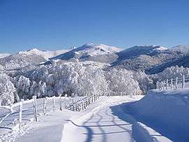 The Col de Légal | |
Location of Saint-Projet-de-Salers 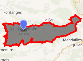
| |
 Saint-Projet-de-Salers  Saint-Projet-de-Salers | |
| Coordinates: 45°05′11″N 2°31′39″E | |
| Country | France |
| Region | Auvergne-Rhône-Alpes |
| Department | Cantal |
| Arrondissement | Mauriac |
| Canton | Naucelles |
| Intercommunality | Pays de Salers |
| Government | |
| • Mayor (2008–2014) | Bruno Faure |
| Area 1 | 36.32 km2 (14.02 sq mi) |
| Population (2017-01-01)[1] | 138 |
| • Density | 3.8/km2 (9.8/sq mi) |
| Time zone | UTC+01:00 (CET) |
| • Summer (DST) | UTC+02:00 (CEST) |
| INSEE/Postal code | 15208 /15140 |
| Elevation | 720–1,736 m (2,362–5,696 ft) (avg. 800 m or 2,600 ft) |
| 1 French Land Register data, which excludes lakes, ponds, glaciers > 1 km2 (0.386 sq mi or 247 acres) and river estuaries. | |
Population
| Year | Pop. | ±% |
|---|---|---|
| 1962 | 381 | — |
| 1968 | 325 | −14.7% |
| 1975 | 225 | −30.8% |
| 1982 | 186 | −17.3% |
| 1990 | 157 | −15.6% |
| 1999 | 117 | −25.5% |
| 2008 | 125 | +6.8% |
| 2016 | 138 | +10.4% |
gollark: Hold on while I fix `os.pullEvent`.
gollark: Any exploit in the backend would likely affect all node.js/ws/express programs anyway, and therefore be very bad.
gollark: The only exploits I was aware of could only be exploited by locally running code anyway, and I patched them.
gollark: It's very secure.
gollark: Yes, the remote debugging service.
See also
References
- "Populations légales 2017". INSEE. Retrieved 6 January 2020.
| Wikimedia Commons has media related to Saint-Projet-de-Salers. |
| Authority control |
|
|---|
This article is issued from Wikipedia. The text is licensed under Creative Commons - Attribution - Sharealike. Additional terms may apply for the media files.