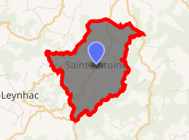
Saint-Antoine, Cantal
Saint-Antoine (Sant Antòni in Occitan) is a commune in the Cantal department in south-central France.
Saint-Antoine | |
|---|---|
Location of Saint-Antoine 
| |
 Saint-Antoine  Saint-Antoine | |
| Coordinates: 44°45′05″N 2°20′18″E | |
| Country | France |
| Region | Auvergne-Rhône-Alpes |
| Department | Cantal |
| Arrondissement | Aurillac |
| Canton | Maurs |
| Intercommunality | Pays de Maurs |
| Government | |
| • Mayor (2008–2014) | Claude Robert |
| Area 1 | 7.22 km2 (2.79 sq mi) |
| Population (2017-01-01)[1] | 106 |
| • Density | 15/km2 (38/sq mi) |
| Time zone | UTC+01:00 (CET) |
| • Summer (DST) | UTC+02:00 (CEST) |
| INSEE/Postal code | 15172 /15220 |
| Elevation | 485–702 m (1,591–2,303 ft) (avg. 700 m or 2,300 ft) |
| 1 French Land Register data, which excludes lakes, ponds, glaciers > 1 km2 (0.386 sq mi or 247 acres) and river estuaries. | |
Population
| Year | Pop. | ±% |
|---|---|---|
| 1962 | 144 | — |
| 1968 | 160 | +11.1% |
| 1975 | 132 | −17.5% |
| 1982 | 145 | +9.8% |
| 1990 | 135 | −6.9% |
| 1999 | 133 | −1.5% |
| 2008 | 121 | −9.0% |
| 2016 | 112 | −7.4% |
gollark: Okay, just come here and try it.
gollark: On your neural interface, I mean?
gollark: Anyway, perhaps you would like to... *test* a potatOS computer?
gollark: You said `or even a cc emulator in cc`, please stop being hypocritical.
gollark: jrengen: look at discord, you can see that bit of code the potatOS sandbox has for, OH LOOK, running the BIOS inside a filesystem sandboxing.
See also
References
- "Populations légales 2017". INSEE. Retrieved 6 January 2020.
| Wikimedia Commons has media related to Saint-Antoine (Cantal). |
This article is issued from Wikipedia. The text is licensed under Creative Commons - Attribution - Sharealike. Additional terms may apply for the media files.