Saint-Étienne-Cantalès
Saint-Étienne-Cantalès is a commune in the Cantal department in south-central France.
Saint-Étienne-Cantalès | |
|---|---|
Location of Saint-Étienne-Cantalès 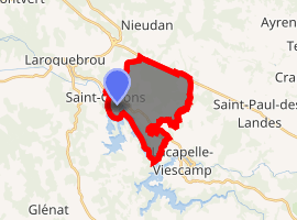
| |
 Saint-Étienne-Cantalès  Saint-Étienne-Cantalès | |
| Coordinates: 44°56′55″N 2°13′28″E | |
| Country | France |
| Region | Auvergne-Rhône-Alpes |
| Department | Cantal |
| Arrondissement | Aurillac |
| Canton | Saint-Paul-des-Landes |
| Government | |
| • Mayor (2008–2014) | André Bouygues |
| Area 1 | 11.21 km2 (4.33 sq mi) |
| Population (2017-01-01)[1] | 132 |
| • Density | 12/km2 (30/sq mi) |
| Time zone | UTC+01:00 (CET) |
| • Summer (DST) | UTC+02:00 (CEST) |
| INSEE/Postal code | 15182 /15150 |
| Elevation | 452–604 m (1,483–1,982 ft) (avg. 518 m or 1,699 ft) |
| 1 French Land Register data, which excludes lakes, ponds, glaciers > 1 km2 (0.386 sq mi or 247 acres) and river estuaries. | |
Population
| Year | Pop. | ±% |
|---|---|---|
| 1962 | 196 | — |
| 1968 | 221 | +12.8% |
| 1975 | 183 | −17.2% |
| 1982 | 172 | −6.0% |
| 1990 | 188 | +9.3% |
| 1999 | 157 | −16.5% |
| 2008 | 140 | −10.8% |
| 2016 | 134 | −4.3% |
gollark: (also, how would you specify fallthrough if you wanted that?)
gollark: Well, you could possibly, but it would likely be awful and not type safe.
gollark: The issue isn't the extra typing, it's that it's easy to forget and introduce weirdness (and also the extra line is ugly).
gollark: What a great* idea.
gollark: I mostly use it for mildly patternmatchy ones, so it is irritating there.
See also
References
- "Populations légales 2017". INSEE. Retrieved 6 January 2020.
| Wikimedia Commons has media related to Saint-Étienne-Cantalès. |
| Authority control |
|
|---|
This article is issued from Wikipedia. The text is licensed under Creative Commons - Attribution - Sharealike. Additional terms may apply for the media files.